Port Jefferson in Suffolk County, New York — The American Northeast (Mid-Atlantic)
Well-Worn Ways
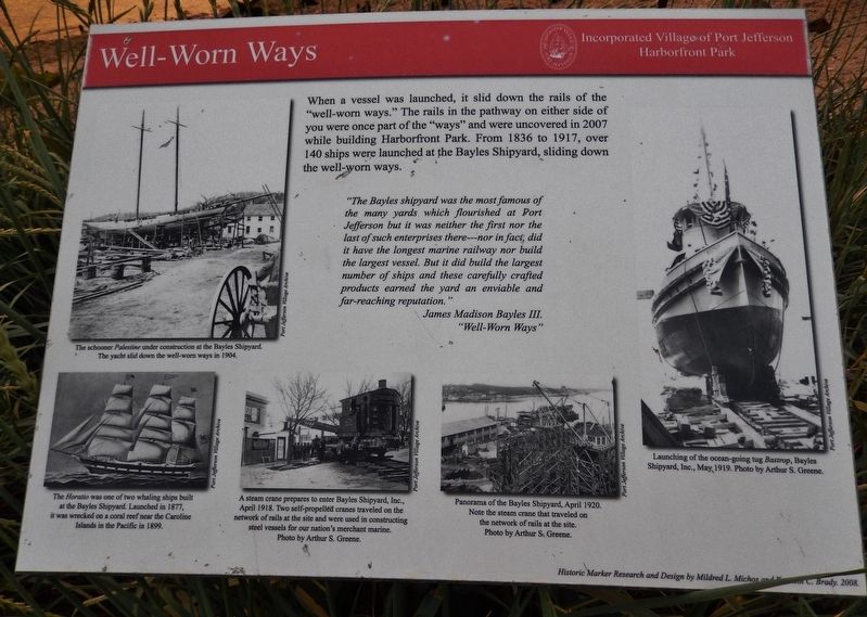
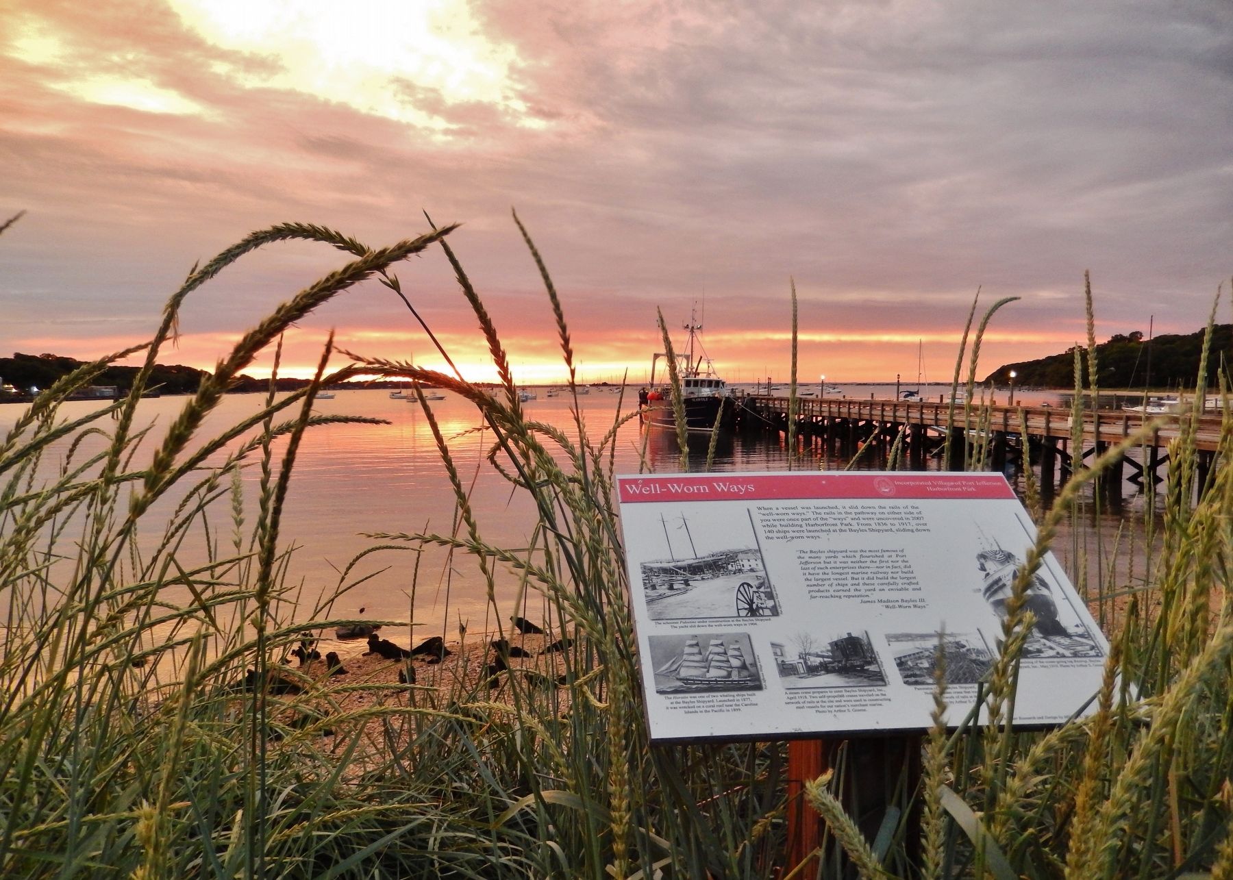
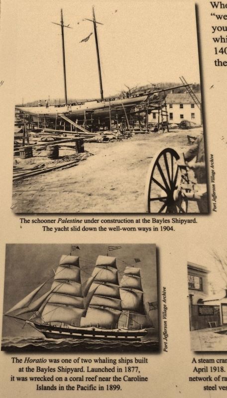
When a vessel was launched, it slid down the rails of the "well-worn ways." The rails in the pathway on either side of you were once part of the "ways" and were uncovered in 2007 while building Harborfront Park. From 1836 to 1917, over 140 ships were launched at the Bayles Shipyard, sliding down the well-worn ways.
"The Bayles shipyard was the most famous of the many yards which flourished at Port Jefferson but it was neither the first nor the last of such enterprises there – nor in fact, did it have the longest marine railway nor build the largest vessel. But it did build the largest number of ships and these carefully crafted products earned the yard an enviable and farreaching reputation."
James Madison Bayles III.
"Well-Worn Ways"
Harborfront Park
Historic Marker Research and Design by Mildred L. Michos and Kenneth C. Brady. 2008.
Topics. This historical marker is listed in these topic lists: Industry & Commerce • Waterways & Vessels.
Location. 40° 56.966′ N, 73° 4.061′ W. Marker is in Port Jefferson, New York, in Suffolk County. Marker can be reached from Pass Way north of East Broadway . Marker is located near the center of Port Jefferson's Harborfront Park, overlooking the harbor. Touch for map. Marker is at or near this postal address: 101 East Broadway, Port Jefferson NY 11777, United States of America. Touch for directions.
Other nearby markers. At least 8 other markers are within 2 miles of this marker, measured as the crow flies. Delivered Afloat in the Harbor (within shouting distance of this marker); The Anchor of Our Community (within shouting distance of this marker); Bayles Chandlery (about 500 feet away, measured in a direct line); "Bucket of Blood" (about 700 feet away); First Baptist Church of Port Jefferson (approx. ¼ mile away); Culper Spy Ring (approx. 0.4 miles away); Roe Tavern (approx. 1.6 miles away); Setauket School (approx. 1.9 miles away). Touch for a list and map of all markers in Port Jefferson.
Photos courtesy of the Port Jefferson Village Archive
2. Marker detail: the Palestine & the Horatio
The schooner Palestine under construction at the Bayles Shipyard. The yacht slid down the well-worn ways in 1904.
The Horatio was one of two whaling ships built at the Bayles Shipyard. Launched in 1877, it was wrecked on a coral reef near the Caroline Islands in the Pacific in 1899.
The Horatio was one of two whaling ships built at the Bayles Shipyard. Launched in 1877, it was wrecked on a coral reef near the Caroline Islands in the Pacific in 1899.
Photos courtesy of the Port Jefferson Village Archive, June 8, 2017
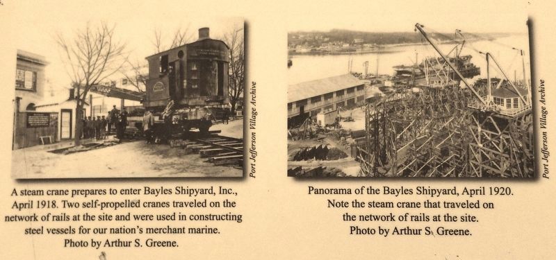
4. Marker detail: self-propelled steam cranes
A steam crane prepares to enter Bayles Shipyard, Inc., April 1918. Two self-propelled cranes traveled on the network of rails at the site and were used in constructing steel vessels for our nation's merchant marine.
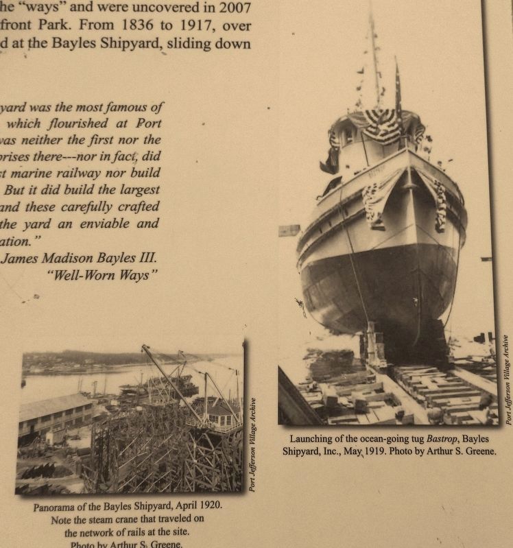
Panorama of the Bayles Shipyard, April 1920. Note the steam crane that traveled on the network of rails at the site.
Panorama of the Bayles Shipyard, April 1920. Note the steam crane that traveled on the network of rails at the site.
Credits. This page was last revised on March 10, 2018. It was originally submitted on March 8, 2018, by Cosmos Mariner of Cape Canaveral, Florida. This page has been viewed 221 times since then and 13 times this year. Photos: 1, 2, 3, 4, 5, 6. submitted on March 8, 2018, by Cosmos Mariner of Cape Canaveral, Florida. • Andrew Ruppenstein was the editor who published this page.
