San Miguel in Santo Domingo, Distrito Nacional, Dominican Republic — Caribbean Region of the Americas (Hispaniola, Greater Antilles, West Indies)
The Church of Saint Michael
Photographed by J. Makali Bruton, March 10, 2018
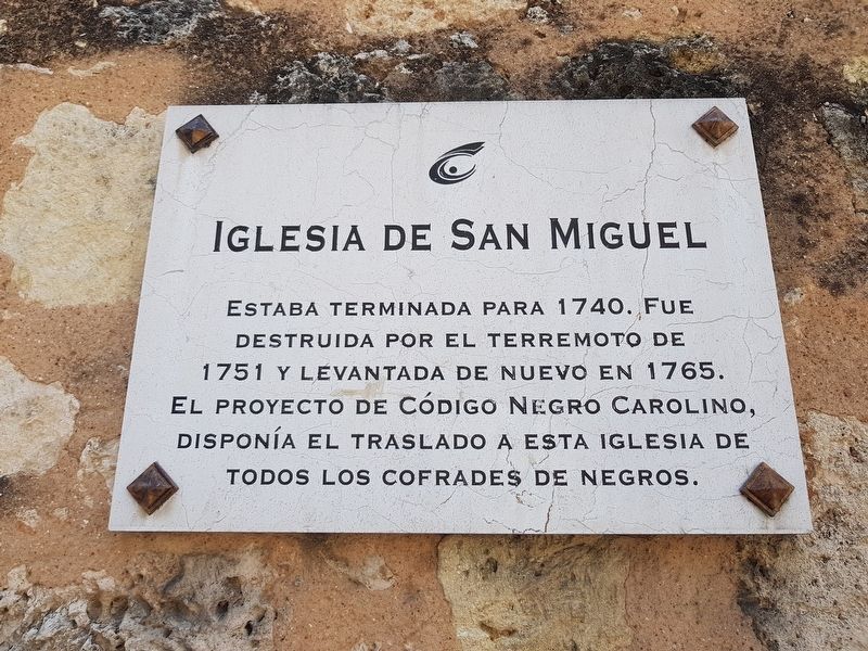
1. The Church of Saint Michael Marker

Estaba terminada para 1740. Fue destruida por el terremoto de 1751 y levantada de nuevo en 1765. El proyecto de Código Negro Carolino, disponía el traslado a esta iglesia de todos los cofrades de negros.
This church was finished by 1740. It was destroyed by the earthquake of 1751 and built again in 1765. The Carolinian Black Codes project directed that all of the black brotherhoods would be moved to this church.
Topics. This historical marker is listed in these topic lists: African Americans • Colonial Era • Fraternal or Sororal Organizations • Religion & Religious Structures. A significant historical year for this entry is 1740.
Location. 18° 28.531′ N, 69° 53.306′ W. Marker is in San Miguel, Distrito Nacional, in Santo Domingo. It is on Calle José Reyes just south of Calle Juan Isidro Pérez, on the right when traveling south. Touch for map. Marker is in this post office area: San Miguel, Distrito Nacional 10211, Dominican Republic. Touch for directions.

Regionally, it is one of the Greater Antilles on the Caribbean Sea, on in the
this page online
Other nearby markers. At least 8 other markers are within walking distance of this marker: Gregorio Garcia Castro (about 150 meters away, measured in a direct line); Church of Las Mercedes (about 180 meters away); Dominican Resistance to the US Invasion of 1965 (about 180 meters away); Emilio Rodriguez Demorizi (about 210 meters away); The Chapel of the Hospital of Saint Lazarus (approx. 0.2 kilometers away); José Martí in Santo Domingo (approx. 0.2 kilometers away); Federico Henriquez y Carvajal (approx. 0.3 kilometers away); Salomé Ureña de Henríquez (approx. 0.3 kilometers away).
Regarding The Church of Saint Michael. The Carolinian Black Codes described in the marker were a series of orders from Spanish king Carlos III in 1785. The codes were an attempt to restrict the interaction of free blacks and slaves in Santo Domingo. As the marker mentions, the Catholic religious brotherhoods ("cofradías") were centralized at this church as a way to limit interaction between free
Photographed by J. Makali Bruton, March 10, 2018
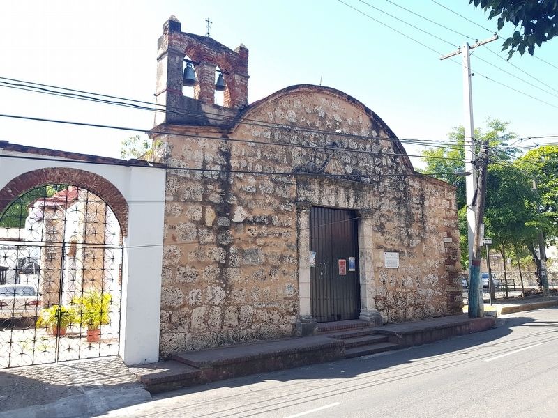
2. The Church of Saint Michael Marker
The marker can be seen in this view to the right of its main entrance.
Credits. This page was last revised on July 28, 2023. It was originally submitted on March 10, 2018, by J. Makali Bruton of Washington, District of Columbia. This page has been viewed 301 times since then and 17 times this year. Photos: 1, 2. submitted on March 10, 2018, by J. Makali Bruton of Washington, District of Columbia.
