Annapolis in Anne Arundel County, Maryland — The American Northeast (Mid-Atlantic)
Commodore John Barry
Annapolis Charter 300 1708-2008
| — | Commemorating the 1708 Royal Charter under Queen Anne to the City of Annapolis | — |
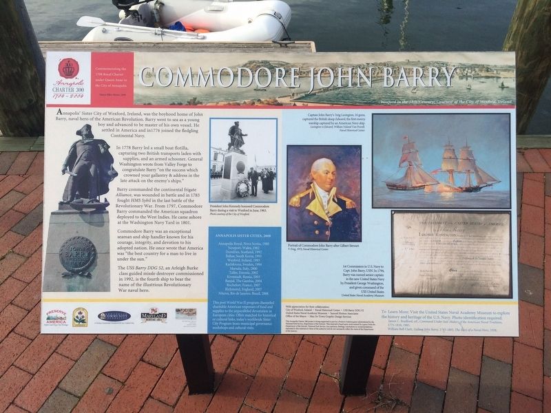
In 1778 Barry led a small boat flotilla capturing two British transports laden with supplies, and an armored schooner. General Washington wrote from Valley Forge to congratulate Barry "on the success which crowned your gallantry & address in the late attack on the enemy's ships."
Barry commanded the continental frigate Alliance, was wounded in battle and in 1783 fought HMS Sybil in the last battle of the Revolutionary War. From 1797, Commodore Barry commanded the American squadron deployed to the West Indies. He came ashore at the Washington Navy Yard in 1801.
Commodore Barry was an exceptional seaman and ship handler known for his courage, integrity, and devotion to his adopted nation. He once wrote that America was "the best country for a man to live in under the sun."
The USS Barry DDG 52, an Arleigh Burke class guided missle destroyer commissioned
this page online
[Aside:]
Annapolis Royal, Nova Scotia, 1980
Newport, Wales, 1982
Dumfries, Scotland, 1992
Jinhae, South Korea, 1993
Wexford, Ireland, 1993
Karlskrona, Sweden, 1994
Marsala, Italy, 2000
Tallin, Estonia, 2002
Kronstadt, Russia, 2003
Banjul, The Gambia, 2004
Rochefort, France, 2007
Richmond, England, 2007
Nitcrois, Rio de Janeiro, Brazil, 2008
Erected by the City of Annapolis.
Topics and series. This historical marker is listed in these topic lists: Heroes • War, US Revolutionary • Waterways & Vessels. In addition, it is included in the Former U.S. Presidents: #01 George Washington series list. A significant historical year for this entry is 1776.
Location. 38° 58.621′ N, 76° 29.065′ W. Marker
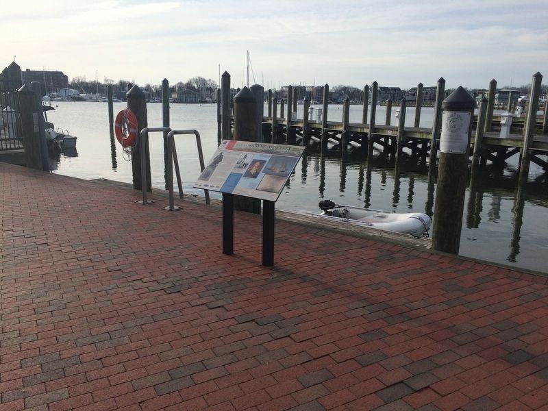

Regionally, this marker is in Central Maryland. It is also in the American Mid-Atlantic, in the Chesapeake Bay Region, and on the Eastern Seaboard. Globally, it is in the North Atlantic Region, North America, the Western Hemisphere, the Western World, and the Anglosphere. Historically, it finds itself in what was once one of the original Thirteen Colonies and also the Antebellum South.
Other nearby markers. At least 8 other markers are within walking distance of this marker: Steamboats Give Way to the New Bay Bridge (within shouting distance of this marker); Transportation on the Chesapeake Highway (within shouting distance of this marker); Annapolis: Capital of Commerce (within shouting distance of this marker); Watermen and Working Harbor (within shouting distance of this marker); Maritime Annapolis: An Enduring Legacy (within shouting distance of this marker); Gateway to Discovery (within shouting distance of this marker); Annapolis Depicted (about 400 feet away, measured in a direct line); Sy Mohr's City Dock Harbormaster Collage (about 400 feet away). Touch for a list and map of all markers in Annapolis.
Credits. This page was last revised on May 10, 2020. It was originally submitted on March 10, 2018, by Devry Becker Jones of Washington, District of Columbia. This page has been viewed 567 times since then and 41 times this year. Last updated on March 12, 2018, by Devry Becker Jones of Washington, District of Columbia. Photos: 1, 2. submitted on March 10, 2018, by Devry Becker Jones of Washington, District of Columbia. • Andrew Ruppenstein was the editor who published this page.
