Near Sykesville in Howard County, Maryland — The American Northeast (Mid-Atlantic)
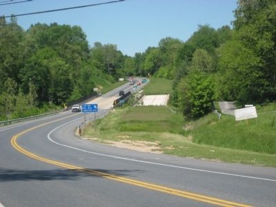
The Sykesville Bypass Bridge
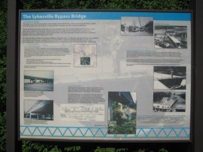
This bridge is one of only six aluminum girder bridges in the United States, and the only one in Maryland. Despite its ordinary appearance, the bridge is a remarkable feat of engineering with worldwide significance.
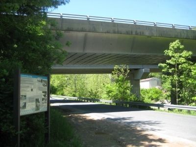
The Sykesville Bypass Bridge stands today as it was originally built. It is two lanes wide and 294 feet long. Three girder spans composed of triangular aluminum box beams are supported by two piers and two abutments of reinforced concrete. Among its other unique characteristics, the Sykesville Bypass Bridge is the longest aluminum triangular box beam girder bridge in the world.
The Sykesville Bypass Bridge was opened to traffic on 17 October 1963. At that time, the United States was expanding its network of roads through combined federal and state efforts. Steel, the traditional building material, grew increasingly scarce. Consequently, interest turned to the use of aluminum as an alternative for bridge construction.
Early Aluminum Bridges
The use of aluminum for bridge constructions can be traced to 1933, when the deck of the 1882 Smithfield Steel Bridge in Pittsburgh, Pennsylvania was replaced with a lightweight aluminum deck. This inspired engineers to investigate using aluminum on the primary structural material in bridge design. From the 1940s to the 1960s, several all-aluminum bridges were erected in North America and Europe. Although the initial cost of aluminum was greater than either steel or concrete, this was partially offset by other savings and benefits associated with aluminum's unique characteristics:
Aluminum is lighter than mild structural steel but comparable in strength.
It has excellent corrosion resistance.
It has high toughness, even in frigid winter temperatures.
Aluminum is easy to fabricate, which allows for complex shapes and efficient structural designs
The higher costs of aluminum, however, discourages its wider use; only six aluminum bridges were built in the United States.
Fairchild Design Bridges
Great advances in aluminum bridge construction occurred in the early 1960s. Referred to as the Fairchild or Unistress Design, the new approach adapted the principles of aircraft fabrication to bridge construction, taking advantage of aluminum's light weight and ease of fabrication.
The Fairchild Design was conceived by the Fairchild Engine and Airplane Company in nearby Hagerstown, Maryland. In place of the usual steal I-beam or reinforced concrete girders in a bridge, the Fairchild Design employed an unconventional system of hollow-triangular box-beam girders joined together to form a single, enormous structural unit that was

Photographed By F. Robby, May 9, 2009
2. Marker Closeup on Lower Left Photos
Top Photo - Ames Bridge, Des Moines, Iowa (1958): The first use of aluminum for a new highway bridge in the United States was this two-lane, four-span bridge over I-80, a conventional built-up I-beam design. It remained in service until about 1993
Bottom Photo - Amityville Bridge, Amityville, New York (1963): Two four-span bridges, designed by Kaiser Aluminum and Chemical Corporation, were erected to carry Route 110 over the Sunrise Highway.
Bottom Photo - Amityville Bridge, Amityville, New York (1963): Two four-span bridges, designed by Kaiser Aluminum and Chemical Corporation, were erected to carry Route 110 over the Sunrise Highway.
Design and Construction of the Sykesville Bypass Bridge
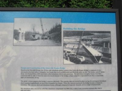
Based on the Fairchild Design, the 35-foot wide aluminum girder system of the Sykesville Bypass Bridge is composed of nine alternately inverted, hollow, triangular box beams that were prefabricated and lifted into place on site. The beams, each 67-inches deep, were formed from 0.091-inch thick rolled aluminum sheets and extrusions. The individual triangular beams were then connected side-by-side to form the main structural element of the bridge, a huge composite trapezoidal beam that is remarkably light yet enormously strong.
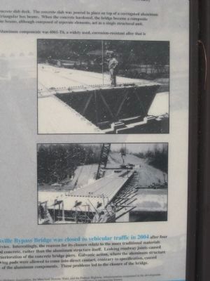
The girder system supports the bridge's concrete slab deck. The concrete slab was poured in place on top of a corrugated aluminum sheet running longitudinally on top of the triangular box beam. When the concrete hardened, the bridge became a composite structure. The concrete deck and aluminum beams, although composed of separate elements, act as a single structural unit.
The aluminum alloy selected for all of the aluminum components was 6061-T6, a widely used, corrosion-resistant alloy that is still used today.
The Sykesville Bypass Bridge was closed to vehicular traffic in 2004 after four decades in service. Interestingly, the reasons for its closure relate to the more traditional materials used, steel and concrete, rather than the aluminum structure itself. Leaking roadway joints causes premature deterioration of the concrete bridge piers. Galvanic action, where the aluminum structure and steel bearing pads were allowed to come into direct contact, contrary to specification, cause deterioration of the aluminum components. These problems led to the closure of the bridge.
Topics. This historical marker is listed in these topic lists: Bridges & Viaducts • Industry & Commerce • Roads & Vehicles. A significant historical date for this entry is October 17, 1963.
Location. 39° 21.723′ N, 76° 58.008′ W. Marker is near Sykesville, Maryland, in Howard County. Marker is on River Road, 0.1 miles east of Main Street (Maryland Route 851), on the right when traveling east. Marker is just beyond the overpass of the bridge. Touch for map. Marker is in this post office area: Sykesville MD 21784, United States of America. Touch for directions.
Other nearby markers. At least 8 other markers are within walking distance of this marker. Baldwin's Station (approx. 0.2 miles away); Baltimore & Ohio Railroad Station (approx. 0.2 miles away); Sykesville (approx. 0.2 miles away); St. Joseph's Roman Catholic Church (approx. ¼ mile away); The Town House (approx. ¼ mile away); The Strawbridge Home for Boys (approx. 0.3 miles away); The Historic Sykesville Colored Schoolhouse (approx. half a mile away); History of the Freedom Community (approx. 0.6 miles away). Touch for a list and map of all markers in Sykesville.
Additional commentary.
1. Access
If you use River Rd. (off of 32) to get to the bridge, it makes for a nice scenic drive along the river on approach. Adds about 10 minutes of travel.
— Submitted December 28, 2012, by Andy P of Ellicott City, Maryland.
Credits. This page was last revised on January 12, 2020. It was originally submitted on May 20, 2009, by F. Robby of Baltimore, Maryland. This page has been viewed 8,133 times since then and 148 times this year. Last updated on March 16, 2018, by Craig Baker of Sylmar, California. Photos: 1, 2, 3, 4, 5, 6. submitted on May 22, 2009, by F. Robby of Baltimore, Maryland. • Andrew Ruppenstein was the editor who published this page.
