Memphis in Shelby County, Tennessee — The American South (East South Central)
Palmetto Bend/Jackson Point/St. Catherine’s Creek/Ellis Cliffs
Mississippi River Walk
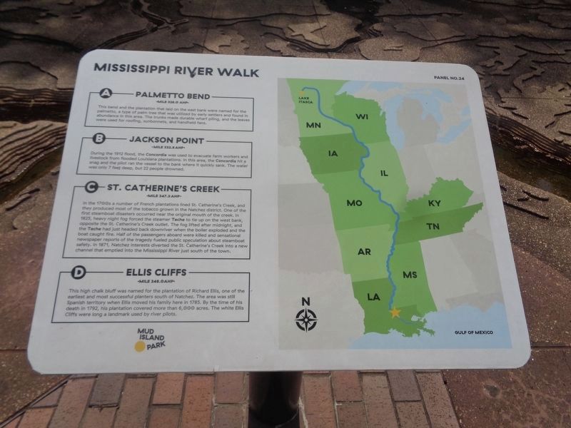
Photographed by Jason Voigt, August 2, 2024
1. Palmetto Bend/Jackson Point/St. Catherine’s Creek/Ellis Cliffs Marker
Marker was replaced with one put up by Mud Island Park
A.Palmetto Bend
Mile 326.0 AHP
This bend and the plantation that lay on its bank were named for the Palmetto, a type of palm tree that was utilized by early settlers and found in abundance in this area. The trunks made durable wharf piling, and the broad leaves were used for roofing, sun bonnets, and hand held fans.
B. Jackson Point
Mile 332.8 AHP
During the 1912 flood, the steamboat Concordia was used to evacuate farm workers and livestock from flooded Louisiana Plantations. In this area, the Concordia hit a snag and the pilot ran the vessel to the bank where it quickly sank. The water was only seven feet deep but 22 people drowned.
C. St. Catherine’s Creek
Mile 347.3 AHP
In the 1700s, a number of French plantation lined St. Catherine’s Creek, and they produced most of the tobacco grown in the Natchez district. One of the first steamboat disasters occurred near the original mouth of the creek in 1825. Heavy night fog had forced the steamer Teche to tie up on the west bank opposite the St. Catherine’s Creek outlet. The fog lifted after midnight, and the Teche had just headed back downriver when the boiler
this page online
D. Ellis Cliffs
Mile 348.0 AHP
This high chalk bluff was named for the plantation of Richard Ellis one of the earliest and most successful planters south of Natchez. The area was still Spanish Territory when Ellis moved his family here in 1785. By the time of his death in 1792, his plantation covered more than 6,000 acres. The white Ellis Cliffs were long a landmark used by river pilots.
Erected by Mud Island Park. (Marker Number 24.)
Topics. This historical marker is listed in these topic lists: Disasters • Settlements & Settlers • Waterways & Vessels. A significant historical year for this entry is 1792.
Location. 35° 8.823′ N, 90° 3.579′ W. Marker is in Memphis, Tennessee, in Shelby County. It can be reached from Riverside Drive. Marker is located at Mud Island Park. Touch for map. Marker is at

Photographed by Sandra Hughes, May 18, 2010
2. Palmetto Bend/Jackson Point/St. Catherine’s Creek/Ellis Cliffs Marker

Regionally, this marker is in West Tennessee. It is also in the American South, specifically in the Deep South, in the Upper South, in the Mississippi Delta, and in the Great River Road Region. Globally, it is in North America, the Western Hemisphere, the Western World, and the Anglosphere. Historically, it finds itself in what was once the territory of the Mississippian Culture, one of the Confederate States of America, and the Antebellum South.
Other nearby markers. At least 8 other markers are within walking distance of this marker: Gauges and Navigation Lights (here, next to this marker); Fort Adams, Mississippi/Old River Control Structure/Homochitto Cutoff (a few steps from this marker); Natchez Island / Vidalia, Louisiana / Giles Cutoff (a few steps from this marker); Natchez, Mississippi (a few steps from this marker); Hog Point, Louisiana/Raccourci Cutoff/Caernarvon Crevasse (a few steps from this marker); The Atchafalaya Problem (a few steps from this marker); Waterproof, Louisiana/Ashland Landing, Mississippi

Photographed by Sandra Hughes, May 18, 2010
3. Palmetto Bend/Jackson Point/St. Catherine’s Creek/Ellis Cliffs Marker
Shows Markers 22-30
Also see . . . Ellis Cliffs, Mississippi. Ellis Cliffs is a ghost town in Adams County, Mississippi, United States. Situated atop a high chalky bluff overlooking the Mississippi River, the white cliffs were frequently mentioned by early river voyagers. The settlement was located approximately 14 mi (23 km) south of Natchez and approximately 1 mi (1.6 km) northeast of Hutchins Landing. (Submitted on March 18, 2018, by Sandra Hughes Tidwell of Killen, Alabama, USA.)
Credits. This page was last revised on August 23, 2024. It was originally submitted on March 18, 2018, by Sandra Hughes Tidwell of Killen, Alabama, USA. This page has been viewed 865 times since then and 72 times this year. Photos: 1. submitted on August 23, 2024, by Jason Voigt of Glen Carbon, Illinois. 2, 3. submitted on March 18, 2018, by Sandra Hughes Tidwell of Killen, Alabama, USA. • Bill Pfingsten was the editor who published this page.
