Stillwater in Saratoga County, New York — The American Northeast (Mid-Atlantic)
American River Fortifications
Photographed by Bill Coughlin, July 13, 2008
1. American River Fortifications Marker
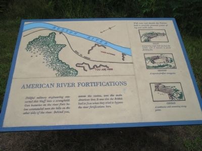
Skillful military engineering converted this bluff into a stronghold. Gun batteries on the river flats below commanded even the hills on the other side of the river. Behind you, across the ravine, was the main American line. It was this the British had to face when they tried to bypass the river fortifications here.
Erected by Saratoga National Historical Park, National Park Service.
Topics. This historical marker is listed in these topic lists: Notable Events • Notable Places • War, US Revolutionary.
Location. Marker has been permanently removed. It was located near 42° 58.798′ N, 73° 37.713′ W. Marker was in Stillwater, New York, in Saratoga County. It was on Park Tour Road, on the right when traveling south. Marker is in Saratoga National Historical Park along a walking trail at the American River Fortifications stop. Touch for map. Marker was in this post office area: Stillwater NY 12170, United States of America.
We have been informed that this marker is no longer there and will not be replaced. This page is an archival view of what was.
Regionally,
this page online

Other nearby markers. At least 7 other markers are within walking distance of this location: Not Everyone’s Loyalties are Clear (a few steps from this marker); The Enemy of My Enemy is My Friend (a few steps from this marker); “We have a Fine Train of Artillery, consisting of 24 Pieces” (within shouting distance of this marker); “The General … Discovered a Spot which Fully Answered His Wishes” (about 600 feet away, measured in a direct line); High Ground Halts an Invasion (about 700 feet away); “You will observe that we have some new works.” (approx. 0.2 miles away); A Liberty Loving Engineer (approx. 0.2 miles away). Touch for a list and map of all markers in Stillwater.
Other markers no longer nearby. Patriots’ Eye-View (was
Photographed by Bill Coughlin, July 13, 2008
2. Marker on the Saratoga Battlefield
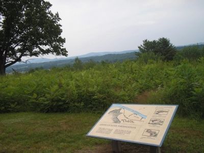
The fortifications here, built under the direction of Polish military engineer Col. Thaddeus Kosciuszko, were key to the American strategy against the British.
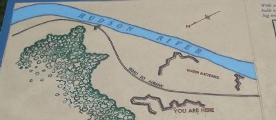
More about this marker. The top of the marker contains a map of the redoubt where the marker is located and the water batteries, along with the Hudson River and the road to Albany.
Three pictures of various types of fortifications, with their descriptions, are on the right of the marker. “With axes and shovels the Patriots built a carefully planned system of log and earth walls.
Redan – A projecting angle built
Photographed by Bill Coughlin, July 13, 2008
3. Saratoga Markers
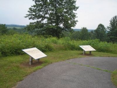
Several markers are found at this location at the American River Fortifications tour stop. The "American River Fortifications" marker is the one on the right.
Redoubt – A separate fortified strongpoint.
Curtain – A continuous wall connecting strongpoints.”
Also see . . .
1. Saratoga National Historical Park. National Park Service website entry. (Submitted on September 16, 2008, by Bill Coughlin of Woodland Park, New Jersey.)
2. The Battle of Saratoga. Saratoga Chamber of Commerce website entry (Submitted on September 16, 2008, by Bill Coughlin of Woodland Park, New Jersey.)
Photographed by Bill Coughlin, July 13, 2008
4. American River Fortifications Map from Marker
Credits. This page was last revised on August 6, 2024. It was originally submitted on September 16, 2008, by Bill Coughlin of Woodland Park, New Jersey. This page has been viewed 1,357 times since then and 39 times this year. Photos: 1, 2, 3, 4. submitted on September 16, 2008, by Bill Coughlin of Woodland Park, New Jersey.
