Stillwater in Saratoga County, New York — The American Northeast (Mid-Atlantic)
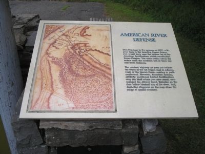
American River Defense
Photographed by Bill Coughlin, July 13, 2008
1. American River Defense Marker
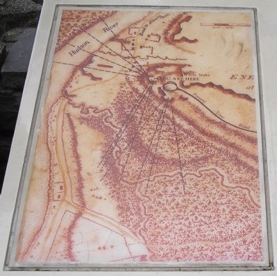
The modern highway on your left follows the traces of the old wagon road to Albany, route of the Crown Forces seeking to push southward. However, American cannon, skillfully positioned behind fortifications atop the bluff where you now stand commanded the Albany Road. Batteries on the flats below blocked use of the river. Red dash-line diagrams on the map show the range of typical cannons.
Erected by Saratoga National Historical Park, National Park Service.
Topics. This historical marker is listed in these topic lists: Notable Events • Notable Places • War, US Revolutionary. A significant historical year for this entry is 1777.
Location. Marker has been permanently removed. It was located near 42° 58.802′ N, 73° 37.719′ W. Marker was in Stillwater, New York, in Saratoga County. It was on Park Tour Road, on the right when traveling south. Marker
this page online
We have been informed that this marker is no longer there and will not be replaced. This page is an archival view of what was.
Regionally, this marker was in Upstate New York, in the Capital District, and in the Albany Metropolitan Area. It was also in the American Northeast and in the Mid-Atlantic. Globally, it was in North America, the Great North Woods, the Western Hemisphere, the Western World, and the Anglosphere. Historically, it found itself in what was once New Netherland and also one of the original Thirteen Colonies.

Other nearby markers. At least 7 other markers are within walking distance of this location: Not Everyone’s Loyalties are Clear (here, next to this marker); The Enemy of My Enemy is My Friend (a few steps from this marker); “We have a Fine Train of Artillery, consisting of 24 Pieces” (within shouting distance of this marker); “The General … Discovered a Spot which Fully Answered His Wishes” (about
Photographed by Bill Coughlin, July 13, 2008
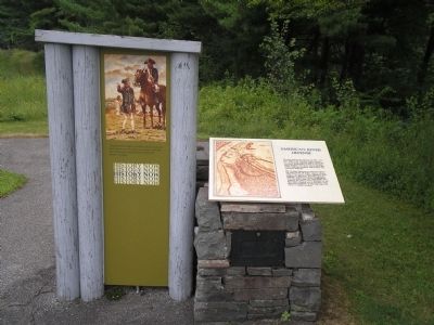
2. Markers on the Saratoga Battlefield
Other markers no longer nearby. Thaddeus Kosciusko (was here, next to this marker but has been permanently removed); Redoubt (was a few steps from this marker but has been permanently removed); Patriots’ Eye-View (was a few steps from this marker but has been permanently removed); American River Fortifications (was a few steps from this marker but has been permanently removed); Strategy and Terrain (was about 700 feet away but has been permanently removed); Fortifying The High Ground (was about 700 feet away but has been permanently removed); Questions of Loyalty (was about 700 feet away but has been permanently removed); Anchor of the American Line (was about 700 feet away but has been permanently removed); North Redan (was approx. ¼ mile away but has been permanently removed).
More about this marker. The left of the marker contains a map
Photographed by Bill Coughlin, July 13, 2008
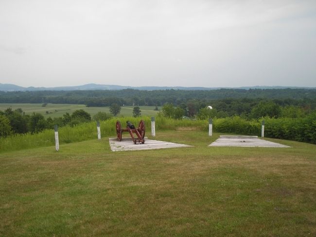
3. Artillery at the American River Defense
The artillery at this fortification controlled the road to Albany below, preventing the British from using it. This cannon is located near the marker. The blue-topped poles indicate the war-time location of the redoubt.
Also see . . .
1. Saratoga National Historical Park. National Park Service website entry. (Submitted on September 16, 2008, by Bill Coughlin of Woodland Park, New Jersey.)
2. The Battle of Saratoga. Saratoga Chamber of Commerce website entry; 07/16/2021 LPG. (Submitted on September 16, 2008, by Bill Coughlin of Woodland Park, New Jersey.)
Photographed by Bill Coughlin, July 13, 2008
4. American River Defense Map from Marker
Credits. This page was last revised on August 2, 2024. It was originally submitted on September 16, 2008, by Bill Coughlin of Woodland Park, New Jersey. This page has been viewed 1,349 times since then and 36 times this year. Photos: 1, 2, 3, 4. submitted on September 16, 2008, by Bill Coughlin of Woodland Park, New Jersey.
