Columbia in Marion County, Mississippi — The American South (East South Central)
Gov. Hugh L. White Mansion
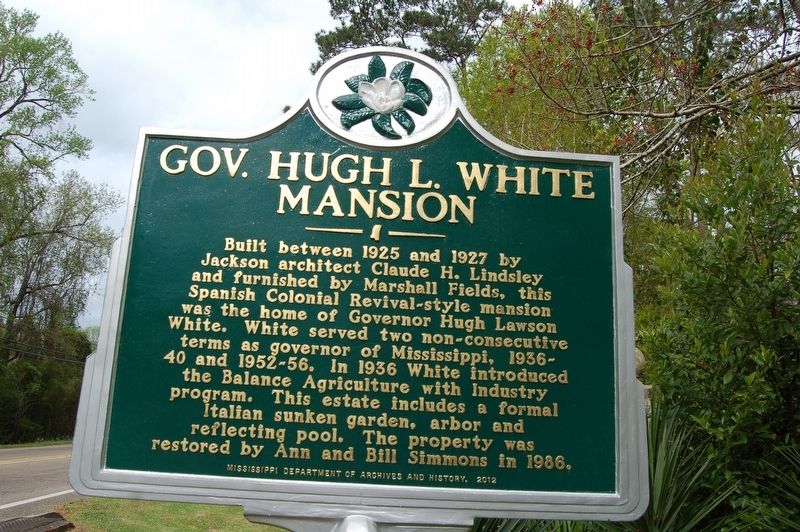
Photographed by Cajun Scrambler, March 23, 2018
1. Gov. Hugh L. White Mansion Marker
Erected 2012 by Mississippi Department of Archives and History.
Topics and series. This historical marker is listed in these topic lists: Agriculture • Architecture • Industry & Commerce. In addition, it is included in the Mississippi State Historical Marker Program series list.
Location. 31° 14.984′ N, 89° 48.854′ W. Marker is in Columbia, Mississippi, in Marion County. It is on Broad Street west of Sumrall Road (State Highway 44), on the left when traveling west. Touch for map. Marker is in this post office area: Columbia MS 39429, United States of America. Touch for directions.

Regionally,
this page online
Other nearby markers. At least 8 other markers are within 4 miles of this marker, measured as the crow flies: Birthplace of Mississippi Rodeo (approx. 0.4 miles away); Lampton-Thompson-Bourne House (approx. one mile away); First Baptist Church (approx. 1.1 miles away); Hanging of Will Purvis (approx. 1.2 miles away); Marion County War Memorial (approx. 1.2 miles away); 720 Main Street (approx. 1.3 miles away); Temporary State Capital (approx. 1.3 miles away); Ford House (approx. 3.9 miles away). Touch for a list and map of all markers in Columbia.

Photographed by Cajun Scrambler, March 23, 2018
2. Gov. Hugh L. White Mansion Marker
Credits. This page was last revised on September 19, 2023. It was originally submitted on March 28, 2018, by Cajun Scrambler of Assumption, Louisiana. This page has been viewed 1,410 times since then and 95 times this year. Photos: 1, 2. submitted on March 28, 2018.
