Intersection of State and South Canal streets
Natchez Trails
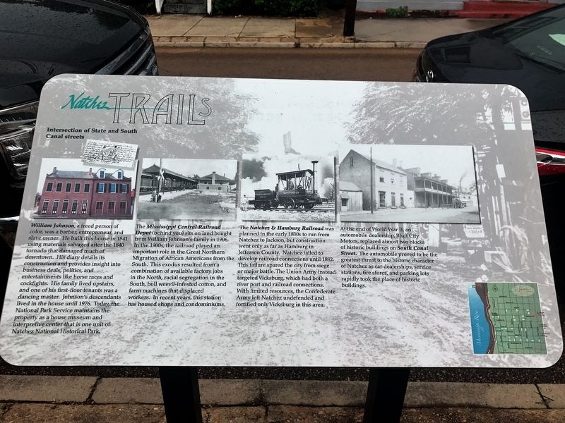
William Johnson, a freed person of color, was a barber, entrepreneur, and slave owner. He built this house in 1841 using materials salvaged after the 1840 tornado that damaged much of downtown. His diary details its construction and provides insight into business deals, politics, and entertainments like horse races and cockfights. His family lived upstairs, and one of his first-floor tenants was a dancing master. Johnson's descendants lived in the house until 1976. Today, the National Park Service maintains the property as a house museum and interpretive center that is one unit of Natchez National Historical Park.
The Mississippi Central Railroad Depot (behind you) sits on land bought from William Johnson's family in 1906. In the 1900s, the railroad played an important role in the Great Northern Migration of African Americans from the South. This exodus resulted from a combination of available factory jobs in the North, racial segregation in the South, boll weevil-infested cotton, and farm machines that displaced workers. In recent years, this station has housed shops and condominiums.
The Natchez & Hamburg Railroad was planned
this page online
At the end of World War II, an automobile dealership, Bluff City Motors, replaced almost two blocks of historic buildings on South Canal Street. The automobile proved to be the greatest threat to the historic character of Natchez as car dealerships, service stations, tire stores, and parking lots rapidly took the place of historic buildings.
Erected by City of Natchez.
Topics and series. This historical marker is listed in these topic lists: Railroads & Streetcars • Roads & Vehicles • Settlements & Settlers. In addition, it is included in the Mississippi - Natchez Trails series list.
Location. 31° 33.622′ N, 91° 24.365′ W. Marker is in
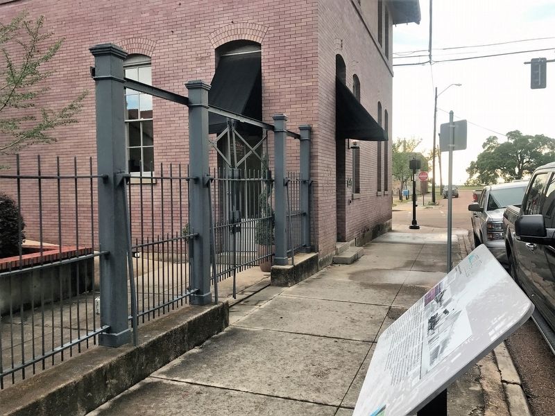

Regionally, this marker is in Southwest Mississippi and in Natchez Trace Corridor. It is also in the American South, specifically in the Deep South, and in the Great River Road Region. Globally, it is in North America, a Gulf of Mexico state, the Western Hemisphere, the Western World, and the Anglosphere. Historically, it finds itself in what was once New Spain, the Viceroyalty of New France, the territory of the Mississippian Culture, one of the Confederate States of America, and the Antebellum South.
Other nearby markers. At least 8 other markers are within walking distance of this marker: The William Johnson House (within shouting distance of this marker); a different marker also named William Johnson House (within shouting distance of this marker); Intersection of State and South Wall streets (about 300 feet away, measured in a direct line); Adams County Confederate Memorial (about 400 feet away); Texada (about 400 feet away); Commercial Bank Building (about 500 feet away); Intersection of Washington and South Wall Streets (about 500 feet away); Intersection of Main and Canal Streets (about 500 feet away). Touch for a list and map of all markers in Natchez.
Credits. This page was last revised on March 29, 2018. It was originally submitted on March 29, 2018, by Cajun Scrambler of Assumption, Louisiana. This page has been viewed 654 times since then and 40 times this year. Photos: 1, 2. submitted on March 29, 2018.
