
Vicksburg National Military Park in Warren County, Mississippi — The American South (East South Central)
Ewing's Brigade; Assault, May 19, 1863.
Union Position Tablet
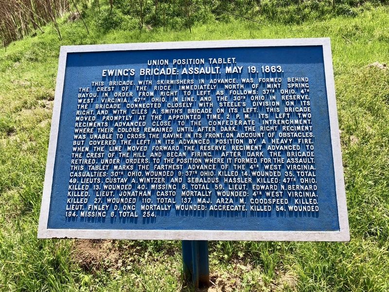
Photographed by Mark Hilton, March 23, 2018
1. Ewing's Brigade; Assault, May 19, 1863. Marker
this page online
Erected by the United States War Department.
Topics. This historical marker is listed in this topic list: War, US Civil.
Location. 32° 22.253′ N, 90° 50.739′ W. Marker is in Vicksburg National Military Park, Mississippi, in Warren County. It can be reached from Confederate Avenue west of Old Graveyard Road. As of April, 2018, Confederate Avenue from Fort Hill to Graveyard Road is closed to vehicles due to soil erosion. Touch for map. Marker is at or near this postal address: Confederate Avenue, Vicksburg MS 39183, United States of America. Touch for directions.

Regionally, this marker is in Natchez Trace Corridor and in Greater Jackson. It is also in the American South, specifically in the Deep South, in the Mississippi Delta, and in the Great River Road Region. Globally, it is in North America, a Gulf of Mexico state, the Western
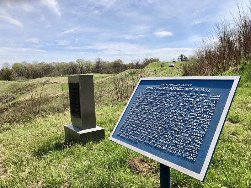
Photographed by Mark Hilton, March 23, 2018
2. View from marker east towards Old Graveyard Road and the Stockade Redan.
Other nearby markers. At least 8 other markers are within walking distance of this marker: West Virginia 4th Infantry (here, next to this marker); C.S. McNally's (Arkansas) Battery; (within shouting distance of this marker); Lunette at left of Stockade. (within shouting distance of this marker); Leon Dawson Marks (within shouting distance of this marker); Louisiana 27th Infantry (within shouting distance of this marker); L.L. Mc Laurin (within shouting distance of this marker); Francis M. Cockrell (within shouting distance of this marker); Martin L. Smith (about 300 feet away, measured in a direct line). Touch for a list and map of all markers in Vicksburg National Military Park.
Credits. This page was last revised on April 1, 2018. It was originally submitted on April 1, 2018, by Mark Hilton of Montgomery, Alabama. This page has been viewed 326 times since then and 12 times this year. Photos: 1, 2. submitted on April 1, 2018, by Mark Hilton of Montgomery, Alabama.
