Fairfax, Virginia — The American South (Mid-Atlantic)
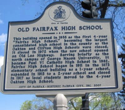
Old Fairfax High School
Photographed by Craig Swain, April 14, 2008
1. Old Fairfax High School Marker
Erected 2007 by City of Fairfax - Historic Fairfax City, Inc.
Topics. This historical marker is listed in this topic list: Education. A significant historical year for this entry is 1935.
Location. 38° 51.335′ N, 77° 18.87′ W. Marker is in Fairfax, Virginia. It is on Lee Highway / Fairfax Boulevard (U.S. 29/50), on the right when traveling east. Touch for map. Marker is at or near this postal address: 10675 Fairfax Boulevard, Fairfax VA 22030, United States of America. Touch for directions.

Regionally, this marker is in the Washington Metropolitan Area and in
this page online
Other nearby markers. At least 8 other markers are within walking distance of this marker: Richard Ratcliffe's Mount Vineyard Plantation (approx. 0.4 miles away); Mount Vineyard (approx. 0.4 miles away); Ratcliffe Cemetery (approx. 0.4 miles away); Old Baptismal Area (approx. half a mile away); Arlington-Fairfax Electric Railway (approx. half a mile away); Confederate Memorial (approx. 0.6 miles away); Confederate Dead (approx. 0.6 miles away); Dr. William Gunnell House (approx. 0.6 miles away). Touch for a list and map of all markers in Fairfax.
Other markers no longer nearby. Richard Ratcliffe’s Mount Vineyard Plantation (was approx. 0.4 miles away but has been replaced with another marker now near it); Birthplace of the Confederate Battle Flag
Photographed by Craig Swain, April 14, 2008
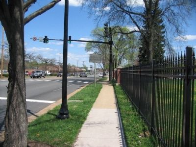
2. Old Fairfax High School Marker
Photographed by Craig Swain, April 14, 2008
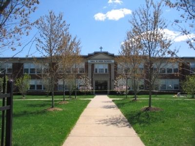
3. The Old Fairfax High School
Today the school is the Paul VI Catholic High School.
Credits. This page was last revised on April 5, 2018. It was originally submitted on April 14, 2008, by Craig Swain of Leesburg, Virginia. This page has been viewed 5,653 times since then and 257 times this year. Last updated on April 3, 2018, by Devry Becker Jones of Washington, District of Columbia. Photos: 1, 2, 3. submitted on April 14, 2008, by Craig Swain of Leesburg, Virginia. • Bill Pfingsten was the editor who published this page.
