Discovery of the Pothole
Discovery & Preservation
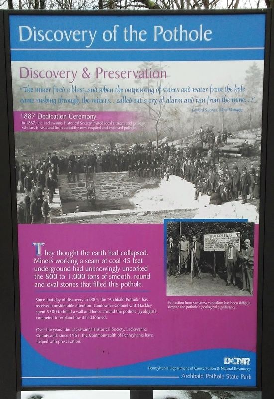
"The miner fired a blast, and when the outpouring of stones and water from the hole came rushing through, the miners...called out a cry of alarm and ran from the mine..."
Edward S. Jones, Mine Manager
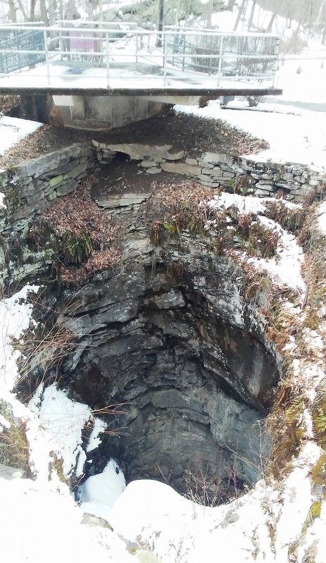
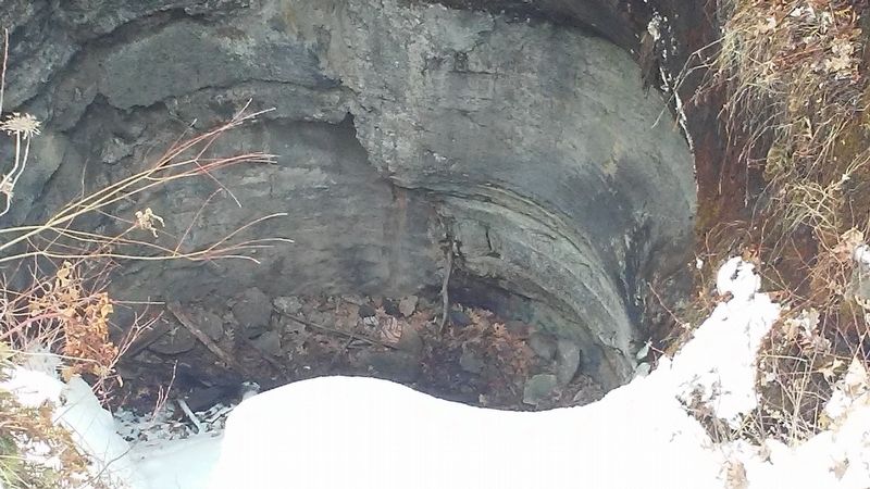
They thought the earth had collapsed. Miners working a seam of coal 45 feet underground had unknowingly uncorked the 800 to 1,000 tons of smooth, round and oval stones that filled this pothole.
Since that day of discovery in 1884, the "Archbald Pothole" has received considerable attention. Landowner Colonel C.B. Hackley spent $500 to build a wall and fence around the pothole; geologists competed to explain how it had formed.
Over the years, the Lackawanna Historical Society, Lackawanna County and, since 1961, the Commonwealth of Pennsylvania have helped with preservation.
[Photo captions, from top to bottom, read]
• 1887 Dedication Ceremony
In 1887, the Lackawanna Historical Society invited local citizens and geologic scholars to visit and learn about the now emptied and enclosed pothole.
• Protection from senseless vandalism has been difficult, despite the pothole's geological significance.
Erected by Pennsylvania
this page online
Topics. This historical marker is listed in this topic list: Natural Features. A significant historical year for this entry is 1884.
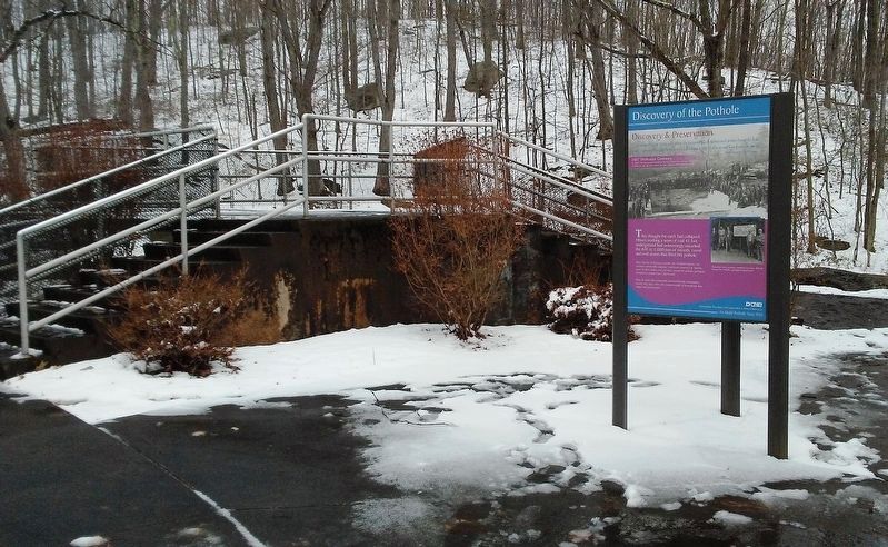
Location. 41° 30.712′ N, 75° 34.441′ W. Marker is in Archbald, Pennsylvania, in Lackawanna County. It can be reached from Scranton Carbondale Highway. Marker kiosk is near the pothole in Archbald Pothole State Park. Touch for map. Marker is at or near this postal address: 861 Scranton Carbondale Highway, Archbald PA 18403, United States of America. Touch for directions.

Regionally, this marker is in the Wyoming Valley and in Greater Scranton and Wilkes-Barre. It is also in the American Northeast, in the Mid-Atlantic, in Appalachia, and specifically in Northern Appalachia. Globally, it is in North America, the Western Hemisphere, the Western World, and the Anglosphere. Historically, it finds itself in what was once the Haudenosaunee (Iroquois) Confederacy and also one of the original Thirteen Colonies.
Other nearby markers. At least 8 other markers are within 2 miles of this marker, measured as the crow flies: The Geology of the Pothole (here, next
Also see . . . History of Archbald State Park. (Submitted on April 3, 2018, by William Fischer, Jr. of Reynoldsburg, Ohio.)
Credits. This page was last revised on April 3, 2018. It was originally submitted on April 3, 2018, by William Fischer, Jr. of Reynoldsburg, Ohio. This page has been viewed 543 times since then and 57 times this year. Photos: 1, 2, 3, 4, 5. submitted on April 3, 2018, by William Fischer, Jr. of Reynoldsburg, Ohio.
