Portsmouth in Rockingham County, New Hampshire — The American Northeast (New England)
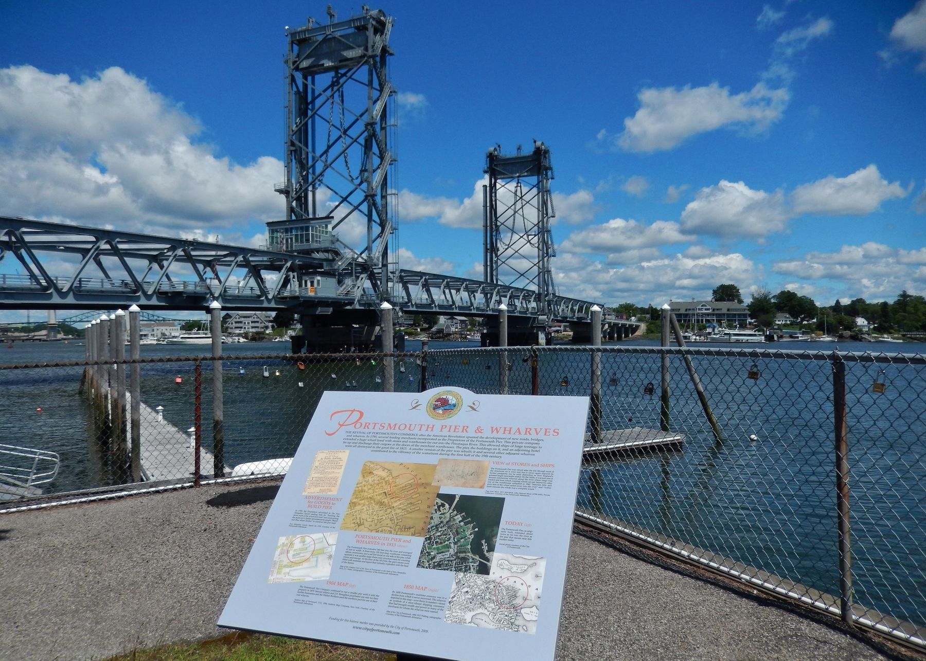
Portsmouth Pier & Wharves
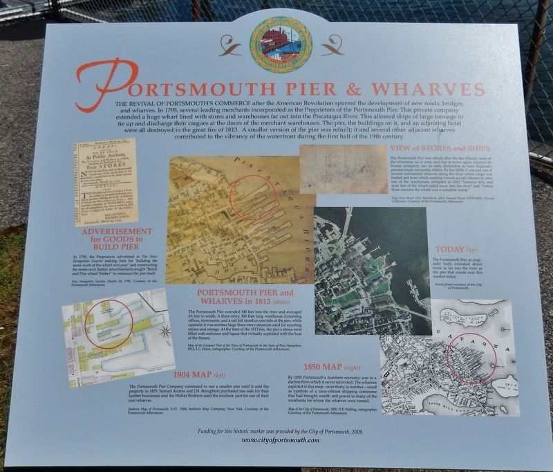
The revival of Portsmouth’s commerce after the American Revolution spurred the development of new roads, bridges, and wharves. In 1795, several leading merchants incorporated as the Proprietors of the Portsmouth Pier. This private company extended a huge wharf lined with stores and warehouses far out into the Piscataqua River. This allowed ships of large tonnage to tie up and discharge their cargoes at the doors of the merchant warehouses. The pier, the buildings on it, and an adjoining hotel were all destroyed in the great fire of 1813. A smaller version of the pier was rebuilt; it and several other adjacent wharves contributed to the vibrancy of the waterfront during the first half of the 19th century.
Advertisement for Goods to Build Pier
In 1795, the Proprietors advertised in The New-Hampshire Gazette seeking bids for "building the stone work of the wharf next year" and constructing the stores on it. Earlier advertisements sought "Beech and Pine wharf Timber" to construct the pier itself.
View of Stores and Ships
The Portsmouth Pier was rebuilt after the fire (though most of the structures on it were not) but it never again enjoyed its former prosperity nor its early distinction as New England's greatest single mercantile edifice. By the 1820s, it was just one of several commercial wharves along the river where cargo was loaded and from which coasting vessels set sail. Moreover, after one of the warehouses collapsed in 1842 "between fifty and sixty feet of the wharf sailed away into the river" and "within three minutes the whole was a complete wreck."
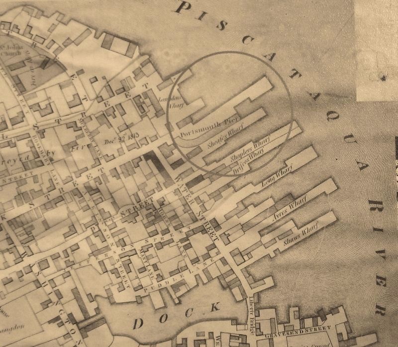
Portsmouth Pier and Wharves in 1813
The Portsmouth Pier extended 340 feet into the river and averaged 65 feet in width. A three-story, 320 foot long warehouse containing offices, storerooms, and a sail loft stood on one side of the pier, while opposite it was another large three-story structure used for counting rooms and storage. At the time of the 1813 fire, the pier's stores were filled with molasses and liquor that virtually exploded with the heat of the flames.
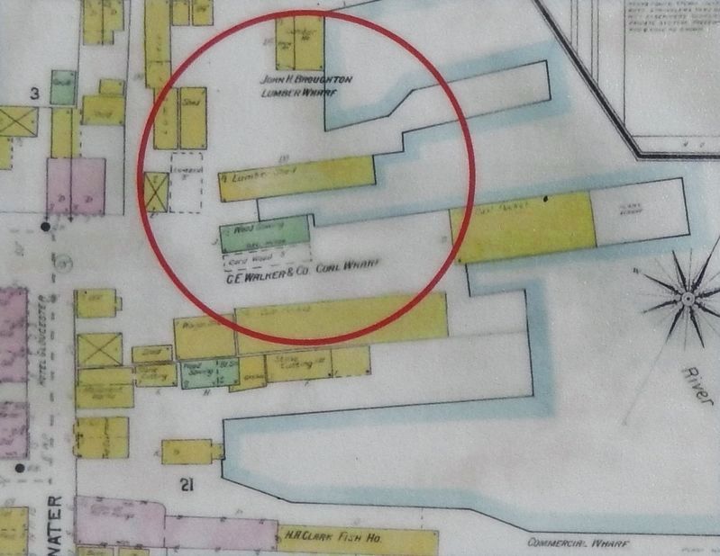
1904 Map
The Portsmouth Pier Company continued to run a smaller pier until it sold the property in 1879. Samuel Adams and J.H. Broughton purchased one side for their lumber businesses and the Walker Brothers used the southern part for one of their coal wharves.
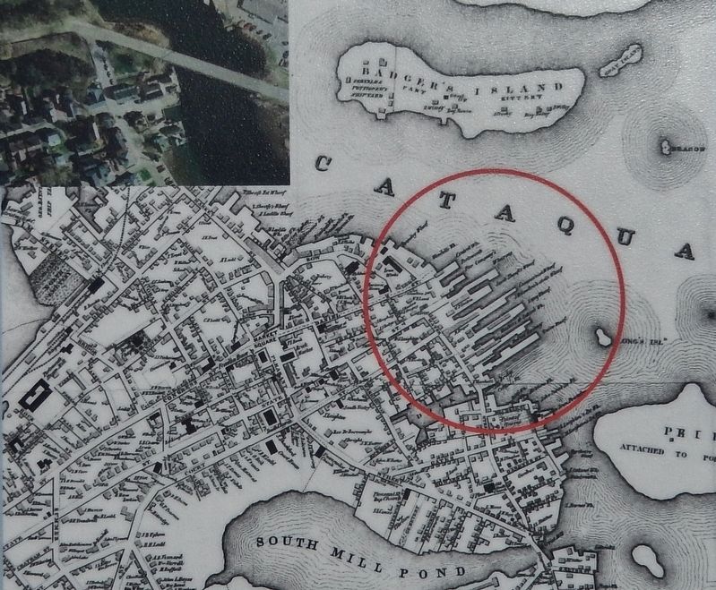
1850 Map
By 1850 Portsmouth's maritime economy was in a decline from which it never recovered. The wharves depicted in this map – over thirty in number – stood as symbols of a once-vibrant shipping commerce that had brought wealth and power to many of the merchants for whom the
wharves were named.
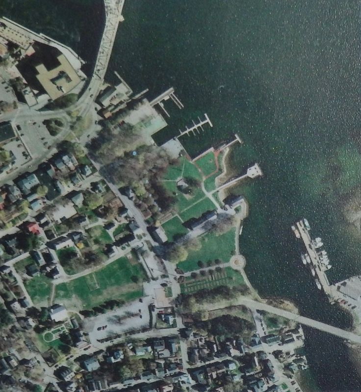
Today
The Portsmouth Pier, as originally built, extended about twice as far into the river as the pier that stands near this marker today.
Erected 2011 by City of Portsmouth, New Hampshire.
Topics. This historical marker is listed in these topic lists: Industry & Commerce • War, US Revolutionary • Waterways & Vessels.
Location. 43° 4.68′ N, 70° 45.134′ W. Marker is in Portsmouth, New Hampshire, in Rockingham County. Marker can be reached from State Street north of Marcy Street, on the right when traveling north. Marker is located at the northeast corner of Prescott Park, at the north end of the parking lot, near the Sawtelle Pier, overlooking the Piscataqua River and the Memorial Bridge. Touch for map. Marker is at or near this postal address: 105 Marcy Street, Portsmouth NH 03801, United States of America. Touch for directions.
Other nearby markers. At least 8 other markers are within walking distance of this marker. North Pier (here, next to this marker); Memorial Bridge 1923-2012 (within shouting distance of this marker); Portsmouth Veteran's Memorial (about 400 feet away, measured in a direct line); Portsmouth Navy Yard (about 400 feet away); Portsmouth Memorial Bridge Marker (about 400 feet away); Oracle House
(about 400 feet away); Black Yankees and The Sea (about 500 feet away); Portsmouth NH Marine Railway (about 500 feet away). Touch for a list and map of all markers in Portsmouth.
Also see . . .
1. The Great Portsmouth Fire of 1813.
What would become known as The Great Portsmouth Fire began on the northwest corner of Church and Court Streets, where the Stone Church is located today. The burning barn quickly spread flames to the neighboring buildings. Conditions were perfect for a firestorm, and soon sparks carried by the wind began randomly setting fire to buildings on State Street and the surrounding areas. The town’s firefighting efforts, consisting of water-bucket brigades and hand-pumped engines, were quickly overwhelmed as blazes burned out of control in various locations and continued to spread. The inferno grew and grew until light from the fires could be seen as far away as Boston, Massachusetts; Windsor, Vermont; and Providence, Rhode Island. (Submitted on April 6, 2018, by Cosmos Mariner of Cape Canaveral, Florida.)
2. Portsmouth, New Hampshire.
The Piscataqua River is a tidal estuary with a swift current, but forms a good natural harbor. The west bank of the harbor was settled by English colonists in 1630 and named Strawbery Banke, after the many wild
strawberries growing there. The village was fortified by Fort William and Mary. Strategically located for trade between upstream industries and mercantile interests abroad, the port prospered. Fishing, lumber and shipbuilding were principal businesses of the region. Enslaved Africans were imported as laborers as early as 1645 and were integral to building the city's prosperity. Portsmouth was part of the Triangle Trade, which made significant profits from slavery. (Submitted on April 6, 2018, by Cosmos Mariner of Cape Canaveral, Florida.)
Credits. This page was last revised on April 7, 2018. It was originally submitted on April 6, 2018, by Cosmos Mariner of Cape Canaveral, Florida. This page has been viewed 260 times since then and 14 times this year. Last updated on April 7, 2018, by Cosmos Mariner of Cape Canaveral, Florida. Photos: 1, 2, 3, 4, 5, 6. submitted on April 6, 2018, by Cosmos Mariner of Cape Canaveral, Florida. • Andrew Ruppenstein was the editor who published this page.
