Owl's Head in Knox County, Maine — The American Northeast (New England)
Welcome to Owls Head Light Station
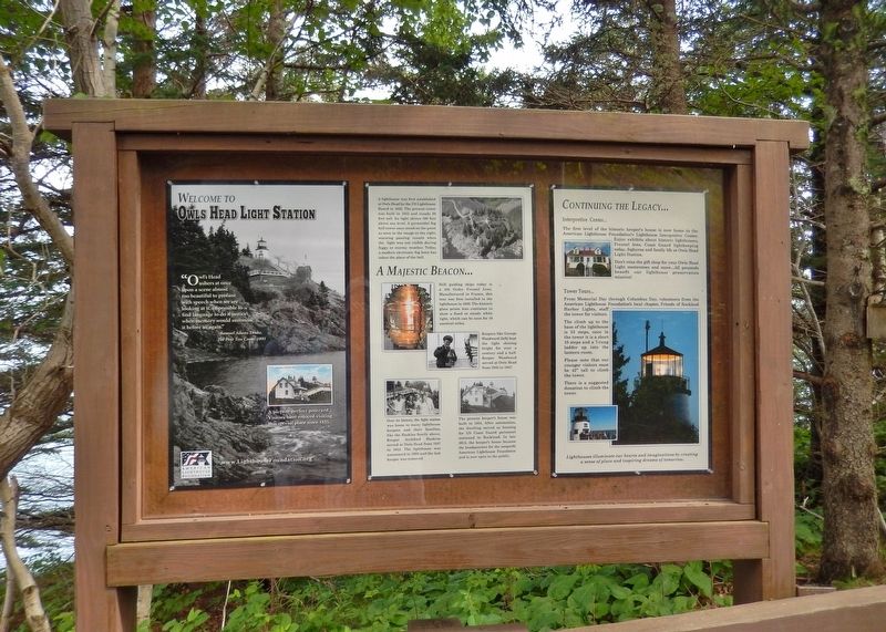
(panel 1)
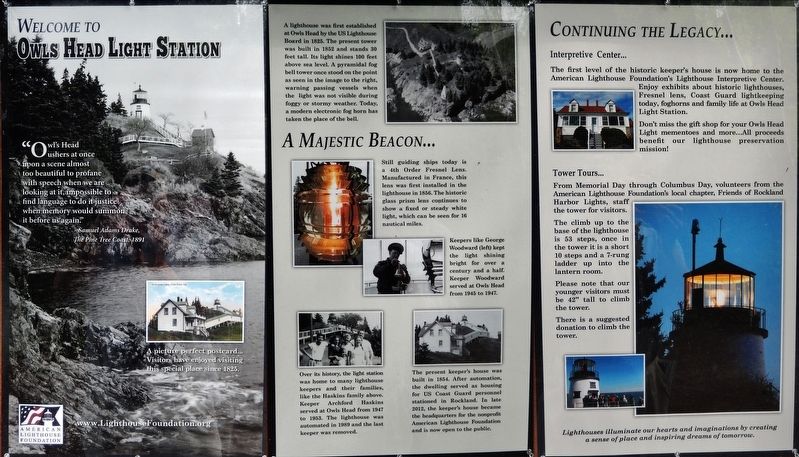
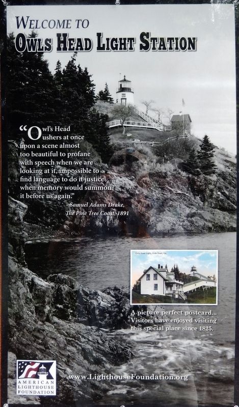
Welcome to Owls Head Light Station
“Owl's Head ushers at once upon a scene almost too beautiful to profane with speech when we are looking at it; impossible to find language to do it justice when memory would summon it before us again.”
- Samuel Adams Drake,
The Pine Tree Coast, 1891
(panel 2)
A Majestic Beacon
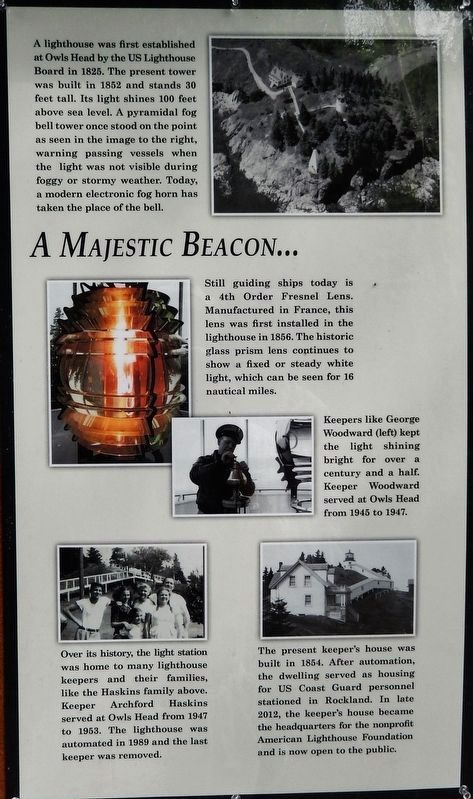
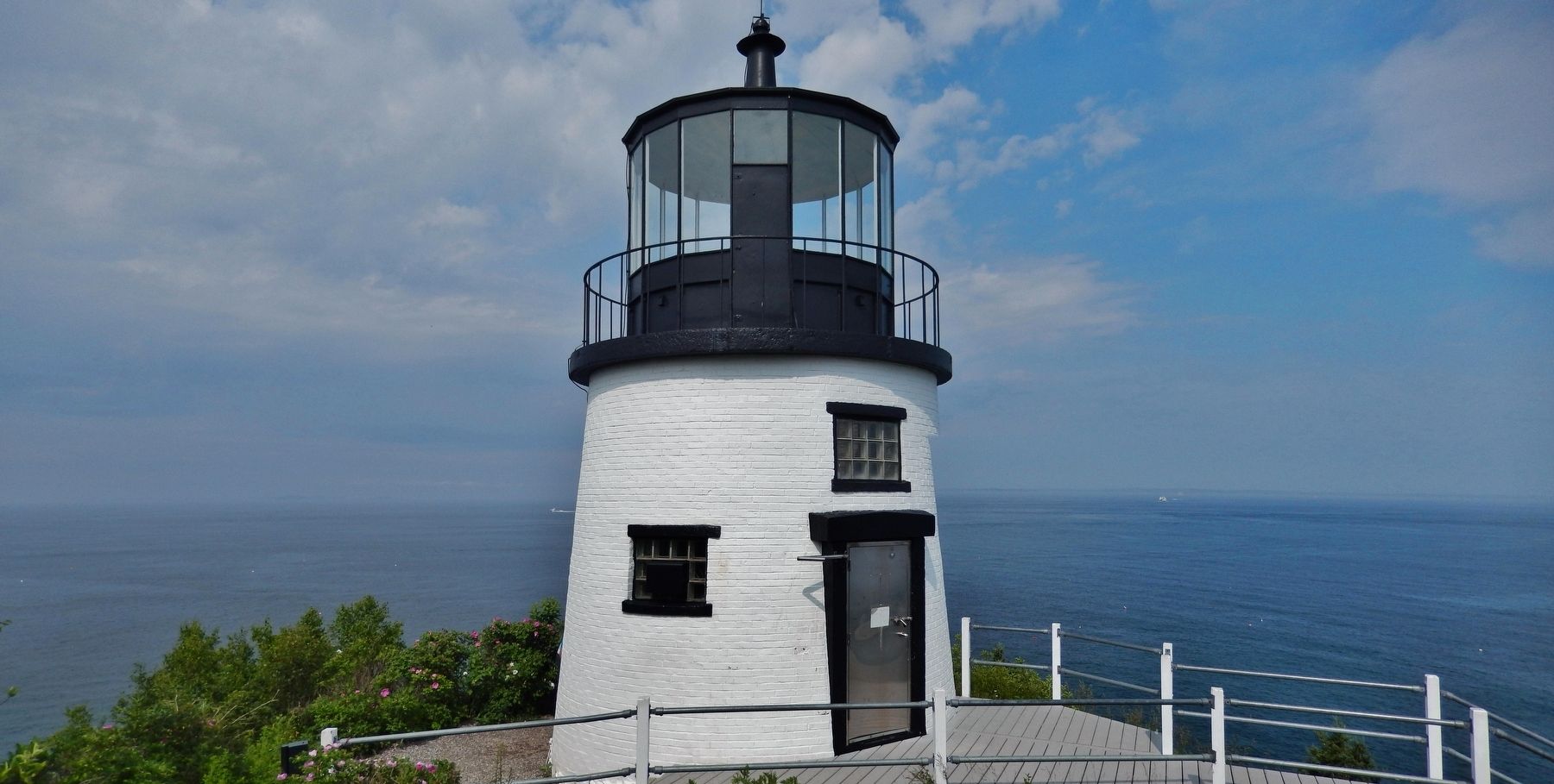
A lighthouse was first established at Owls Head by the US Lighthouse Board in 1825. The present tower was built in 1852 and stands 30 feet tall. Its light shines 100 feet above sea level. A pyramidal fog bell tower once stood on the point as seen in the image to the right, warning passing vessels when the light was not visible during foggy or stormy weather. Today, a modern electronic fog horn has taken the place of the bell.
Still guiding ships today is a 4th Order Fresnel Lens. Manufactured in France, this lens was first installed in the lighthouse in 1856. The historic glass prism lens continues to show a fixed or steady white light, which can be seen for 16 nautical miles.
Keepers like George Woodward (left) kept the light shining bright for over a century and a half. Keeper Woodward served at Owls Head from 1945 to 1947.
Over its history, the light station was home to many lighthouse keepers and their families, like the Haskins family above. Keeper Archford Haskins served at Owls Head from 1947 to 1953. The lighthouse was automated in 1989 and the last keeper was removed.
The present keeper's house was built in 1854. After automation, the dwelling served as housing for US Coast Guard personnel stationed in Rockland. In late 2012, the keeper's house became the headquarters for the nonprofit American Lighthouse Foundation and is now open to the public.
(panel 3)
Continuing the Legacy
Interpretive Center…
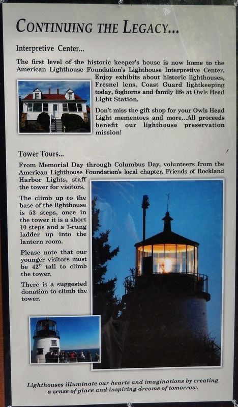
The first level of the historic keeper's house is now home to the American Lighthouse Foundation's Lighthouse Interpretive Center. Enjoy exhibits about historic lighthouses, Fresnel lens, Coast Guard lightkeeping today, foghorns and family life at Owls Head Light Station. Don't miss the gift shop for your Owls Head Light mementoes and more… All proceeds benefit our lighthouse preservation mission!
Tower Tours…
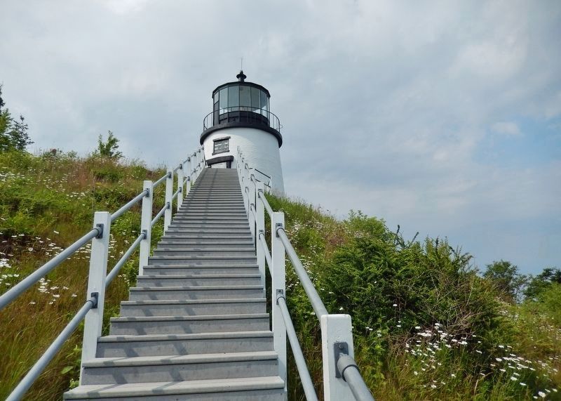
From Memorial Day through Columbus Day, volunteers from the American Lighthouse Foundation's local chapter, Friends of Rockland Harbor Lights, staff the tower for visitors. The climb up to the base of the lighthouse is 53 steps, once in the tower it is a short 10 steps and a 7-rung ladder up into the lantern room. Please note that our younger visitors must be 42" tall to climb
the tower.
There is a suggested donation to climb the tower.
Lighthouses illuminate our hearts and imaginations by creating a sense of place and inspiring dreams of tomorrow.
Topics and series. This historical marker is listed in these topic lists: Communications • Waterways & Vessels. In addition, it is included in the Lighthouses series list. A significant historical year for this entry is 1852.
Location. 44° 5.496′ N, 69° 2.674′ W. Marker is in Owl's Head, Maine, in Knox County. Marker can be reached from Lighthouse Road, 0.4 miles north of Dodge Point Lane, on the right when traveling north. Marker is near the Keeper's House, at the end of Lighthouse Road, in Owl's Head Light State Park. Touch for map. Marker is at or near this postal address: Lighthouse Road, Owls Head ME 04854, United States of America. Touch for directions.
Other nearby markers. At least 8 other markers are within 4 miles of this marker, measured as the crow flies. Owl's Head Light Station (here, next to this marker); Owl's Head Light (within shouting distance of this marker); Owl's Head Veterans Memorial (approx. 0.9 miles away); Rockland Breakwater Lighthouse (approx. 1.9 miles away); Rockland Harbor Trail (approx. 2.6 miles away); The Blues Trail: Mississippi to Maine (approx. 3.2 miles away); Portland Head Light Bell (1942)
(approx. 3.2 miles away); a different marker also named Rockland Harbor Trail (approx. 3.3 miles away). Touch for a list and map of all markers in Owl's Head.
Also see . . .
1. History of Owls Head Light, Maine.
One of the most memorable events in the history of Owl's Head Light took place during the storm of December 22, 1850. A small schooner from Massachusetts was anchored nearby at Jameson's Point. The captain went ashore, leaving the mate, Richard B. Ingraham, a seaman named Roger Elliott, and one passenger, Lydia Dyer. The cables holding the vessel snapped and the schooner headed across the Penobscot Bay toward Owl's Head. It quickly smashed into the rocky ledges south of the lighthouse. The three on board were soon practically frozen in the surf. Elliott escaped and managed to climb over the ice-covered rocks to the shore. The keeper happened to be driving by in a sleigh, and he took the dazed Elliott to the keeper's house. Elliott was able to tell the keeper about the others. A dozen men were rounded up, and the rescue party soon found the schooner. They found a block of ice enveloping Ingraham and Dyer. From all appearances the couple was dead. The men brought the block to the kitchen of the keeper's house. They chipped the ice away, keeping the pair in
cold water. Then they slowly raised the temperature of the water and began to exercise the limbs of the victims. After almost two hours of this massaging and exercising, Lydia Dyer showed signs of life. An hour later Ingraham opened his eyes and said, "What is all this? Where are we?" (Submitted on April 8, 2018, by Cosmos Mariner of Cape Canaveral, Florida.)
2. Owls Head Lighthouse.
The light station was established in 1825 with the construction of a round, rubblestone tower by Jeremiah Berry and Green & Foster. The tower was rebuilt in 1852. It is a 30-foot-tall cylindrical brick tower on a granite foundation standing on top a cliff. It has one of the last six Fresnel lenses in operation in Maine. The light is located 100 feet (30 m) above mean sea level. (Submitted on April 8, 2018, by Cosmos Mariner of Cape Canaveral, Florida.)
3. Owls Head Lighthouse.
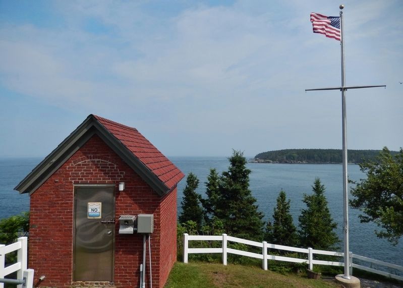
Station established: 1825 - Present lighthouse built: 1852 - Automated: 1989 - Construction material: Brick - Other buildings still standing: 1854 keeper's house (now Coast Guard housing), 1895 oil house, generator building - Height of tower: 30 feet - Height of focal plane: 100 feet - Optic: Fourth order Fresnel lens (1856), still in use (Submitted on April 8, 2018, by Cosmos Mariner of Cape Canaveral, Florida.)
4. Owls Head Lighthouse.
In 1831, Captain Derby of the Revenue Cutter
Morris wrote “Owls Head Light is the most miserable one on the whole coast & I am fearful it will not stand till spring.”
Despite repairs, the condition of the lighthouse was no better in 1842. Inspector I.W.P. Lewis wrote that the interior of the tower was covered with ice in the winter and was “in a filthy state.” The tower roof leaked, the lantern had broken panes of glass, and the reflectors were out of alignment. The house was in a comparable state. Keeper Penley Haines confirmed the report, adding, “The light-house contains a fixed light of eight lamps, with 14-inch reflectors. The tower stands on the summit of Owl’s head, which terminates in a sharp pointed rock, sloping steeply down to the sea, 90 feet below. The distance from the dwelling-house to the tower is 120 feet up a sharp ascent, which, during winter, I find very difficult, and even unsafe in heavy storms.”
Despite Haines’ complaint, it took till 1874 before a set of walkways and stairs linked the dwelling with the light. (Submitted on April 24, 2018, by Cosmos Mariner of Cape Canaveral, Florida.)
Credits. This page was last revised on September 23, 2020. It was originally submitted on April 8, 2018, by Cosmos Mariner of Cape Canaveral, Florida. This page has been viewed 318 times since then and 22 times this year. Photos: 1, 2, 3, 4, 5, 6. submitted on April 8, 2018, by Cosmos Mariner of Cape Canaveral, Florida. 7, 8, 9. submitted on April 20, 2018, by Cosmos Mariner of Cape Canaveral, Florida. • Andrew Ruppenstein was the editor who published this page.
