Salida in Chaffee County, Colorado — The American Mountains (Southwest)
Finding Our Roots
| — | Collegiate Peaks Scenic and Historic Byway | — |
Photographed by Cosmos Mariner, July 23, 2025
1. Finding Our Roots Marker
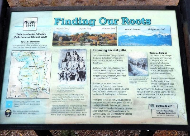
Following ancient paths
The history of Chaffee County as part of the United States began in 1803, with the purchase of the Louisiana Territory from France.
But human history was established here centuries earlier. Many of the hiking trails and roads we use today were once the footpaths of early inhabitants, most often the native Utes and Comanches.
The Utes are the oldest continuous residents of Colorado. It is not known when they arrived, but it is possible the Utes were the reason for the Anasazi people’s exodus to cliff dwellings south of the area.
From spring to fall, Ute family groups dispersed over a wide area to hunt and gather food for the coming cold months. In winter, groups would gather together around central camps. The most important of these camps was located in the Gunnison Valley near Montrose to the west and in the San Luis Valley to the south.
Horses = Change
The Ute way of life changed significantly with the arrival of European explorers, particularly the Spanish. The first Spanish record of peaceful trades with the Utes was in 1626. The most significant trade item was the horse.
Possession of horses allowed
this page online
Some of the peaks of the Sawatch Range on the western edge of Chaffee County remind us of this area’s history. “Sawatch” derives from a Ute word meaning “blue earth.”
The trio of mountains south of Highway 50 near Poncha Springs are named for Ute Chief Ouray, his wife Chipeta and their son Pahlone. North of Highway 50 and west of Highway 285 are Mount Shavano, with its famous “angel,” Tabeguache Peak and Mount Antero.
[photo captions]
• Chief Ouray, center, with Warets, Shavano, Ankatosh and Guerro, sub-chiefs of the Tabeguach (Uncompahgre) Ute band.
• Utes, including Edwin Cloud and George Norris, en route to the reburial of the remains of Chief Ouray near Ignacio, Colorado. 1913.
Explore More!
Follow the Aspen Ridge Exploration Route and add your steps to the Ute Trail.
You’re traveling the Collegiate Peaks Scenic and Historic Byway
For visitor information:
www.colorado.com/byways/collegiate-peaks
Heart of the Rockies Chamber of Commerce
Buena Vista Area Chamber of Commerce
Erected by Federal
Photographed by Cosmos Mariner, July 23, 2025
2. Finding Our Roots Marker
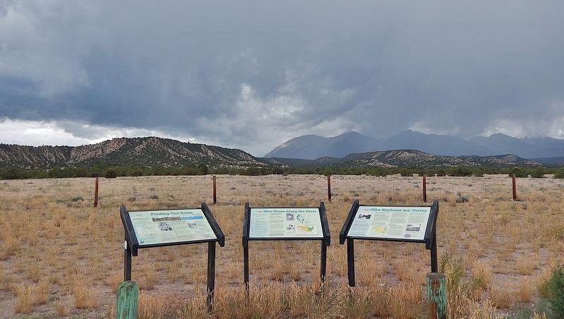
This marker is the leftmost of three related interpretive panels at the Christmas 1806 Picnic Ground wayside.
Topics. This historical marker is listed in these topic lists: Exploration • Indigenous Peoples and Communities.
Location. 38° 35.527′ N, 106° 5.111′ W. Marker is in Salida, Colorado, in Chaffee County. It is on U.S. 285 5 miles north of U.S. 50, on the left when traveling north. The marker is located at the Christmas 1806 Picnic Ground wayside. Touch for map. Marker is at or near this postal address: 12025 US Highway 285, Salida CO 81201, United States of America. Touch for directions.

Regionally, this marker is in the Arkansas River Valley, in the Colorado High Rockies and on the Continental Divide. It is also in the American Mountain West. Globally, it is in North America, the Rocky Mountains, the Western Hemisphere, the Western World, and the Anglosphere.
Other nearby markers. At least 8 other markers are within 5 miles of this marker, measured as the crow flies: New Faces Along the River (here, next to this marker); Pike Explores the Valley (here, next to this marker); Christmas 1806 (a few steps from this marker); The Faces of Industry (approx. 4.3 miles away); Remnant of an Era (approx. 4.3 miles away); A Valley Landmark (approx. 4.3 miles away); The Roof of the Rockies (approx. 4.9 miles away); Cities in the Wilderness (approx. 4.9 miles away). Touch for a list and map of all markers in Salida.
Related markers. Click here for a list of markers that are related to this marker.
Credits. This page was last revised on February 16, 2026. It was originally submitted on January 4, 2014, by Cosmos Mariner of Cape Canaveral, Florida. This page has been viewed 1,404 times since then and 53 times this year. Last updated on April 9, 2018, by Cosmos Mariner of Cape Canaveral, Florida. Photos: 1, 2. submitted on February 16, 2026, by Cosmos Mariner of Cape Canaveral, Florida. • Andrew Ruppenstein was the editor who published this page.
