Stony Point in Rockland County, New York — The American Northeast (Mid-Atlantic)
The British Occupy Stony Point
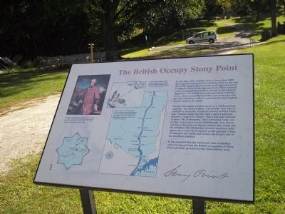
In late May 1779, a British force of more than 6000 men captured the Hudson River and the small American fort at Verplanck’s Point on the opposite shore. These strategic locations guarded the southern entrance to the Hudson Highlands. The British also took possession of King’s Ferry, which crossed between these two peninsulas and gave the Americans a direct route between New England and the states to the south.
Having thus improved their access to a vital maritime highway – the Hudson River – the British were also in position to attack the American fortress at West Point, only 12 miles north, but they had a more important objective. General Sir Henry Clinton had been directed to draw “Mr. Washington,” the Continental Army, out of their winter quarters in Middlebrook, New Jersey, and into a “general and decisive action” that would end the rebellion. The British had already launched raids against the Connecticut coast in a vain attempt to lure Washington into battle and restore the King’s rule to the rebellious colonies.
It was essential that the Americans take immediate action to oppose both the British occupation of Stony Point and their presence in this vital military area.
Erected by Stony Point Battlefield State Historic Site.
Topics. This historical marker is listed in these topic lists: Notable Events • Notable Places • War, US Revolutionary. A significant historical month for this entry is May 1779.
Location. 41° 14.503′ N, 73° 58.481′ W. Marker is in Stony Point, New York, in Rockland County. Marker can be reached from Stony Point Park Road, on the left when traveling east. The marker is located in front of the museum at Stony Point Battlefield State Historic Site. Touch for map. Marker is in this post office area: Stony Point NY 10980, United States of America. Touch for directions.
Other nearby markers. At least 8 other markers are within walking distance of this marker. Stony Point Battlefield (a few steps from this marker); Capture of Stony Point (a few steps from this marker); 17th British Regiment of Foot (within shouting distance of this marker); The American Strategy (within shouting distance of this marker); "I … imagined them to be British Troops, but found my mistake by being wounded and taken prisoner." (within shouting distance of this marker); British Defenses: The Outer Works (within shouting distance of this marker); “By the light occasioned by the flash of the gun I could perceive a body of them...” (within shouting distance of this
marker); Fraser’s Highlanders (about 300 feet away, measured in a direct line). Touch for a list and map of all markers in Stony Point.
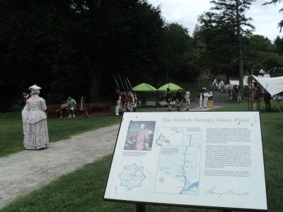
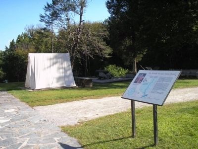
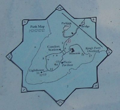
More about this marker. The upper left of the marker contains a picture of “Sir Henry Clinton, British Commander-in-Chief in America from 1778 to 1782. This portrait by Andrea Solodi depicts him around 1760, about the time he first saw active service.” Next to this are two maps. One is of the location of King’s Ferry between Stony Point and Verplanck’s Point, with the caption “Stony Point Controlled the north-south passage on the Hudson River and east-west river crossing at King’s Ferry.” The second map shows the bridges over the Hudson River between Albany and New York City. Also indicated on the map are Stony Point Battlefield and West Point. This map has a caption of “Detail from Plan of Attacks on Forts Clinton and Montgomery by William Faden, London, 1784. Reproduced courtesy of the New York State Library.” The bottom left of the marker contains a map of the walking tour of the Stony Point Battlefield.
Related markers. Click here for a list of markers that are related to this marker. This series of markers follow the walking tour of the Stony Point Battlefield.
Also see . . .
1. Stony Point Battlefield State Historic Site. New York State Parks, Recreation and Historic Preservation website entry (Submitted on September 20, 2008, by Bill Coughlin of Woodland Park, New Jersey.)
2. The Battle of Stoney (sic) Point. American Revolution War website entry (Submitted on September 20, 2008, by Bill Coughlin of Woodland Park, New Jersey.)
Credits. This page was last revised on August 24, 2021. It was originally submitted on September 20, 2008, by Bill Coughlin of Woodland Park, New Jersey. This page has been viewed 1,161 times since then and 23 times this year. Photos: 1. submitted on September 20, 2008, by Bill Coughlin of Woodland Park, New Jersey. 2. submitted on August 12, 2014, by Bill Coughlin of Woodland Park, New Jersey. 3, 4, 5. submitted on September 20, 2008, by Bill Coughlin of Woodland Park, New Jersey.
