Stony Point in Rockland County, New York — The American Northeast (Mid-Atlantic)
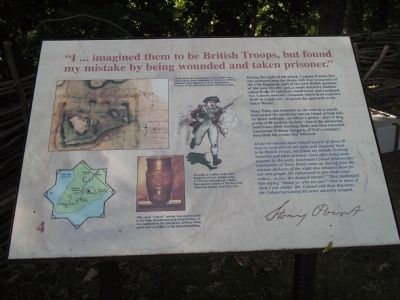
"I … imagined them to be British Troops, but found my mistake by being wounded and taken prisoner."
During the night of the attack, Captain Francis Tew was stationed near the abatis with four companies of the 17th Regiment, part of the total British garrison of 564 men. On this spot, a small defensive position called flech #2 had been constructed, and contained two Cohorn mortars – weapons which fired explosive shells in a high arc – to guard the approach to the Outer Works.
Stony Point was bounded on the west by a marsh that turned the peninsula into an island at high tide. At about midnight, and officer’s picket – part of the group of 88 sentries on duty – heard the advancing Americans, fired warning shots, and then retreated. Lieutenant William Simpson, of Tew’s company, described the events that followed:
About ten minutes later I heard a party of about 30 men in confusion on my right, and imagined them to be British Troops, but found my mistake by being wounded and taken prisoner. Soon after being made prisoner by this party, Lieutenant Colonel Johnson [the commander of Stony Point] came up, having from the extreme darkness of the night also mistaken them for our own people. He endeavored to give them some orders … to face the damned rascals!” They challenged him saying “Damn ye, who are you?” One or more of them I saw charge the Colonel with their Bayonets … the Colonel perceiving his error, narrowly escaped.
Erected by Stony Point Battlefield State Historic Site.
Topics. This historical marker is listed in these topic lists: Notable Events • Notable Places • War, US Revolutionary.
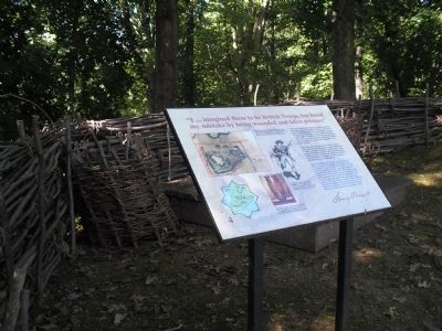
Location. 41° 14.486′ N, 73° 58.498′ W. Marker is in Stony Point, New York, in Rockland County. Marker can be reached from Stony Point Park Road, on the left when traveling east. The marker is found in the British camp located near the Stony Point Museum. Touch for map. Marker is in this post office area: Stony Point NY 10980, United States of America. Touch for directions.
Other nearby markers. At least 8 other markers are within walking distance of this marker. The American Strategy (a few steps from this marker); Stony Point Battlefield (a few steps from this marker); 17th British Regiment of Foot (a few steps from this marker); Capture of Stony Point (within shouting distance of this marker); British Defenses: The Outer Works (within shouting distance of this marker); The British Occupy Stony Point (within shouting distance of this marker); “By the light occasioned by the flash of the gun I could perceive a body of them...” (within shouting distance of this marker); Fraser’s Highlanders (about 300 feet away, measured in a direct line). Touch for a list and map of all markers in Stony Point.
More about this marker.
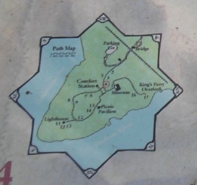
The upper left of the marker features an 18-century map of Stony Point Battlefield by British Lt. William Marshall, 63rd Regiment of Foot highlighting Fleche #2. The map was reproduced courtesy of The Historical Society of Pennsylvania. Below this is a “Drawing of a soldier of the 17th Regiment of Foot, British Army, c. 1779, by Alexander R. Cattley. Reproduced courtesy of The New York Historical Society, New York City.” Also on the marker is a photograph of a piece of British artillery with the caption “This small ‘cohorn’ mortar was carried easily in the field. Manufactured in Great Britain, it was captured by the Americans at Stony Point, and is now on exhibit in the museum building.” Finally, the lower left of the marker contains a map of the walking tour of the Stony Point Battlefield.
Related markers. Click here for a list of markers that are related to this marker. This series of markers follow the walking tour of the Stony Point Battlefield.
Also see . . .
1. Stony Point Battlefield State Historic Site. New York State Parks, Recreation and Historic Preservation website entry (Submitted on September 20, 2008, by Bill Coughlin of Woodland Park, New Jersey.)
2. The Battle of Stoney (sic) Point. American Revolution War website entry (Submitted on September 20, 2008, by Bill Coughlin of Woodland Park, New Jersey.)
Credits. This page was last revised on August 24, 2021. It was originally submitted on September 20, 2008, by Bill Coughlin of Woodland Park, New Jersey. This page has been viewed 1,312 times since then and 26 times this year. Photos: 1, 2. submitted on September 20, 2008, by Bill Coughlin of Woodland Park, New Jersey. 3. submitted on August 12, 2014, by Bill Coughlin of Woodland Park, New Jersey. 4, 5, 6. submitted on September 20, 2008, by Bill Coughlin of Woodland Park, New Jersey.
