Erie in Erie County, Pennsylvania — The American Northeast (Mid-Atlantic)
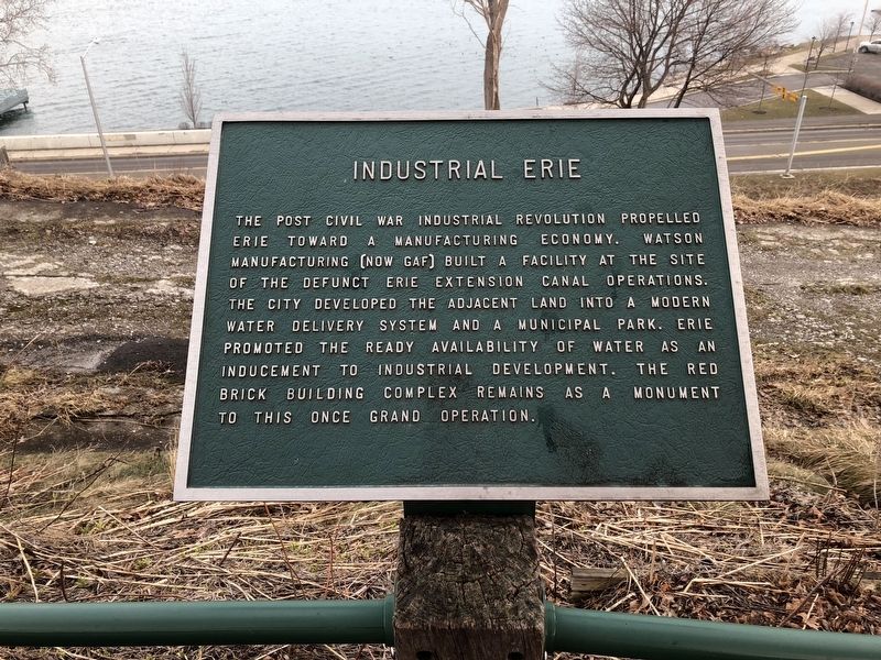
Industrial Erie
Topics. This historical marker is listed in these topic lists: Industry & Commerce • Parks & Recreational Areas.
Location. 42° 7.843′ N, 80° 5.882′ W. Marker is in Erie, Pennsylvania, in Erie County. It is on Bayfront Promenade west of Chestnut Street, on the right when traveling west. Touch for map. Marker is at or near this postal address: 340 Bayfront Promenade, Erie PA 16507, United States of America. Touch for directions.

Regionally, this marker is in Northwestern Pennsylvania. It is also in the American Northeast, in the Mid-Atlantic, in Appalachia, and specifically in Northern Appalachia. Globally,
this page online
Other nearby markers. At least 8 other markers are within walking distance of this marker: This Public Pier is Dedicated to (about 300 feet away, measured in a direct line); Presque Isle and the Bay (about 300 feet away); Bayfront Metamorphosis (approx. 0.2 miles away); 21st Century Erie (approx. ¼ mile away); The Ariel, Porcupine, Scorpion and Tigress (approx. 0.3 miles away); The Erie Extension Canal (approx. 0.3 miles away); The Cascade Street Docks (approx. 0.3 miles away); Commodore Oliver Hazard Perry (approx. 0.3 miles away). Touch for a list and map of all markers in Erie.
Credits. This page was last revised on March 18, 2019. It was originally submitted on April 16, 2018, by Devry Becker Jones of Washington, District of Columbia. This page has been viewed 599 times since then and 18 times this year. Photos: 1, 2. submitted on April 16, 2018, by Devry Becker Jones of Washington, District of Columbia. • Andrew Ruppenstein was the editor who published this page.
