
Locust Grove in Orange County, Virginia — The American South (Mid-Atlantic)
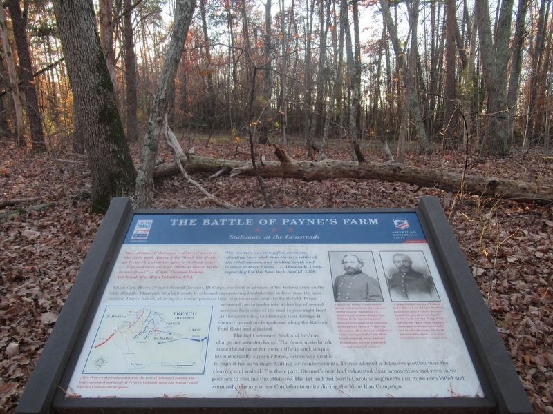
The Battle of Payne’s Farm
Stalemate at the Crossroads
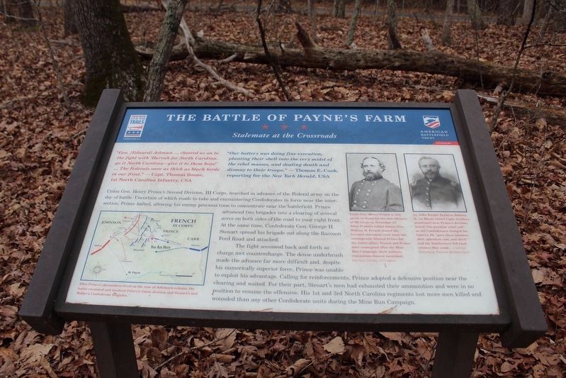
Photographed by Evan Dwyer, January 6, 2026
1. The Battle of Payne’s Farm Marker
A new marker, identical in content and layout but with the American Battlefield Trust styling, has been erected.
“Our battery was doing fine execution, planting their shell into the very midst of the rebel masses, and dealing death and dismay to their troops.” — Thomas E. Cook, reporting for the New York Herald, USA
Union Gen. Henry Prince’s Second Division, III Corps, marched in advance of the Federal army on the day of battle. Uncertain of which roads to take and encountering Confederates in force near the intersection, Prince halted, allowing his enemy precious time to concentrate near the battlefield. Prince advanced two brigades into a clearing of several acres on both sides of the road to your right front. At the same time, Confederate Gen. George H. Steuart spread his brigade out along the Raccoon Ford Road and attacked.
The fight seesawed back and forth as charge met countercharge. The dense underbrush made the advance far more difficult
this page online
Erected 2011 by The Civil War Trust and Virginia Civil War Trails.
Topics and series. This historical marker is listed in this topic list: War, US Civil. In addition, it is included in the Virginia Civil War Trails series list.
Location. 38° 20.266′ N, 77° 49.757′ W. Marker is in Locust Grove, Virginia, in Orange County. It can be reached from Zoar Road (Virginia Route 611) east of Indiantown Road ( Route 603). Touch for map. Marker is at or near this postal address: 31334 Zoar Road, Locust Grove VA 22508, United States of America. Touch for directions.

Regionally, this marker is in Northern Virginia and in the Piedmont. It is also in the American South
Photographed by Bernard Fisher, June 6, 2011
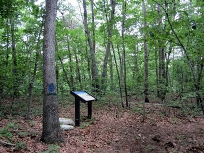
2. The Battle of Payne’s Farm CWT Marker
Other nearby markers. At least 8 other markers are within walking distance of this marker: A different marker also named The Battle of Payne’s Farm (approx. 0.2 miles away); a different marker also named The Battle of Payne’s Farm (approx. ¼ mile away); a different marker also named The Battle of Payne’s Farm (approx. ¼ mile away); a different marker also named The Battle of Payne’s Farm (approx. 0.3 miles away); a different marker also named The Battle of Payne’s Farm (approx. 0.4 miles away); a different marker also named The Battle of Payne’s Farm (approx. 0.4 miles away); a different marker also named The Battle of Payne’s Farm (approx. 0.4 miles away); The Mine Run Campaign (approx. 0.4 miles away). Touch for a list and map of all markers in Locust Grove.
More about this marker. On the
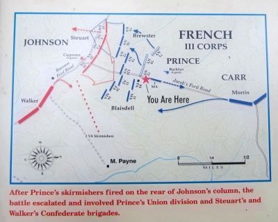
3. The Battle of Payne’s Farm initial troop deployment
On the upper right are two portraits with the captions, "Union Gen. Henry Prince is only partly to blame for the slow advance of III Corp on November 27. After Prince’s initial delays, Gen. William H. French slowed the forward movement even more but subsequently blamed Prince for the entire affair. French and Prince were reassigned after the Mine Run Campaign, their military reputations forever tarnished. Courtesy Library of Congress" and "Lt. John Knight Bucklyn, Battery E, 1st Rhode Island Light Artillery, positioned near Prince’s division, heard “the peculiar rebel yell” as the Confederates charged his battery. He “gave them canister, shot, spherical case, and shell,” and the Southerners fell back whence they came. — Courtesy Gettysburg National Military Park"
Also see . . .
1. Mine Run (Payne's Farm). American Battlefield Trust (Submitted on June 6, 2011.)
2. The Mine Run Campaign by James K. Bryant II.
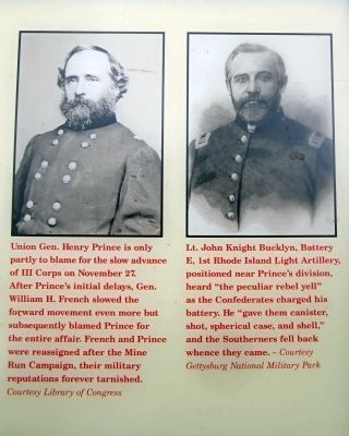
June 6, 2011
4. Union officers
Photographed by Benjamin Harrison Allen, November 26, 2021
5. The Battle of Payne’s Farm Marker
A new version of the marker has been installed.
Photographed by Bernard Fisher, June 6, 2011
6. Jacob's Ford Road is in the distance
Photographed by Evan Dwyer, January 6, 2026
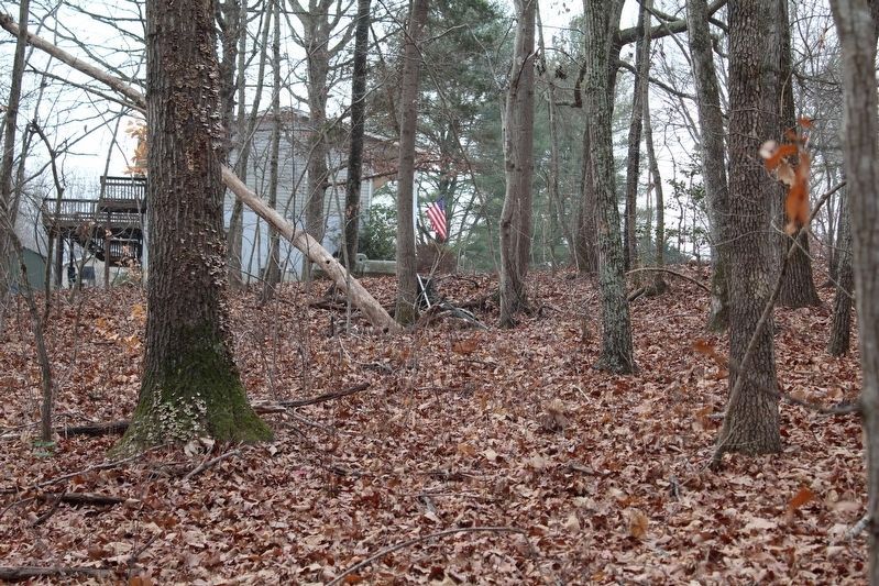
7. Herndon Farm Icehouse
An overlooked "landmark" on the trail is about 150 feet south and just to the left of the trail (if hiking the markers chronologically from the church area entrance). On private property - but readily visible from the trail as evidenced by the photograph - is the depression where the icehouse of the Herndon farm used to sit, and would have been present at the time of the battle just off Jacob's Ford Road. A modern house is on the homesite, and the icehouse's pit is now used as a trash dump by the current owners. Trash and a dead tree protruding from the pit mark the location in this image.
Credits. This page was last revised on February 28, 2026. It was originally submitted on June 6, 2011, by Bernard Fisher of Richmond, Virginia. This page has been viewed 1,394 times since then and 65 times this year. Last updated on April 16, 2018, by Bradley Owen of Morgantown, West Virginia. Photos: 1. submitted on February 24, 2026, by Evan Dwyer of Richmond, Virginia. 2, 3, 4. submitted on June 6, 2011, by Bernard Fisher of Richmond, Virginia. 5. submitted on February 23, 2022, by Benjamin Harrison Allen of Amissville, Virginia. 6. submitted on June 6, 2011, by Bernard Fisher of Richmond, Virginia. 7. submitted on February 24, 2026, by Evan Dwyer of Richmond, Virginia.
