Locust Grove in Orange County, Virginia — The American South (Mid-Atlantic)
The Battle of Payne’s Farm
Baptism of Fire
Photographed by Bernard Fisher, June 6, 2011
1. The Battle of Payne’s Farm CWT Marker
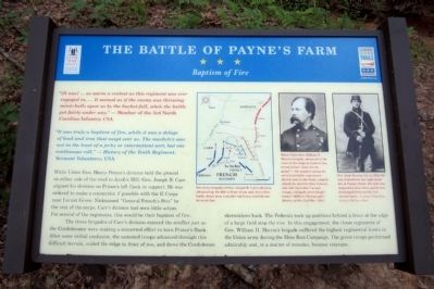
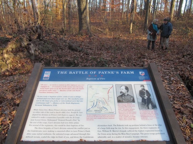
“[It was] … as warm a contest as this regiment was ever engaged in. … It seemed as if the enemy was throwing minie-balls upon us by the bucket-full, when the battle got fairly under way.” — Member of the 3rd North Carolina Infantry, CSA
“It was truly a baptism of fire, while it was a deluge of lead and iron that swept over us. The musketry was not in the least of a jerky or intermittent sort, but one continuous roll.” — History of the Tenth Regiment, Vermont Volunteers, USA
While Union Gen. Henry Prince’s division held the ground on either side of the road to Jacob’s Mill, Gen. Joseph B. Carr aligned his division on Prince’s left flank in support. He was ordered to make a connection if possible with the II Corps near Locust Grove. Nicknamed “General French’s Pets” by the rest of the corps, Carr’s division had seen little action. For several of the regiments, this would be their baptism of fire.
The three brigades of Carr’s division entered the conflict just as the Confederates were making a concerted effort to turn Prince’s flank. After some initial confusion, the untested troops advanced through this difficult
this page online
(captions)
The three brigades of Gen. Joseph B. Carr’s division advanced up the hill in front of you and, in its first battle, drove away a smaller but heavy Confederate skirmish line.
When Union Gen. William H. Morris’s brigade advanced to the crest of the ridge in front of you, it had at last “seen the elephant”—the popular saying for one’s first battle experience. Morris rode to the front, congratulated his men for their bravery, and told them that “as new troops, a brigade never fought better.” Miller’s Photographic History of the Civil War (1911)
Pvt. Jesse Benson, Co. A, 151st NY, was wounded in the right shoulder at Payne’s Farm. His arm was amputated soon after, and he was discharged from service two months later. — Courtesy Gettysburg National Military Park
Erected 2011
Photographed by Benjamin Harrison Allen, November 26, 2021
2. The Battle of Payne’s Farm Marker
An updated marker has been installed.
Topics and series. This historical marker is listed in this topic list: War, US Civil. In addition, it is included in the Virginia Civil War Trails series list.
Location. 38° 20.297′ N, 77° 49.503′ W. Marker is in Locust Grove, Virginia, in Orange County. It can be reached from Zoar Road (Virginia Route 611) east of Indiantown Road ( Route 603). Touch for map. Marker is at or near this postal address: 31334 Zoar Road, Locust Grove VA 22508, United States of America. Touch for directions.

Regionally, this marker is in Northern Virginia and in the Piedmont. It is also in the American South and specifically in the Upper South. Globally, it is in North America, the Western Hemisphere, the Western World, and the Anglosphere. Historically, it finds itself in what was once the territory of the Mississippian Culture, one of the original Thirteen Colonies, one of the Confederate States of America, and the Antebellum South.
Other nearby markers. At least 8 other markers are within walking distance of this marker: A different
Photographed by Bernard Fisher, June 6, 2011
3. The Battle of Payne’s Farm Walking Trail
Another marker is no longer nearby. The Mine Run Campaign (was approx. half a mile away but has been permanently removed).
Also see . . .
1. Mine Run (Payne's Farm). American Battlefield Trust (Submitted on November 11, 2021.)
2. The Mine Run Campaign by James K. Bryant II. Essential Civil War Curriculum, Virginia Center for Civil War Studies at Virginia Tech (Submitted on November 11, 2021.)

4. Carr's Division advances toward the open fields on Payne's Farm
Credits. This page was last revised on February 24, 2026. It was originally submitted on June 6, 2011, by Bernard Fisher of Richmond, Virginia. This page has been viewed 1,332 times since then and 83 times this year. Last updated on February 24, 2026, by Evan Dwyer of Richmond, Virginia. Photos: 1. submitted on June 6, 2011, by Bernard Fisher of Richmond, Virginia. 2. submitted on February 22, 2022, by Benjamin Harrison Allen of Amissville, Virginia. 3, 4. submitted on June 6, 2011, by Bernard Fisher of Richmond, Virginia. • Devry Becker Jones was the editor who published this page.
