Middletown Township in Monmouth County, New Jersey — The American Northeast (Mid-Atlantic)
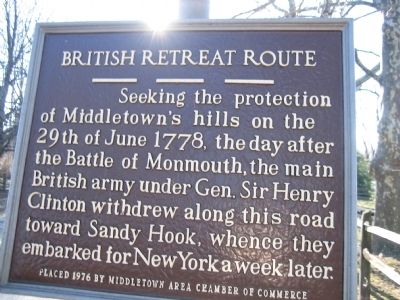
British Retreat Route
Photographed by David Anderson, February 28, 2008
1. British Retreat Route Marker
Erected 1976 by Middletown Area Chamber of Commerce.
Topics. This historical marker is listed in these topic lists: Colonial Era • War, US Revolutionary. A significant historical date for this entry is June 29, 1778.
Location. 40° 23.688′ N, 74° 5.184′ W. Marker is in Middletown Township, New Jersey, in Monmouth County. It is on King's Highway East, on the right when traveling west. West of Sleepy Hollow Road. Touch for map. Marker is in this post office area: Middletown NJ 07748, United States of America. Touch for directions.

Regionally, this marker is in Central Jersey, specifically on the Jersey Shore, and in the New York City Metropolitan Area. It is also in the American Northeast, in the Mid-Atlantic, and on the Eastern Seaboard. Globally, it is in the North Atlantic Region, North America, the Western Hemisphere, the Western World, and the Anglosphere. Historically,
this page online
Other nearby markers. At least 8 other markers are within 2 miles of this marker, measured as the crow flies: British Campsite (approx. 0.8 miles away); Chapel Hill (approx. 0.8 miles away); a different marker also named British Retreat Route (approx. 0.9 miles away); Middletown Village (approx. one mile away); Fairview Cemetery Veterans Monument (approx. 1.3 miles away); a different marker also named British Retreat Route (approx. 1.4 miles away); a different marker also named Middletown Village (approx. 1.4 miles away); 29th Regiment New Jersey Volunteer Infantry Civil War Memorial (approx. 1.4 miles away). Touch for a list and map of all markers in Middletown Township.
Related markers. Click here for a list of markers that are related to this marker. To better understand the relationship, study each marker in the order shown.
Photographed by David Anderson, February 28, 2008
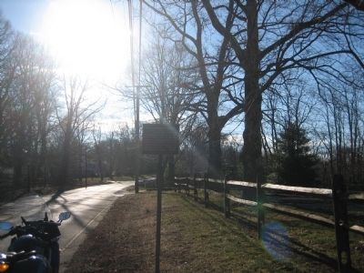
2. British Retreat Route Marker
Photographed by David Anderson, February 28, 2008
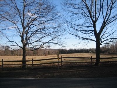
3. British Retreat Route Marker
This is the cow pasture near the British Retreat Historical Marker. It is one of the last open spaces on King's Highway.
Credits. This page was last revised on February 7, 2023. It was originally submitted on February 28, 2008, by David Anderson of Middletown, New Jersey. This page has been viewed 3,058 times since then and 82 times this year. Last updated on April 27, 2018, by @histkeep of Walnut Creek, California. Photos: 1, 2, 3. submitted on February 28, 2008, by David Anderson of Middletown, New Jersey. • Andrew Ruppenstein was the editor who published this page.
