San Felipe in Austin County, Texas — The American South (West South Central)
San Felipe de Austin Cemetery
Photographed by Brian Anderson, April 28, 2018
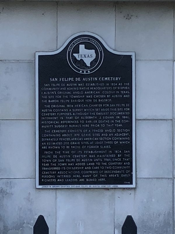
1. San Felipe de Austin Cemetery Marker
The original 1824 Mexican charter for San Felipe de Austin contains a survey which set aside this site for cemetery purposes. Although the earliest documented interment is that of Elisebath J. Eidman in 1846, historical references to earlier deaths in the community suggest burials here prior to that year.
The cemetery consists of a fenced Anglo section containing about 370 grave sites and an adjacent, separately fenced, African American section containing an estimated 200 grave sites, at least three of which are known to be those of former slaves.
From the time of its establishment in 1824 San Felipe de Austin Cemetery was maintained by the town of San Felipe de Austin until 1966. Since that year the town has added land to the cemetery and transferred its ownership and care to two community cemetery associations comprised of descendants of persons interred here. Many
this page online
(incise)
James W. Brown Chapter DRT-San Felipe de Austin Cemetery Assn.
Erected 1993 by Texas Historical Commission. (Marker Number 4537.)
Topics. This historical marker is listed in this topic list: Cemeteries & Burial Sites. A significant historical year for this entry is 1824.
Location. 29° 47.894′ N, 96° 6.045′ W. Marker is in San Felipe, Texas, in Austin County. It is on Campo Santo Street west of Farm to Market Road 1458, on the left when traveling west. Touch for map. Marker is at or near this postal address: 4902 Campo Santo Street, San Felipe TX 77473, United States of America. Touch for directions.

Regionally, this marker is in the American South and on the Gulf Coast. Globally, it is in North America, a Gulf of Mexico state, the Western Hemisphere, the Western World, and the Anglosphere. Historically, it finds itself in what was once New Spain, the Republic of Texas, one of the Confederate States of America, and the Antebellum South.
Other nearby markers. At least 8 other markers are within walking distance of this marker: San Felipe School (approx.
Photographed by Brian Anderson, April 28, 2018
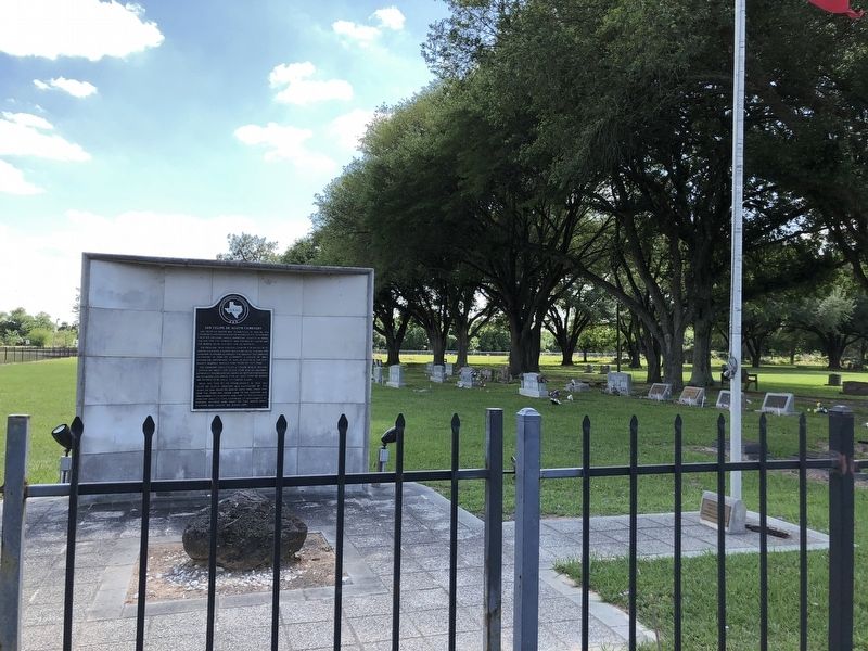
2. San Felipe de Austin Cemetery Marker
Credits. This page was last revised on August 27, 2020. It was originally submitted on April 30, 2018, by Brian Anderson of New Albany, Ohio. This page has been viewed 594 times since then and 47 times this year. Last updated on May 2, 2018, by Brian Anderson of New Albany, Ohio. Photos: 1, 2. submitted on April 30, 2018, by Brian Anderson of New Albany, Ohio. • Bernard Fisher was the editor who published this page.
