Auburn in Fauquier County, Virginia — The American South (Mid-Atlantic)
Stuart's Bivouac
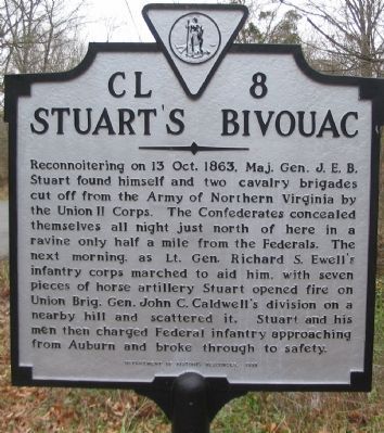
Photographed by Craig Swain, December 22, 2007
1. Stuart's Bivouac Marker
Erected 1998 by Department of Historic Resources. (Marker Number CL-8.)
Topics and series. This historical marker is listed in this topic list: War, US Civil. In addition, it is included in the Virginia Department of Historic Resources (DHR) series list. A significant historical year for this entry is 1863.
Location. 38° 41.559′ N, 77° 40.887′ W. Marker is in Auburn, Virginia, in Fauquier County. It is on Old Dumfries Road (County Route 667), on the right when traveling north. Touch for map. Marker is in this post office area:
this page online

Regionally, this marker is in the Washington Metropolitan Area and in Northern Virginia. It is also in the American South, specifically in the Upper South, and in the Mid-Atlantic. Globally, it is in North America, the Western Hemisphere, the Western World, and the Anglosphere. Historically, it finds itself in what was once the territory of the Mississippian Culture, one of the original Thirteen Colonies, one of the Confederate States of America, and the Antebellum South.
Other nearby markers. At least 8 other markers are within 4 miles of this marker, measured as the crow flies: Neavil's Ordinary (approx. one mile away); St. Stephen's Episcopal Church (approx. 1.2 miles away); Battle of Coffee Hill (approx. 1.3 miles away); Second Battle of Auburn (approx. 1.3 miles away); Neavil’s Mill (approx. 1.3 miles away); Grapewood Farm Engagement (approx. 3 miles away); Fauquier County / Prince William County (approx. 3.3 miles away); Mosby’s Raid at Catlett’s Station (approx. 3.4 miles away). Touch for a list and map of all markers in Auburn.
Another marker
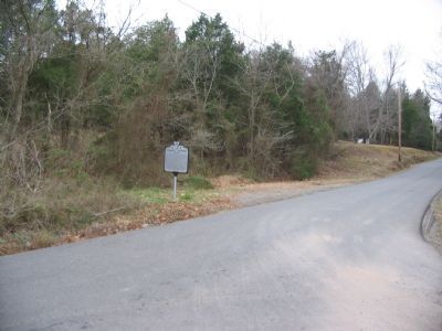
Photographed by Craig Swain, December 22, 2007
2. Stuart's Bivouac Marker
Also see . . .
1. First Battle of Auburn. Brief National Park Service summary. On October 13, 1863, Brig. Gen. Lunsford L. Lomax's Confederate cavalry brigade sparred with elements of the Federal III Corps along the Old Carolina Road (Todays Rouge's Road, County Route 602). With Lomax's repulse, Stuart realized he was right in the middle of the Federal Army of the Potomac, and effectively cut off. As result, he opted to wait out the Federals and camp quietly on the east side of Cedar Run. (Submitted on December 23, 2007, by Craig Swain of Leesburg, Virginia.)
2. Second Battle of Auburn. This short summary discusses the action described on the marker, which occurred the next day, October 14, 1863. (Submitted on December 23, 2007, by Craig Swain of Leesburg, Virginia.)
Additional commentary.
1. Bristoe Station Campaign
The Battle of Auburn was part of a series of minor actions, compared to the great Civil War battles involving the Federal Army of the Potomac and the Confederate
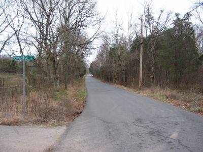
Photographed by Craig Swain, December 22, 2007
3. Stuart's Bivouac and Withdrawal
Stuart sheltered his command in the low ground around a branch from Cedar Run. After halting Caldwell's Federal Division, which was camped to the north on the other side of Coffee Hill, Stuart retreated down Dufries Road.
On October 8, 1863, he ordered the Army forward, advancing along the well traveled routes through Fauquier County. He dispatched cavalry under General Stuart to locate the Federal flanks. Soon Stuart discovered the Federal army was also in motion and moving on a parallel path along the Orange & Alexandria Railroad, also headed for Manassas. In discovering this, Stuart had committed his command along the line of march of the Federals. As discussed on the marker, he was effectively cut off from the rest of the Confederate Army.
General Lee detailed a portion of his army to fight through the Federal line of march and regain contact with Stuart, resulting in the Second Battle of Auburn, or Coffee Hill. Meanwhile, further to the east, Confederate General A.P. Hill located elements of the Federal Army moving through Bristoe Station, some of which
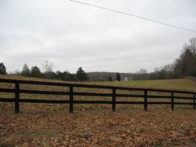
Photographed by Craig Swain, December 22, 2007
4. Beckham's Artillery Position
Looking east from the intersection of County Routes 670 and 667, Stuart ordered Major Robert F. Beckham's Horse Artillery deployed on the high ground just beyond the fence line. Beckham faced his guns west toward Coffee Hill and the artillery of Caldwell's Division.
The fighting here at Auburn was part of a fast moving and somewhat confusing to follow campaign through Fauquier and Prince William Counties.
— Submitted December 23, 2007, by Craig Swain of Leesburg, Virginia.
Credits. This page was last revised on May 3, 2018. It was originally submitted on December 23, 2007, by Craig Swain of Leesburg, Virginia. This page has been viewed 3,034 times since then and 116 times this year. Last updated on May 2, 2018, by Bradley Owen of Morgantown, West Virginia. Photos: 1, 2, 3, 4. submitted on December 23, 2007, by Craig Swain of Leesburg, Virginia. • Andrew Ruppenstein was the editor who published this page.
