Near Warrenton in Fauquier County, Virginia — The American South (Mid-Atlantic)
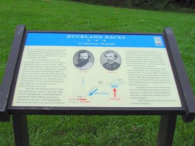
Buckland Races
An Inglorious Skedaddle
Photographed by J. J. Prats, September 24, 2006
1. Bucklland Races Marker
For Gen. J.E.B. Stuart and his Confederate cavalry, the 1863 campaigns brought fewer victories against the improving cavalry corps of the Union Army of the Potomac—that is, until October 19, 1863.
Here on Chestnut Hill the wily Confederate had set a trap for Gen. Judson Kilpatrick’s Union cavalry division. Using Gen. Wade Hampton’s cavalry division as bait, Stuart had lured one of Kilpatrick’s brigades here by retreating from Buckland Mill (5 miles east of here) along the Warrenton Turnpike (present-day Route 15/29). The jaw of the trap was Confederate Gen. Fitzhugh Lee’s cavalry division moving north toward Buckland Mill from east of here to cut off Kilpatrick’s line of retreat.
By 3:30 that afternoon, Stuart’s gray clad troopers were coiled to strike on Chestnut Hill as Kilpatrick’s unwitting Federals approached, when suddenly cannon fire erupted from the east. Lee’s Confederates had struck the Union rear guard at Buckland. At that moment Stuart’s three brigades swooped down on the Federals with a rebel yell, turning an organized retreat into an inglorious skedaddle. Hootin’ and hollerin’ all
this page online
Fortunately for Kilpatrick, his other supporting brigade was commanded by Gen. George Custer. Sensing the Rebel trap before it had been set, Custer delayed his advance to Chestnut Hill. By lingering in the vicinity of Buckland, he thwarted Fitz Lee’s attempt to cut off Kilpatrick long enough for most of the Federals to escape.
Although Stuart had to content himself with 250 Yankee prisoners instead of two entire brigades, the “Buckland Races” did yield a treasure of amusing yarns for future campfires.
This was the last action of the Bristoe Station Campaign.
Erected by Virginia Civil War Trails.
Topics and series. This historical marker is listed in this topic list: War, US Civil. In addition, it is included in the Virginia Civil War Trails series list. A significant historical date for this entry is October 19, 1863.
Location. Marker has been permanently removed. It was located near 38° 44.259′ N, 77° 46.138′ W. Marker was near Warrenton, Virginia, in Fauquier County.
Photographed by J. J. Prats, September 24, 2006
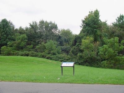
2. Buckland Races Marker
We have been informed that this marker is no longer there and will not be replaced. This page is an archival view of what was.
Regionally, this marker was in the Washington Metropolitan Area and in Northern Virginia. It was also in the American South, specifically in the Upper South, and in the Mid-Atlantic. Globally, it was in North America, the Western Hemisphere, the Western World, and the Anglosphere. Historically, it found itself in what was once the territory of the Mississippian Culture, one of the original Thirteen Colonies, one of the Confederate States of America, and the Antebellum South.

Other nearby markers. At least 8 other markers are within 3 miles of this location, measured as the crow flies: Colonial Road (about 600 feet away, measured in a direct line); McClellan’s Farewell (approx. 0.2 miles away); Rosenwald Schools in Fauquier (approx. 2 miles away); Christ's Chapel on Baldwin Ridge
Photographed by Craig Swain, January 5, 2008
3. Warrenton Turnpike
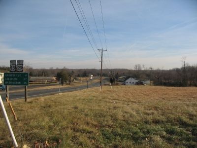
Looking from the intersection of VA 215 and US 15/29 to the east. In the initial stages of the battle, Federals under General Custer pursued Confederate cavalry down the Warrenton Turnpike (modern US 15/29). Later, once the trap was sprung, General Davies brigade fled back down this road seeking safety.
Another marker is no longer nearby. Fredericksburg Campaign (was approx. 0.2 miles away but has been permanently removed).
Also see . . . Buckland, Virginia. History. (Submitted on December 22, 2006.)
Additional commentary.
1. Marker is missing
I visited this site earlier today and can confirm the sign is no longer there.
— Submitted November 19, 2020, by Michael Kleen of Woodbridge, Virginia.
Photographed by Craig Swain, January 5, 2008
4. Custer and Fitzhugh Lee Skirmishing Site
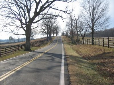
General Custer's Federals contested Confederates under General Fitzhugh Lee along the farm lanes bordering modern VA Highway 214. The rolling country in this area was thankfully preserved somewhat by circumstances. The presence of the old military base at Vint Hill Farms ensured much of the surrounding terrain was protected from large scale development.
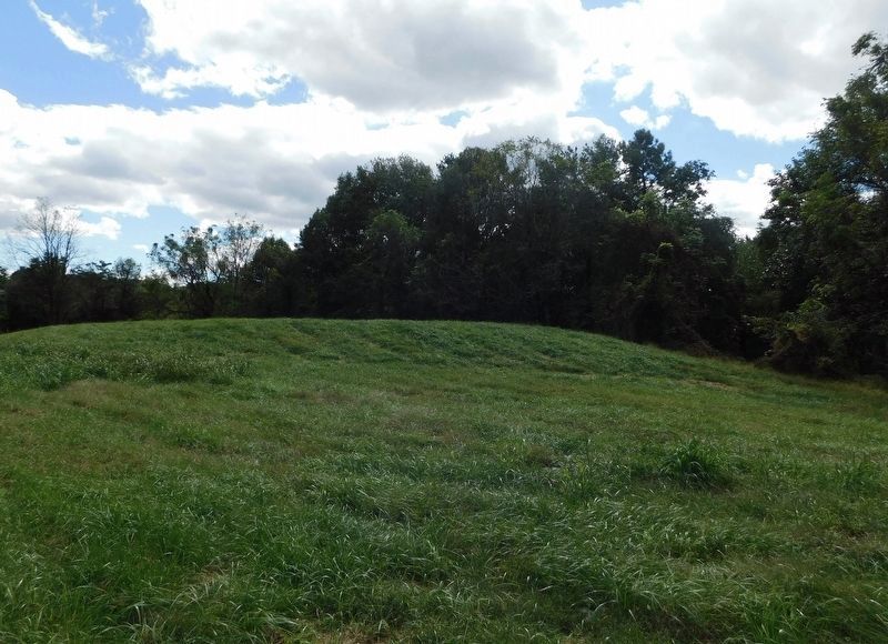
Photographed by Bradley Owen, October 13, 2018
5. Chestnut Hill
Here Confederate Gen. J.E.B. Stuart set a trap for Gen. Judson Kilpatrick’s Union cavalry division.
Credits. This page was last revised on January 5, 2026. It was originally submitted on December 22, 2006, by J. J. Prats of Powell, Ohio. This page has been viewed 4,305 times since then and 86 times this year. Last updated on May 3, 2018, by Bradley Owen of Morgantown, West Virginia. Photos: 1, 2. submitted on December 22, 2006, by J. J. Prats of Powell, Ohio. 3, 4. submitted on January 6, 2008, by Craig Swain of Leesburg, Virginia. 5. submitted on June 6, 2021, by Bradley Owen of Morgantown, West Virginia. • Bill Pfingsten was the editor who published this page.
