Pumpkintown in Pickens County, South Carolina — The American South (South Atlantic)
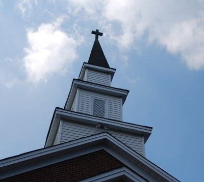
Oolenoy Baptist Church
Inscription.
[Front]:
This church, named for the Cherokee chief, Woolenoy - the spelling was changed to Oolenoy in 1827 - was organized in 1795 by Rev. John Chastain, who became its first minister. By 1797, with 50 members, it was admitted to the Bethel Baptist Association; it has since been a member of the Saluda, Twelve Mile River, Pickens, and Pickens-Twelve Mile Baptist Associations.
[Reverse]:
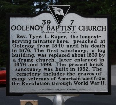
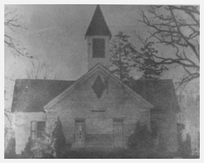
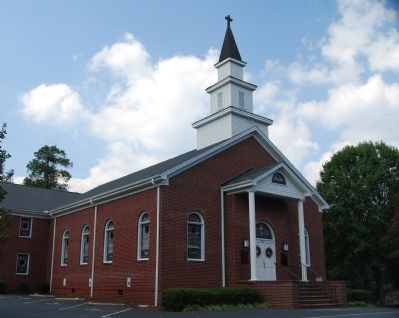
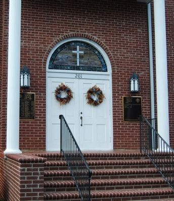
Rev. Tyre L. Roper, the longest-serving minister here, preached at Oolenoy from 1840 until his death in 1876. The first sanctuary, a log building, was replaced about 1830 by a frame church, later enlarged in 1876 and 1899. The present brick sanctuary was built in 1952. The cemetery includes the graves of many veterans of American wars from the Revolution through World War II.
Erected 2001 by Oolenoy Baptist Church Bicentennial Project. (Marker Number 39-7.)
Topics. This historical marker is listed in these topic lists: Cemeteries & Burial Sites • Churches & Religion. A significant historical year for this entry is 1827.
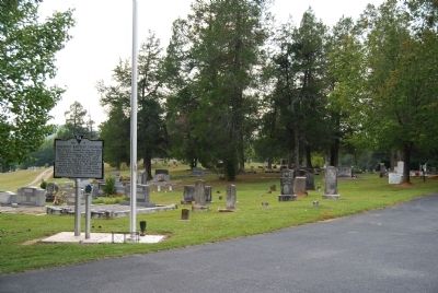
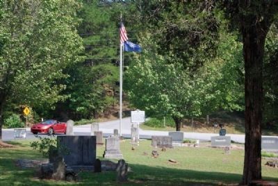
Location. 34° 59.683′ N, 82° 38.467′ W. Marker is in Pumpkintown, South Carolina, in Pickens County. Marker is on Miracle Hill Road (State Highway 39-298). Marker is located with the church's flag pool and its National Register marker on the south side of the church parking lot. Touch for map. Marker is at or near this postal address: 211 Miracle Hill Road, Pickens SC 29671, United States of America. Touch for directions.
Other nearby markers. At least 10 other markers are within 5 miles of this marker, measured as the crow flies. Cornelius Keith (within shouting distance of this marker); Cornelius Keith - 1715-1808 (approx. 0.7 miles away); Pumpkintown (approx. 0.8 miles away); Granite and Gravity (approx. 3.4 miles away); A CCC Classic (approx. 3.8 miles away); Civilian Conservation Corps (approx. 3.8 miles away); Beliefs Set in Stone (approx. 4 miles away); Parkitecture (approx. 4.1 miles away); Table Rock State Park (approx. 4.2 miles away); a different marker also named The Civilian Conservation Corps (approx. 4.2 miles away). Touch for a list and map of all markers in Pumpkintown.
Also see . . .
1. Oolenoy Baptist Church Cemetery. The Oolenoy Baptist Church Cemetery was established ca. 1798 in the Pumpkintown community of Pendleton (later Pickens) District. (Submitted on September 23, 2008, by Brian Scott of Anderson, South Carolina.)
2. Descendants of Cornelius Keith - 8 Generations. (Submitted on September 23, 2008, by Brian Scott of Anderson, South Carolina.)
3. History of Pumpkintown & Oolenoy. The Oolenoy River winds down between steeply rolling hills, on its way from the Gauley and Beasley Mountains to the Saluda River. (Submitted on July 5, 2009, by Brian Scott of Anderson, South Carolina.)
4. Our Keith Clan. Descendants of Cornelius Keith, Sr. (Submitted on July 6, 2009, by Brian Scott of Anderson, South Carolina.)
Additional commentary.
1. Who was Cornelius Keith?
In the foothills of South Carolina, there are many stories about the founding of white settlements. Some come into being due to being near a trading post. Others are carved out for military reasons. The Oolenoy Valley was settled by Cornelius Keith who is said to have traded a pony to Woolenoy, chief of the Cherokee, for the land (now known as Oolenoy Valley) and all fishing and hunting rights in the area. Not a bad bargain for the Scot. He and his family settled in the area. Woolenoy was also remembered as he became the namesake for Oolenoy Baptist Church.
— Submitted September 23, 2008, by Brian Scott of Anderson, South Carolina.
2. About the Oolenoy Baptist Church Cemetery
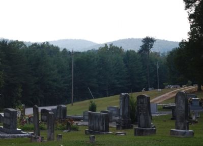
The Oolenoy Baptist Church Cemetery, established ca. 1798, is adjacent to the church, on Miracle Hill Road, just off S.C. Highway 135 near the Pumpkintown community, in the vicinity of Pickens, Pickens
County. This cemetery retains a high degree of integrity of location, setting, design, materials, workmanship, feeling and association. It includes 5.5 acres of the 8.96-acre parcel owned by Oolenoy Baptist Church and is located to the south and west of the sanctuary, which was built in 1952 and is excluded from this nomination.
The cemetery contains 839 marked graves, with headstones, footstones, and a few plot enclosures of granite, marble, fieldstone, or soapstone. Most gravestones are marble or granite tablets, though ledgers, box-tombs, tomb-tables, obelisks, and pedestal-tombs are also present. The earliest marked grave dates from 1798, and occasional burials still occur, although on a limited basis. The stones, arranged by family units within the cemetery boundaries, show some evidence of wear from the elements and from occasional vandalism but retain their integrity.
The cemetery is divided into four sections, with a dirt and gravel road encircling the middle section. It contains little formal landscaping or plantings other than several cedar trees laid out in the nineteenth century and a few boxwoods and holly shrubs. The Oolenoy Baptist Church has worked diligently for the past few years to clean and maintain the cemetery.
Significance: The Oolenoy Baptist Church Cemetery, established ca. 1798, is adjacent to the church, on Miracle Hill
Road, just off S.C. Highway 135 near the Pumpkintown community, in the vicinity of Pickens, Pickens County. It is eligible for listing in the National register under Criterion A for its significance in Exploration/Settlement for its association with the early settlement of the South Carolina upcountry. It is eligible, furthermore, under Criteria Consideration D as a cemetery deriving its significance from its age, as considered in the context of the settlement, growth, and development of this part of the state and as a cemetery containing the graves of persons of transcendent local importance.
This cemetery is an excellent example of a typical nineteenth century to mid-twentieth century church cemetery illustrating vernacular burial customs and gravestone art of the period. It is also significant for its association with Oolenoy Baptist Church, founded in 1795 and the first church established in the Pumpkintown community of Pendleton (later Pickens) District. The cemetery retains a high degree of integrity of location, setting, design, materials, workmanship, feeling, and association and evokes a sense of time and place as a historic church cemetery in the South Carolina upcountry.
Until after the American Revolution the nearby Woolenoy (later Oolenoy) valley and its environs were populated primarily by the Cherokee and a few white settlers. The Cherokee here
were led by a chief named Woolenoy, who called the valley "the land of grain and clear water." Tradition says that this cemetery was originally a Cherokee burying ground. Cornelius Keith (1715-1808), a native of Scotland who emigrated with his parents to Virginia as a child, bought his wife Juda Thompson and their first child to South Carolina from Virginia in 1743; they were the first white settlers in the valley. Other families, including the Elrod, Edens, Hendricks, Jones, McJunkin, Reid, Roper, and Sutherland families, followed and helped settle the area.
By 1795 the white population of the community - named Pumpkintown - was large enough to support a church congregation, and the Reverend John Chastain (1743-1805), a native of Virginia, founded Woolenoy Baptist Church (the name was changed to Oolenoy in 1827) with the assistance of Nathan Davis, a Baptist elder who lived nearby. By 1797, the year before the first documented burial in this cemetery, the church boasted fifty members and was admitted to the Bethel Baptist Association. The first sanctuary at this site, a log building, was replaced about 1830 by a frame church, later enlarged in 1876 and 1899. The present brick structure was built here in 1952.
The cemetery is one of the most important extant historical resources associated with the white exploration, settlement, and early growth of the Pumpkintown
community, and contains the graves of several persons prominent in the area, ranging from the beginning of the nineteenth century to the early twentieth century. Among the most notable are Cornelius Keith, trader and planter; and Reverend Tyre Lewis Roper (1809-1877), the longest-serving minister of Oolenoy Baptist Church, who preached here from 1840 to 1877. It also contains the graves of many veterans from American wars from the Revolution through World War II. (Source: National Register nomination form.)
— Submitted July 6, 2009, by Brian Scott of Anderson, South Carolina.
Photographed By Brian Scott, September 23, 2008
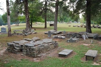
14. Scottish Chieftain Grave Sites
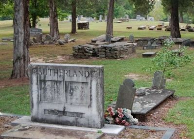
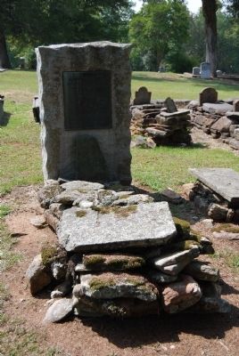
In addition to the many veterans buried in the cemetery, Oolenoy boasts of a number of Scottish chieftains buried in its cemetery. Their graves are the ones above ground, built out of stone as was done in the old country. There are two in the left foreground and a line of several in the right background.
Photographed By Brian Scott, September 23, 2008
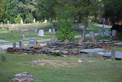
15. More Examples of the Chieftain Burial Sites
Those in the center are known as "slot and slab" tombstones. At the head and/or foot of the top slab, slots are carved in which, markers containing information (such as name and death date) are placed. Of all of the cemeteries I've photographed, this one has the most diverse style of burials I've ever seen.
Photographed By Brian Scott, September 23, 2008
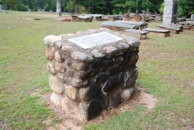
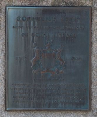
19. Cornelius Keith Plaque
Born in Loch Lomond, Scotland
Of Royal Lineage
1715-1808
Dating from 1010 A.D.
Original pioneer of Oolenoy settlement.
Started about 1743, married Juda Thompson.
Reared twelve children. One son was
Colonel Cornelius Keith, Revolutionary
was hero whose wife was Mary Lafoone.
Credits. This page was last revised on November 24, 2020. It was originally submitted on September 23, 2008, by Brian Scott of Anderson, South Carolina. This page has been viewed 3,576 times since then and 419 times this year. Photos: 1, 2, 3, 4, 5, 6. submitted on September 23, 2008, by Brian Scott of Anderson, South Carolina. 7. submitted on July 6, 2009, by Brian Scott of Anderson, South Carolina. 8, 9, 10, 11, 12. submitted on September 23, 2008, by Brian Scott of Anderson, South Carolina. 13. submitted on July 6, 2009, by Brian Scott of Anderson, South Carolina. 14, 15, 16. submitted on September 23, 2008, by Brian Scott of Anderson, South Carolina. 17. submitted on July 6, 2009, by Brian Scott of Anderson, South Carolina. 18, 19, 20, 21. submitted on September 23, 2008, by Brian Scott of Anderson, South Carolina.

