Wallisville in Chambers County, Texas — The American South (West South Central)
Mission Nuestra Señora de la Luz
Photographed by Jim Evans, October 13, 2012
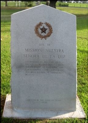
1. Mission Nuestra Senora de la Luz Marker
Mission Nuestra
Señora de la Luz
Established in 1757 by Franciscan
missionaries with
the purpose of civilizing and
Christianizing the Orcoquiza
and Bidai Indians
Abandoned in 1772
Erected 1936 by The State of Texas. (Marker Number 9127.)
Topics and series. This historical marker is listed in these topic lists: Colonial Era • Indigenous Peoples and Communities • Religion & Religious Structures • Settlements & Settlers. In addition, it is included in the Texas 1936 Centennial Markers and Monuments series list. A significant historical year for this entry is 1757.
Location. 29° 50.303′ N, 94° 44.175′ W. Marker is in Wallisville, Texas, in Chambers County. It is on Feeder Road to Interstate 10 0.3 miles west of Wallisville Liberty Road, on the right when traveling east. Marker may be visible from Interstate-10 but is best viewed from the eastbound feeder road. Touch for map. Marker is at or near this postal address: 20136 I-10, Wallisville TX 77597, United States of America. Touch for directions.

Regionally, this marker is in the Houston Metropolitan Area. It is also in the American South and
this page online
Other nearby markers. At least 8 other markers are within 6 miles of this marker, measured as the crow flies: Mission Nuestra Senora de la Luz del Orcoquisac and Presidio San Agustin de Ahumada (here, next to this marker); Joseph Blancpain's French Trading Post (here, next to this marker); Site of Old Wallisville (within shouting distance of this marker); Wallisville Cemetery (approx. ¾ mile away); St. Emily Methodist Church (approx. 4.8 miles away); Turtle Bayou Resolutions (approx. 5 miles away); Chambers County Youth Project Show (approx. 5.2 miles away); Lone Star Canal (approx. 5½ miles away). Touch for a list and map of all markers in Wallisville.
Also see . . . Nuestra Señora de la Luz Mission - The Handbook of Texas Online. Texas State Historical Association (TSHA) (Submitted on May 7, 2018, by Brian Anderson of New Albany, Ohio.)
Photographed by Jim Evans
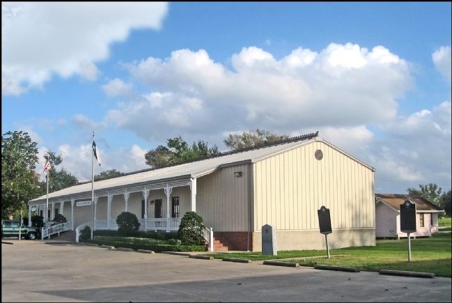
2. Wallisville Heritage Park Museum
Four historical markers are near this building.
Photographed by Jim Evans, October 13, 2012
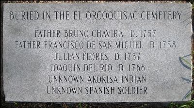
3. Foot Stone Listing People Buried in the Orcoquisac Cemetery
Buried in the El Orcoquisac Cemetery
Father Bruno Chavira d. 1757
Father Francisco de San Miguel d. 1758
Julian Flores d. 1757
Joaquin del Rio d. 1766
Unknown Akokisa Indian
Unknown Spanish soldier
Credits. This page was last revised on May 8, 2018. It was originally submitted on October 15, 2012, by Jim Evans of Houston, Texas. This page has been viewed 1,641 times since then and 54 times this year. Last updated on May 7, 2018, by Brian Anderson of New Albany, Ohio. Photos: 1, 2, 3. submitted on October 15, 2012, by Jim Evans of Houston, Texas. • Bernard Fisher was the editor who published this page.
