Cadereyta de Montes, Querétaro, Mexico — The Central Highlands (North America)
Observing the Yucca Forest
Estación 6
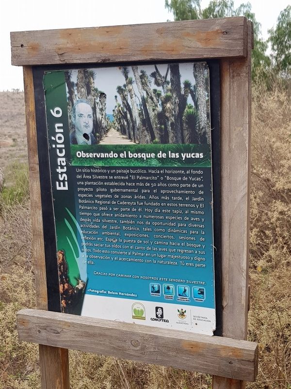
Observando el bosque de las yucas
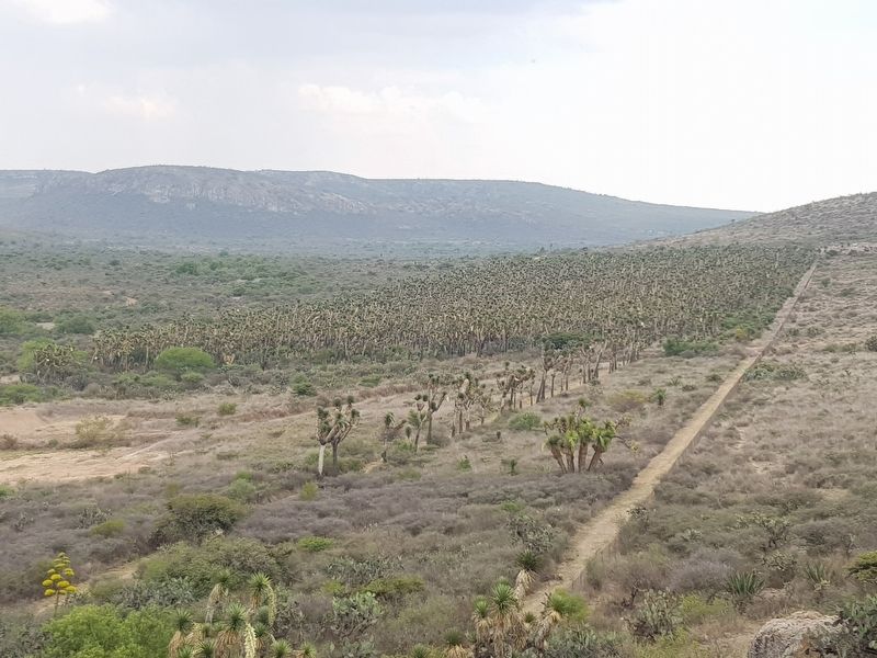
Un sitio histórico y un paisaje bucólico. Hacia el horizonte, al fondo del Área Silvestre se entrevé “El Palmarcito” o “Bosque de Yucas”, una plantación establecida hace más de 50 años como parte de un proyecto piloto gubernamental para el aprovechamiento de especies vegetales de zonas áridas. Años más tarde, el Jardín Botánico Regional de Cadereyta fue fundado en estos terrenos y El Palmarcito pasó a ser parte de él. Hoy día este tapiz, al mismo tiempo que ofrece anidamiento a numerosas especies de aves y desás vida silvestre, también nos da oportunidad para diversas actividades del Jardín Botánico, tales como dinámicas para la educación ambiental, exposiciones, conciertos, sesiones de reflexión etc. Espera la puesta de sol y camina hacia el bosque y podrás saciar tus oídos con el canto de las aves que regresan a sus nidos. Todo esto convierte al Palmar en un lugar majestuoso y digno a la observación y el acercamiento con la naturaleza. Tú eres parte de ella.
Gracias por caminar con nosotros este sendero silvestre.
Fotografía: Belem Hernández
Observing the Yucca Forest
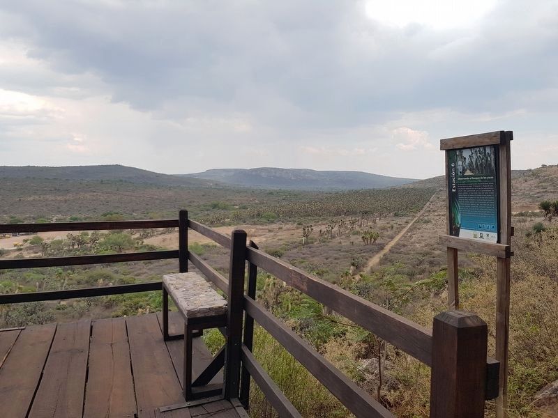
A historical site and a rustic landscape. Towards the horizon, near the end of the Natural Area we can see "El Palmarcito" or the "Yucca Forest", a plantation established more than 50 years ago as part of a government pilot project for the exploitation of plant species in arid zones. Years later, the Regional Botanical Garden of Cadereyta was founded in these lands and El Palmarcito was incorporated into it. Today this tapestry, while offering nesting sites to numerous species of birds and wildlife, also gives us the opportunity for Botanical Garden activities, such as spaces for environmental education, exhibitions, concerts, reflection sessions, etc. Wait for the sunset and walk towards the forest and you will be able to satisfy your ear with the song of the birds returning to their nests. All this makes El Palmarcito a majestic and dignified place for observation and learning about nature. You are part of it.
Thank you for walking with us on this natural trail.
Photographs by Belem Hernández
Erected by Jardín Botánico Regional de Cadereyta y otras organizaciones.
Topics. This historical marker is listed in these topic lists: Agriculture • Charity & Public Work • Parks & Recreational Areas.
Location.
20° 41.081′ N, 99° 48.224′ W. Marker is in Cadereyta de Montes, Querétaro. Marker can be reached from Calle Pilancón. This marker is the last marker along the Water Trail (Sendero del Agua) at the Cadereyta Regional Botanical Garden, a short walking path about 300 m from the visitors center. Touch for map. Marker is in this post office area: Cadereyta de Montes QUE 76500, Mexico. Touch for directions.
Other nearby markers. At least 8 other markers are within 2 kilometers of this marker, measured as the crow flies. Botanical Garden of Cadereyta (approx. 0.4 kilometers away); Cadereyta’s Water Reservoir (approx. 1.1 kilometers away); Temple of the Most Pure Conception (approx. 1.4 kilometers away); The Temple of Saints Peter and Paul (approx. 1.5 kilometers away); Friar Pablo de Betancur (approx. 1.5 kilometers away); The Temple of the Holy Solitude (approx. 1.6 kilometers away); The Temple of the Holy Ladder (approx. 1.6 kilometers away); The Temple of Our Lady of Refuge (approx. 1.7 kilometers away). Touch for a list and map of all markers in Cadereyta de Montes.
Credits. This page was last revised on May 13, 2018. It was originally submitted on May 13, 2018, by J. Makali Bruton of Accra, Ghana. This page has been viewed 98 times since then and 7 times this year. Photos: 1, 2, 3, 4. submitted on May 13, 2018, by J. Makali Bruton of Accra, Ghana.


