New Caney in Montgomery County, Texas — The American South (West South Central)
New Caney
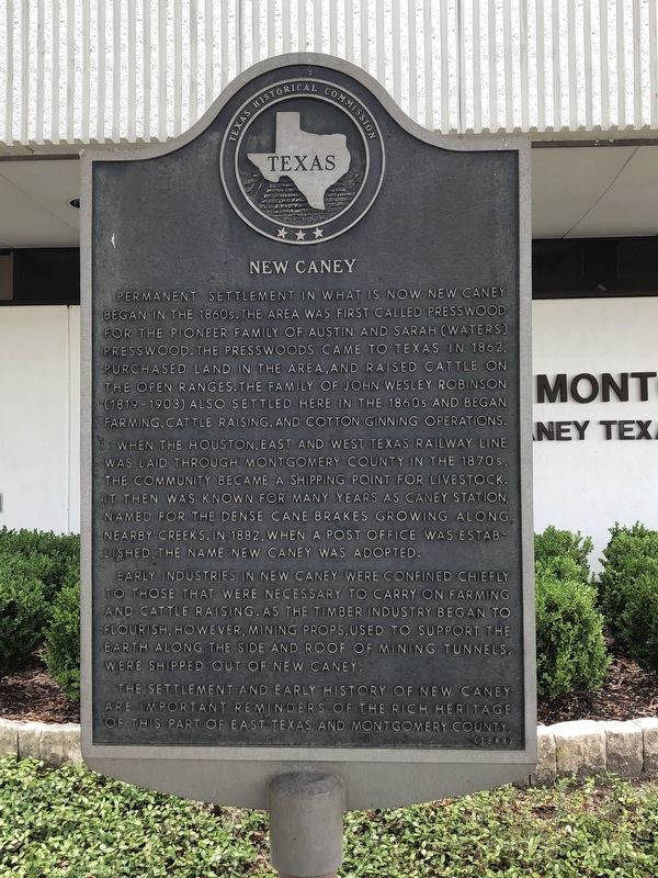
Photographed by Brian Anderson, May 13, 2018
1. New Caney Marker
Permanent settlement in what is now New Caney began in the 1860s. The area was first called Presswood for the pioneer family of Austin and Sarah (Waters) Presswood. The Presswoods came to Texas in 1862, purchased land in the area, and raised cattle on the open ranges. The family of John Wesley Robinson (1819-1903) also settled here in the 1860s and began farming, cattle raising, and cotton ginning operations.
When the Houston, East and West Texas Railway line was laid through Montgomery County in the 1870s, the community became a shipping point for livestock. It then was known for many years as Caney Station, named for the dense cane brakes growing along nearby creeks. In 1882, when a post office was established, the name New Caney was adopted.
Early industries in New Caney were confined chiefly to those that were necessary to carry on farming and cattle raising. As the timber industry began to flourish, however, mining props, used to support the earth along the side and roof of mining tunnels, were shipped out of New Caney.
The settlement and early history of New Caney are important reminders of the rich
this page online
Erected 1984 by Texas Historical Commission. (Marker Number 7892.)
Topics. This historical marker is listed in these topic lists: Agriculture • Railroads & Streetcars • Settlements & Settlers. A significant historical year for this entry is 1862.
Location. 30° 8.392′ N, 95° 13.61′ W. Marker is in New Caney, Texas, in Montgomery County. It can be reached from the intersection of U.S. 59 and Justice Drive. Marker is located in front of the East Montgomery County Courthouse Annex. Touch for map. Marker is at or near this postal address: 21130 US Highway 59, New Caney TX 77357, United States of America. Touch for directions.

Regionally, this marker is in the Houston Metropolitan Area. It is also on the American Gulf Coast. Globally, it is in North America, a Gulf of Mexico state, the Western Hemisphere, the Western World, and the Anglosphere. Historically, it finds itself in what was once New Spain, the Republic of Texas, one of the Confederate States of America, and the Antebellum South.
Other nearby markers. At least 8 other markers are within 11 miles of this marker, measured as the crow flies: Moonshine Hill (approx. 9.7 miles away); Lambrecht's Artesian Well (approx. 9.9 miles away); Humble Independent School District (approx. 10 miles away); City of Humble (approx. 10.1 miles away); Trees of Knowledge (approx. 10.1 miles away); Pangburn Building (approx. 10.1 miles away); Humble Lodge No. 979, A.F. & A.M. (approx. 10.1 miles away); First United Methodist Church of Humble (approx. 10.1 miles away).
Also see . . . New Caney, Texas - The Handbook of Texas Online. Texas State Historical Association (TSHA) (Submitted on June 13, 2018, by Brian Anderson of New Albany, Ohio.)
Credits. This page was last revised on December 2, 2024. It was originally submitted on May 13, 2018, by Brian Anderson of New Albany, Ohio. This page has been viewed 1,536 times since then and 92 times this year. Photo 1. submitted on May 13, 2018, by Brian Anderson of New Albany, Ohio. • Andrew Ruppenstein was the editor who published this page.
