
Near Rice in Prince Edward County, Virginia — The American South (Mid-Atlantic)
Double Bridges
Wagon Train Bogged Down
| — | Lee's Retreat | — |
Photographed by Bernard Fisher, May 19, 2018
1. Double Bridges Marker
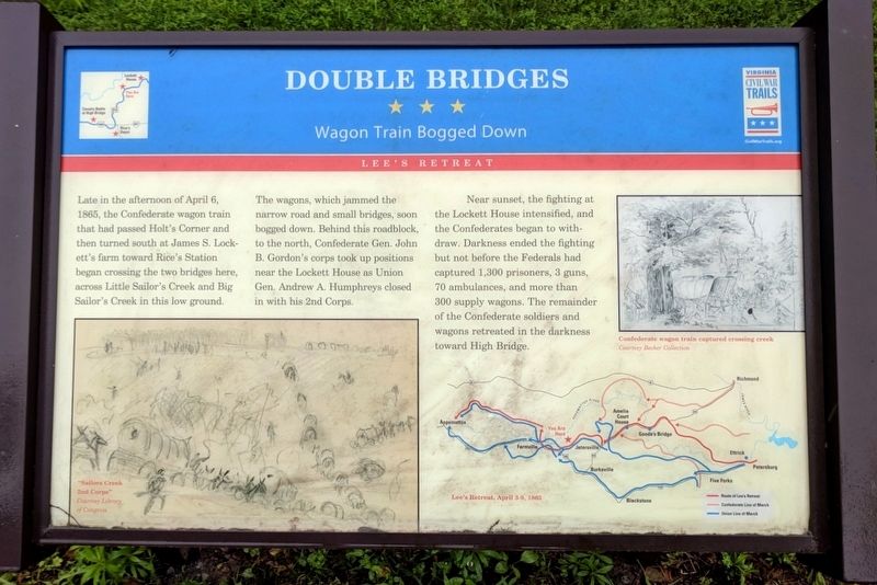
The wagons, which jammed the narrow road and small bridges, soon bogged down. Behind this roadblock, to the north, Confederate Gen. John B. Gordon’s corps took up positions near the Lockett House as Union Gen. Andrew A. Humphreys closed in with his 2nd Corps.
Near sunset, the fighting at the Lockett House intensified, and the Confederates began to withdraw. Darkness ended the fighting but not before the Federals had captured 1,300 prisoners, 3 guns, 70 ambulances, and more than 300 supply wagons. The remainder of the Confederate soldiers and wagons retreated in the darkness toward High Bridge.
Erected by Virginia Civil War Trails.
Topics and series. This historical marker is listed in this topic list: War, US Civil. In addition, it is included in the Virginia Civil War Trails series list. A significant historical date for this entry is April 6, 1865.
Location. 37° 19.603′ N,
this page online

Regionally, this marker is in Virginia’s Piedmont, in Southside Virginia, and specifically in Central Virginia. It is also in the American South and specifically in the Upper South. Globally, it is in North America, the Western Hemisphere, the Western World, and the Anglosphere. Historically, it finds itself in what was once the territory of the Mississippian Culture, one of the original Thirteen Colonies, one of the Confederate States of America, and the Antebellum South.
Other nearby markers. At least 8 other markers are within 3 miles of this marker, measured as the crow flies: A different marker also named Double Bridges (here, next to this marker); Sailor’s Creek (approx. 0.6 miles away); a different marker also named Lockett House (approx. 0.6 miles away); General Wheaton's First Division Assault

Photographed by Mike McKeown, April 25, 2025
2. Double Bridges Marker
Other markers no longer nearby. Lockett House (was approx. 0.6 miles away but has been permanently removed); Crossing Little Sailor's Creek (was approx. 2.3 miles away but has been permanently removed); Assaulting the Confederate Battle Line (was approx. 2.3 miles away but has been permanently removed); Overton/Hillsman House (was approx. 2.3 miles away but has been replaced with another marker now near it); Hillsman House (was approx. 2.3 miles away but has been permanently removed); The Final Clash: With Fate Against Them (was approx. 2.3 miles away but has been permanently removed); Victory or Death (was approx. 2.4 miles away but has been permanently removed).
Also see . . .
1. Sailor's Creek Battlefield State Park. Virginia Department of Conservation and Recreation (Submitted on November 11, 2021.)
2. Sailor's Creek (Saylor's Creek).
Photographed by Evan Dwyer, February 7, 2026
3. Double Bridges - Confluence of Creeks
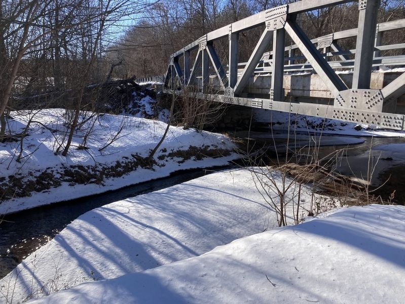
This is the confluence of Sayler's (Sailor's) Creek - nearest the camera - and Little Sailor's Creek (flows from the opposite side of the point of land ending just under the modern bridge). The Two bridges required to span these two creeks at this point gave the site its name. Concrete 20th century remnants remain.

Photographed by Evan Dwyer, February 7, 2026
4. Little Sailor's Creek Defunct Bridge
This is the concrete span, long removed from service, over Little Sailor's Creek. A shorter span would have bridged Sailor's Creek out of the frame just to the left, using the finger of land between the two creeks as a link between the bridges - hence "double bridges."
Credits. This page was last revised on February 28, 2026. It was originally submitted on May 20, 2018, by Bernard Fisher of Richmond, Virginia. This page has been viewed 1,316 times since then and 73 times this year. Photos: 1. submitted on May 20, 2018, by Bernard Fisher of Richmond, Virginia. 2. submitted on May 21, 2025, by Mike McKeown of Baltimore, Maryland. 3, 4. submitted on February 19, 2026, by Evan Dwyer of Richmond, Virginia.
