
Spring Bayou
Spring Bayou Wildlife Management Area
| — | Atchafalaya Water Heritage Trail | — |
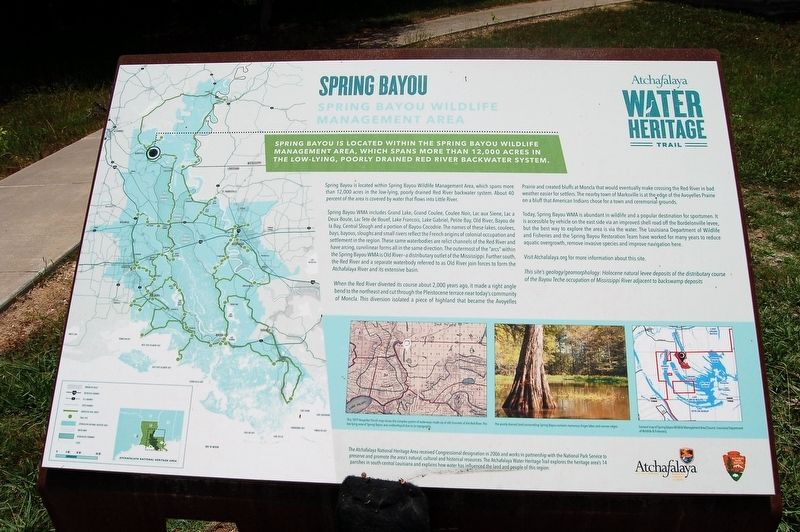
Spring Bayou in located within the Spring Bayou Wildlife Management Area, which spans more than 12,000 acres in the low-lying , poorly drained Red River backwater system.
Spring Bayou is located within Spring Bayou Wildlife Management Area, which spans more than 12,000 acres in the low-lying, poorly drained Red River backwater system. About 40 percent of the area is covered by water that flows into Little River.
Spring Bayou WMA includes Grand Lake, Grand Coulee, Coulee Noir, Lac aux Siene, Lac a Deux Boute, Lac Tete de Bouef, Lake Francois, Lake Gabriel, Petite Bay, Old River, Bayou de la Bay, Central Slough and a portion of Bayou Cocodrie. The names of these lakes, coulees, bays, bayous, sloughs and small rivers reflect the French origins of colonial occupation and settlement in the region. These same waterbodies are relict channels of the Red River and have arcing, curvilinear forms all in the same direction. The outermost of the “arcs” within the Spring Bayou WMA is Old River—a distributary outlet of the Mississippi. Further south, the Red River and a separate waterbody referred to as Old River join
this page online
When the Red River diverted its course about 2,000 years ago, it made a right angle bend to the northeast and cut through the Pleistocene terrace near today’s community of Moncla. This diversion isolated a piece of highland that became the Avoyelles Prairie and created bluffs at Moncla that would eventually make crossing the Red River in bad weather easier for settlers. The nearby town of Marksville is at the edge of the Avoyelles Prairie on a bluff that American Indians chose for a town and ceremonial grounds.
Today, Spring Bayou WMA is abundant in wildlife and a popular destination for sportsmen. It is accessible by vehicle on the east side via an improved shell road off the Bordelonville levee, but the best way to explore the area is via the water. The Louisiana Department of Wildlife and Fisheries and the Spring Bayou Restoration Team have worked for many years to reduce aquatic overgrowth, remove invasive species and improve navigation here.
Visit Atchafalaya.org for more information about this site.
This site’s geology/geomorphology: Holocene natural levee deposits of the distributary course of the Bayou Teche occupation of Mississippi River adjacent to backswamp deposits
Erected by State
Topics and series. This historical marker is listed in these topic lists: Environment • Waterways & Vessels. In addition, it is included in the Atchafalaya Water Heritage Trail series list.
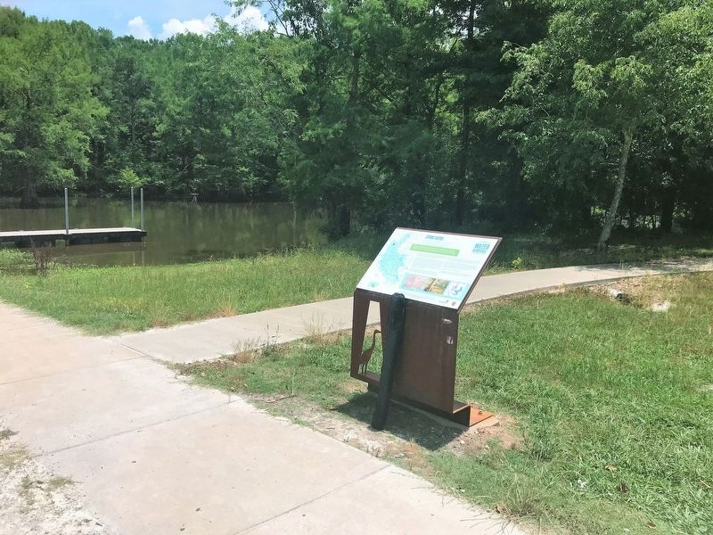
Location. 31° 7.205′ N, 92° 0.702′ W. Marker is in Marksville, Louisiana, in Avoyelles Parish. It is on Spring Bayou Road one mile south of Dr. Michel Road. Located at the Spring Bayou WMA Boat Launch. Touch for map. Marker is at or near this postal address: 2674 Spring Bayou Road, Marksville LA 71351, United States of America. Touch for directions.

Regionally, this marker is in Central Louisiana and in Acadiana — Cajun Country. It is also in the American South and specifically in the Deep South. Globally, it is in North America, a Gulf of Mexico state, the Western Hemisphere, the Western World, and the Anglosphere. Historically, it finds itself in what was once New Spain, Acadia, the territory of the Mississippian Culture, the Louisiana Purchase, one of the Confederate States of America, and the Antebellum South.
Other nearby markers. At
Credits. This page was last revised on July 30, 2023. It was originally submitted on May 22, 2018, by Cajun Scrambler of Assumption, Louisiana. This page has been viewed 1,262 times since then and 76 times this year. Photos: 1, 2, 3. submitted on May 22, 2018.
