Cumberland Township near Gettysburg in Adams County, Pennsylvania — The American Northeast (Mid-Atlantic)
Thomas's Brigade
Pender's Division - Hill's Corps
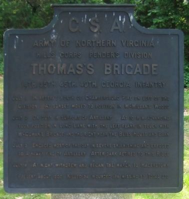
— Army of Northern Virginia —
Army of Northern Virginia
Hill's Corps Pender's Division
Thomas's Brigade
14th. 35th. 45th. 49th. Georgia Infantry
July 1 In reserve north of Chambersburg Pike on left of the Division. At sunset moved to position in McMillan's woods.
July 2 On duty in support of Artillery. At 10 p.m. advancing took position in Long Lane with the left flank in touch with McCowan's Brigade and the right near the Bliss House and Barn.
July 3 Engaged most of the day in severe skirmishing and exposed to a heavy fire of Artillery. After dark retired to this Ridge.
July 4 At night withdrew and began the march to Hagerstown.
Present about 1200. Killed 34, wounded 179, missing 57. Total 270.
Erected 1910 by Gettysburg National Military Park Commission.
Topics. This historical marker is listed in this topic list: War, US Civil. A significant historical month for this entry is July 1927.
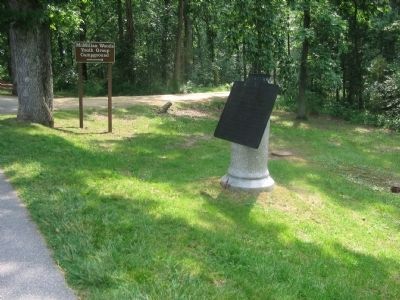
Location. 39° 49.273′ N, 77° 14.764′ W. Marker is near Gettysburg, Pennsylvania, in Adams County. It is in Cumberland Township. Marker is on West Confederate Avenue, on the right when traveling south. Located on the McMillan Woods section of Confederate Avenue, at the entrance to the McMillan Woods Youth Campground, in Gettysburg National Military Park. Touch for map. Marker is in this post office area: Gettysburg PA 17325, United States of America. Touch for directions.
Other nearby markers. At least 8 other markers are within walking distance of this marker. McGraw's Battery - Pegram's Battalion (a few steps from this marker); Lane's Brigade (within shouting distance of this marker); Brander's Battery - Pegram's Battalion (within shouting distance of this marker); Zimmerman's Battery - Pegram's Battalion (within shouting distance of this marker); Pender's Division (within shouting distance of this marker); Pegram's Battalion (about 300 feet away, measured in a direct line); Crenshaw's Battery - Pegram's Battalion (about 400 feet away); Grandy's Battery - Garnett's Battalion (about 400 feet away). Touch for a list and map of all markers in Gettysburg.
Also see . . . Thomas's Brigade. Stone Sentinels website entry (Submitted on June 7, 2023, by Larry Gertner of New York, New York.)

Photographed By Craig Swain, June 28, 2008
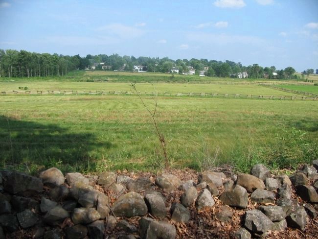
3. Thomas's Brigade in the Long Lane
Looking east from the vicinity of Pender's Division tablet (just north of Thomas' Brigade Tablet). The Long Lane ran roughly where the modern homes stand, extending south toward the Bliss Farm (to the right out of frame). The Brigade was part of an advanced line posed against Cemetery Hill in the afternoon of July 2. Thomas' Brigade was exposed to fire from the Federal artillery on the high ground on Cemetery Hill and Ridge. Also bearing on the brigade were skirmishers from the 14th Connecticut and 12th New Jersey, posted to the Bliss Farm.
Credits. This page was last revised on June 7, 2023. It was originally submitted on September 15, 2008, by Craig Swain of Leesburg, Virginia. This page has been viewed 1,094 times since then and 23 times this year. Last updated on September 26, 2008, by Carolyn Moody of Baltimore, Maryland. Photos: 1, 2, 3. submitted on September 15, 2008, by Craig Swain of Leesburg, Virginia.

