
Near Rice in Prince Edward County, Virginia — The American South (Mid-Atlantic)
Sailor’s Creek
Photographed by Bill Coughlin, April 26, 2007
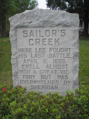
1. Sailor’s Creek Marker
his last battle,
April 6, 1865.
Ewell almost
won a great vic-
tory but was
overwhelmed by
Sheridan.
Nottoway Chapter
U.D.C. 1928
Erected 1928 by United Daughters of the Confederacy, Nottoway Chapter.
Topics and series. This historical marker is listed in this topic list: War, US Civil. In addition, it is included in the Battlefield Trails - Civil War, and the United Daughters of the Confederacy series lists. A significant historical date for this entry is April 6, 1865.
Location. 37° 19.806′ N, 78° 14.908′ W. Marker is near Rice, Virginia, in Prince Edward County. It is on Virginia Route 619, on the left when traveling south. Marker is located near the Lockett House. Touch for map. Marker is in this post office area: Rice VA 23966, United States of America. Touch for directions.

Regionally, this marker is in Virginia’s Piedmont, in Southside Virginia, and specifically in Central Virginia. It is also in the American South and specifically in the Upper South. Globally, it is in North America, the Western Hemisphere, the Western World, and the Anglosphere. Historically, it finds itself in what was once
this page online
Other nearby markers. At least 8 other markers are within 2 miles of this marker, measured as the crow flies: A different marker also named Lockett House (within shouting distance of this marker); Double Bridges (approx. 0.6 miles away); a different marker also named Double Bridges (approx. 0.6 miles away); General Wheaton's First Division Assault (approx. 2 miles away); The Federal Artillery Barrage (approx. 2 miles away); a different marker also named Overton/Hillsman House (approx. 2 miles away); Battle of Sailor's (Sayler's) Creek (approx. 2 miles away); Holt's Corner (approx. 2.1 miles away). Touch for a list and map of all markers in Rice.
Other markers no longer nearby. Lockett House (was here, next to this marker but has been permanently removed); Overton/Hillsman House (was approx. 2 miles away but has been replaced with another marker now near it); Hillsman House (was approx. 2 miles away but has been permanently removed); Crossing Little Sailor's Creek (was approx.
Photographed by Craig Swain, April 18, 2010
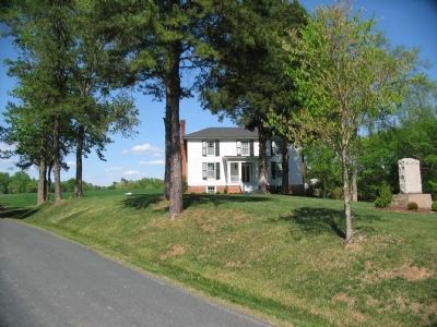
2. Sailor’s Creek Memorial and Restored Lockett House
Related markers. Click here for a list of markers that are related to this marker. Battle of Sailor's Creek by markers.
Also see . . .
1. Sailor’s Creek. CWSAC Battle Summaries. (Submitted on September 27, 2008, by Bill Coughlin of Woodland Park, New Jersey.)
2. Sailor's Creek State Park. Virginia State Parks website. (Submitted on September 27, 2008, by Bill Coughlin of Woodland Park, New Jersey.)
Photographed by Bill Coughlin, April 26, 2007
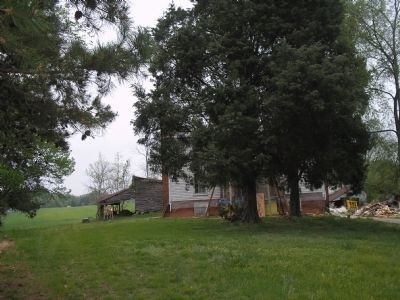
3. Lockett House
The marker is located in front of the house of James Lockett. This house, which still shows scars of the April 6, 1865 battle, was used as a hospital after the fighting.
Photographed by Bill Coughlin, April 26, 2007
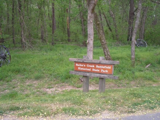
4. Sailor’s Creek Battlefield State Park
The marker is located near this park which preserves the site of the last major battle of Gen. Robert E. Lee's Army of Northern Virginia.
Credits. This page was last revised on June 16, 2016. It was originally submitted on September 27, 2008, by Bill Coughlin of Woodland Park, New Jersey. This page has been viewed 2,043 times since then and 35 times this year. Photos: 1. submitted on September 27, 2008, by Bill Coughlin of Woodland Park, New Jersey. 2. submitted on June 12, 2010, by Craig Swain of Leesburg, Virginia. 3, 4. submitted on September 27, 2008, by Bill Coughlin of Woodland Park, New Jersey.
