San Elizario in El Paso County, Texas — The American South (West South Central)
Salt War
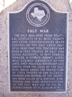
Photographed by Bill Kirchner, November 4, 2010
1. Salt War Marker
Erected 1984 by Texas Historical Commission. (Marker Number 4502.)
Topics. This historical marker is listed in this topic list: Notable Events. A significant historical year for this entry is 1877.
Location. 31° 35.119′ N, 106° 16.383′ W. Marker is in San Elizario, Texas, in El Paso County. It can be reached from the intersection of San Elizario Road and Church Street. Marker is located at the San Elizario Memorial Plaza. Touch for map. Marker is at or near this postal address: 1521 San Elizario Road, San Elizario TX 79849, United States of America.
this page online

Regionally, this marker is in Texas’ Trans-Pecos & Big Bend Region. It is also in the American Borderlands and in the Southwest. Globally, it is in North America, a Gulf of Mexico state, the Western Hemisphere, the Western World, and the Anglosphere. Historically, it finds itself in what was once New Spain, the Republic of Texas, and one of the Confederate States of America.
Other nearby markers. At least 8 other markers are within walking distance of this marker: Rodriguez-Chamuscado Expedition - 1581 (here, next to this marker); The Camino Real (here, next to this marker); The First Thanksgiving (here, next to this marker); Espejo Beltran Expedition - 1582-1583 (here, next to this marker); Juan de Onate Expedition - 1598 (here, next to this marker); San Elizario (here, next to this marker); San Elizario Memorial Plaza (here, next to this marker); Los Portales (within shouting distance of this marker). Touch for a list and map of all markers in San Elizario.
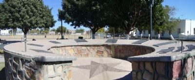
Photographed by Bill Kirchner, November 4, 2010
2. San Elizario Memorial Plaza
Salt War Marker is the third marker on the left.
Credits. This page was last revised on June 10, 2018. It was originally submitted on November 15, 2010, by Bill Kirchner of Tucson, Arizona. This page has been viewed 1,237 times since then and 43 times this year. Last updated on June 5, 2018, by Brian Anderson of New Albany, Ohio. Photos: 1, 2. submitted on November 15, 2010, by Bill Kirchner of Tucson, Arizona. • Andrew Ruppenstein was the editor who published this page.
