
Near Farmville in Cumberland County, Virginia — The American South (Mid-Atlantic)
Engagement at Cumberland Presbyterian Church
7 April 1865
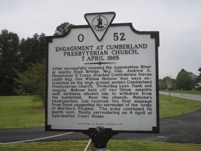
Photographed by Bill Coughlin, April 26, 2007
1. Engagement at Cumberland Presbyterian Church Marker
This marker is along the route of Lee's Retreat to Appomattox.
Erected 1993 by Department of Historic Resources. (Marker Number O-52.)
Topics and series. This historical marker is listed in these topic lists: Religion & Religious Structures • War, US Civil. In addition, it is included in the Virginia Department of Historic Resources (DHR) series list.
Location. 37° 20.751′ N, 78° 23.106′ W. Marker is near Farmville, Virginia, in Cumberland County. It is on Cumberland Road (Virginia Route 45), on the right when traveling
this page online

Regionally, this marker is in the Piedmont and in Central Virginia. It is also in the American South and specifically in the Upper South. Globally, it is in North America, the Western Hemisphere, the Western World, and the Anglosphere. Historically, it finds itself in what was once the territory of the Mississippian Culture, one of the original Thirteen Colonies, one of the Confederate States of America, and the Antebellum South.
Other nearby markers. At least 8 other markers are within 3 miles of this marker, measured as the crow flies: Cumberland Church (within shouting distance of this marker); a different marker also named Cumberland Church (within shouting distance of this marker); James F. Lipscomb (approx. one mile away); Needham Law School (approx. 1.6 miles away); Lest We Forget (approx. 2.4 miles away); Confederate Veterans Monument (approx. 2.4 miles away); Confederate Memorial (approx. 2.4 miles away); Confederate Cemetery (approx. 2.4 miles away). Touch for a list and map of all
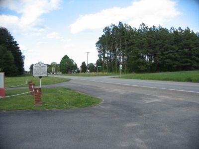
Photographed by Craig Swain, April 18, 2010
2. Engagement at Cumberland Presbyterian Church Marker
Also see . . .
1. Cumberland Church. CWSAC Battle Summaries. (Submitted on September 27, 2008, by Bill Coughlin of Woodland Park, New Jersey.)
2. Lee's Retreat. Virginia's Retreat guide. (Submitted on September 27, 2008, by Bill Coughlin of Woodland Park, New Jersey.)
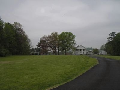
Photographed by Bill Coughlin, April 26, 2007
3. Cumberland Presbyterian Church
During Lee's retreat to Appomattox, Confederate troops entrenched around this church. They held off several attacks by Union troops on April 7, 1865, and withdrew under cover of darkness.
Credits. This page was last revised on July 6, 2021. It was originally submitted on September 27, 2008, by Bill Coughlin of Woodland Park, New Jersey. This page has been viewed 1,879 times since then and 46 times this year. Photos: 1. submitted on September 27, 2008, by Bill Coughlin of Woodland Park, New Jersey. 2. submitted on April 29, 2010, by Craig Swain of Leesburg, Virginia. 3. submitted on September 27, 2008, by Bill Coughlin of Woodland Park, New Jersey.
