
Rico in Dolores County, Colorado — The American Mountains (Southwest)
Rico, Colorado
Photographed by David J Gaines, June 2, 2015
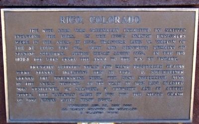
1. Rico, Colorado Marker
The Rico area was originally inhabited by natives including the Utes. In the 1700’s Spanish explorers were in the area. In 1833, trappers like W. Walton of the St. Louis Fur Co., came and reported remains of Spanish smelters. Mining began about 1860. In the mid 1870’s the Utes cede the area to the U.S. by treaty.
Frenzied activity began and many profitable claims were staked, including ten in 1877. D. Swickheimer opened the Enterprise Mine, the most successful mine in the area’s history. At its peak in 1892 Rico boasted 5000 residents, 23 saloons, 2 churches and 88 active mines. The railroad came in 1891 but the silver crash of 1893 ended Rico’s first boom.
Erected 2001 by Al Packer Chapter 100 Colorado E Clampus Vitus.
Topics and series. This historical marker is listed in these topic lists: Indigenous Peoples and Communities • Industry & Commerce • Settlements & Settlers. In addition, it is included in the E Clampus Vitus series list. A significant historical year for this entry is 1833.
Location. 37° 41.665′ N, 108° 1.906′ W. Marker is in Rico, Colorado, in Dolores County. It is on 145, on the left
this page online

Regionally, this marker is in the Western Slope. It is also in the American Mountain West, on the Colorado Plateau, and at the Four Corners. Globally, it is in North America, the Rocky Mountains, the Western Hemisphere, the Western World, and the Anglosphere. Historically, it finds itself in what was once Mexico’s Alta California.
Other nearby markers. At least 8 other markers are within 11 miles of this marker, measured as the crow flies: The Atlantic Cable Mine (here, next to this marker); Colorado Centennial Project (about 700 feet away, measured in a direct line); Rico Town Hall (about 700 feet away); Valley Rico Cemetery (approx. 1.1 miles away); Keeping the Trains Running (approx. 10½ miles away); Winter on a Mountain Pass (approx. 10.7 miles away); Sheep and Cattle Grazing in the High Country (approx. 10.7 miles away); Early History and Railroad Development (approx. 10.7 miles away). Touch for a list and map of all markers in Rico.
More about this marker. The Rico, Colorado
Photographed by David J Gaines, June 2, 2015
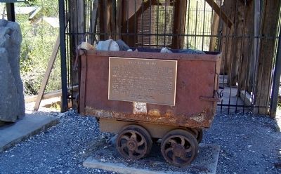
2. Rico, Colorado Marker
Photographed by Frank Gunshow Sanchez
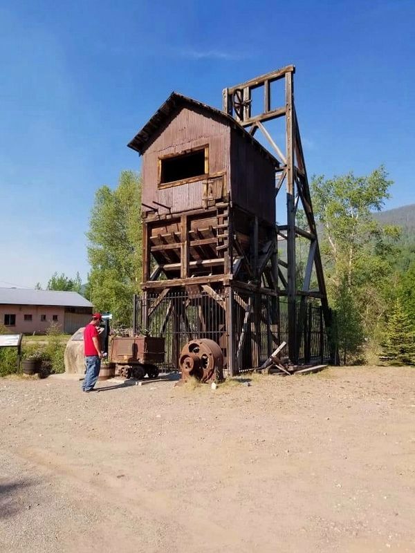
3. Rico, Colorado Marker
Credits. This page was last revised on December 23, 2024. It was originally submitted on July 5, 2015, by David J Gaines of Pinson, Alabama. This page has been viewed 1,080 times since then and 22 times this year. Last updated on June 11, 2018, by Frank Gunshow Sanchez of Hollister, California. Photos: 1, 2. submitted on July 5, 2015, by David J Gaines of Pinson, Alabama. 3. submitted on June 28, 2018, by Frank Gunshow Sanchez of Hollister, California. • Bill Pfingsten was the editor who published this page.
