
Seneca in Montgomery County, Maryland — The American Northeast (Mid-Atlantic)
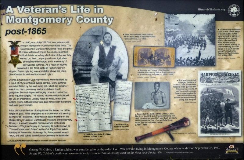
A Veteran’s Life in Montgomery County
post-1865
Photographed by Allen C. Browne, June 10, 2018
1. A Veteran’s Life in Montgomery County Marker
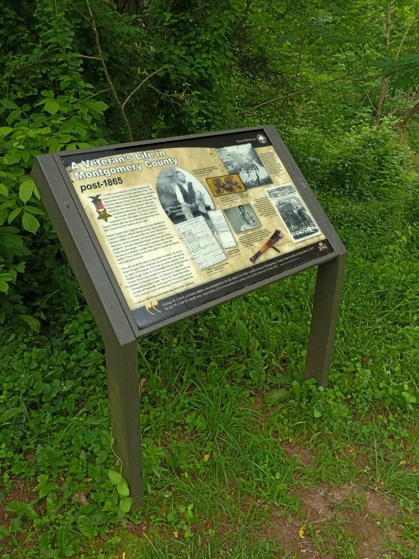
In 1890, one of the 252 Civil War veterans still living in Montgomery County was Elias Price. The Department of Census interviewed Price and other Civil War veterans living in the county, recording critical details including which side of the war they served on, their company, and rank, their date of enlistment/discharge, and the severity of any wounds suffered. As a result of injuries sustained in the 1863 Battle of Parkers Store in Virginia, Price's right leg was amputated above the knee. (See Census list and medical record.)
Overall, 8-half million Civil War veterans were disabled as a result of injuries inflicted during combat. Many suffered wounds inflicted by the lead minie ball, which led to bone infections, blood poisoning, and amputations due to gangrene. Survival depended largely on which part of the body required surgery. The road to recovery often included the use of prosthetics, usually made of wood, metal and leather. These artificial limbs were paid for by both the federal and state governments.
Price did not let the loss of a leg hinder his future, nor did he forget his past. While employed as
this page online
George W. Cubitt, a Union Soldier, was considered to be the oldest Civil War veteran living in Montgomery County when he died on September 28, 1937. At age 95, Cubitt’s death was ‘superinduced by overexertion in cutting corn on his farm near Poolesville.’
Erected by Montgomery Parks.
Topics and series. This historical marker is listed in this topic list: War, US Civil. In addition, it is included in the Maryland, Montgomery Parks series list.
Location. 39° 4.768′ N, 77° 20.412′ W. Marker is in Seneca, Maryland, in Montgomery County. It can be reached from Old River Road. This marker is near Seneca Creek at Poole's Store. Touch for map. Marker is
Photographed by Allen C. Browne, June 10, 2018
2. A Veteran’s Life in Montgomery County Marker

Regionally, this marker is in the Washington Metropolitan Area. It is also in the American Mid-Atlantic. Globally, it is in North America, the Western Hemisphere, the Western World, and the Anglosphere. Historically, it finds itself in what was once one of the original Thirteen Colonies and also the Antebellum South.
Other nearby markers. At least 8 other markers are within walking distance of this marker: Seneca Mills During the Civil War (here, next to this marker); Seneca Store (within shouting distance of this marker); Seneca Mill (within shouting distance of this marker); a different marker also named Seneca Store (within shouting distance of this marker); Seneca Creek: “A Raging River” (approx. 0.6 miles away); Seneca: “Average Man’s Resort” (approx. 0.6 miles away); The Historic Seneca Schoolhouse (approx. 0.6 miles away); Seneca Schoolhouse (approx. 0.6 miles away). Touch for a list and map of all markers in Seneca.
Another marker is no longer nearby. Seneca (was within shouting distance
Photographed by Allen C. Browne, June 13, 2018
3. Elias Price
1840 — 1904
1840 — 1904
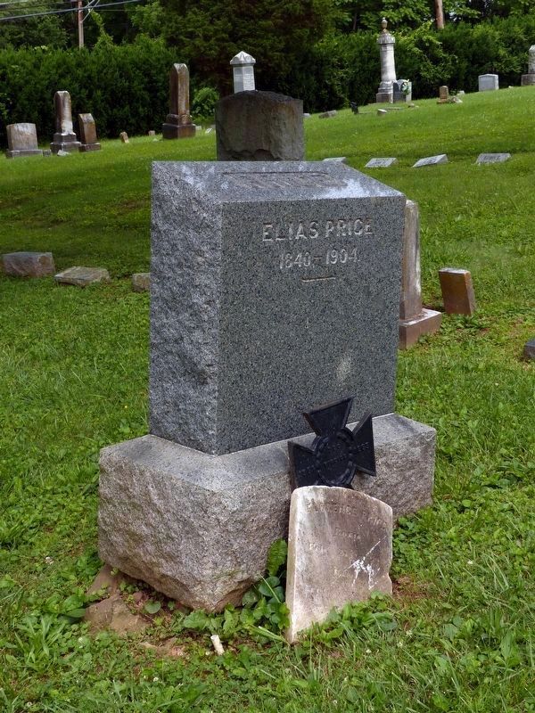
The graves of Elias Price and Frances Price (Feb. 15 1844 — Dec. 21, 1936) in Monocacy Cemetery in Beallsville. Deo Vindici.
Additional commentary.
1. 1864, not 1863?
Parker's Store is part of battle of Wilderness, in 1864, not 1863.
— Submitted July 18, 2026, by Carl Gordon Moore Jr. of North East, Maryland.
Credits. This page was last revised on July 18, 2026. It was originally submitted on June 13, 2018, by Allen C. Browne of Silver Spring, Maryland. This page has been viewed 540 times since then and 34 times this year. Last updated on July 18, 2026, by Carl Gordon Moore Jr. of North East, Maryland. Photos: 1, 2. submitted on June 13, 2018, by Allen C. Browne of Silver Spring, Maryland. 3. submitted on June 15, 2018, by Allen C. Browne of Silver Spring, Maryland. • Devry Becker Jones was the editor who published this page.
