Sturbridge in Worcester County, Massachusetts — The American Northeast (New England)
The Fire Pit
Photographed by William Fischer, Jr., May 20, 2018
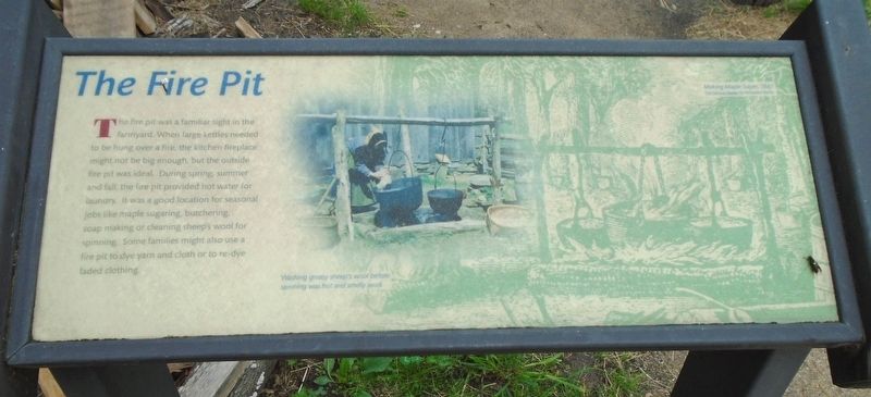
1. The Fire Pit Marker
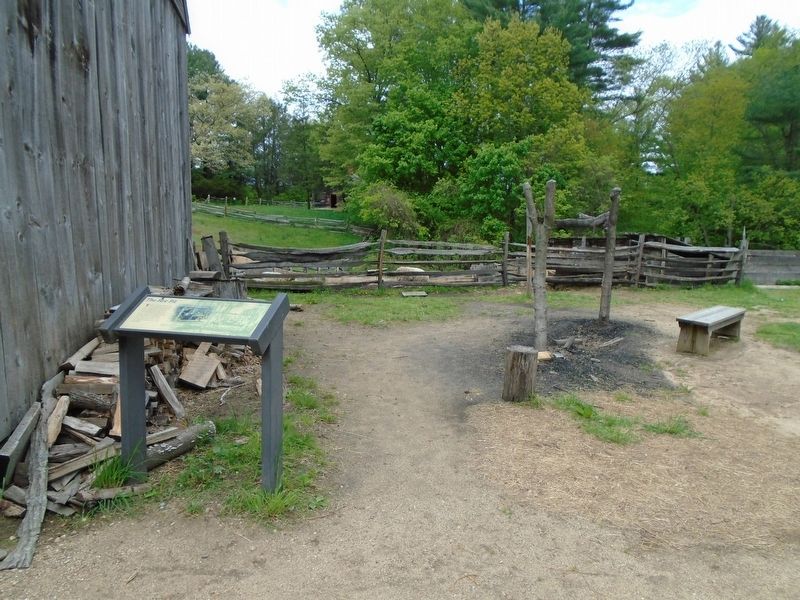
The fire pit was a familiar sight in the farmyard. When large kettles needed to be hung over a fire, the kitchen fireplace might not be big enough, but the outside fire pit was ideal. During spring, summer and fall, the fire pit provided hot water for laundry. It was a good location for seasonal jobs like maple sugaring, butchering, soap making or cleaning sheep's wool for spinning. Some families might also use a fire pit to dye yarn and cloth or to re-dye faded clothing.
[Photo caption reads]
Washing greasy sheep's wool before spinning was hot and smelly work.
[Background illustration caption reads]
Making Maple Sugar, 1847
The Pictorial Reader by Rensselaer Bently
Erected by Old Sturbridge Village.
Topics. This historical marker is listed in these topic lists: Agriculture • Animals • Settlements & Settlers. A significant historical year for this entry is 1847.
Location. 42° 6.408′ N, 72° 5.931′ W. Marker is in Sturbridge, Massachusetts, in Worcester County. It can be reached from Old Sturbridge Village Road. Marker is on the Old Sturbridge Village grounds. Touch for map. Marker is at or near this
this page online

Regionally, this marker is in the Quiet Corner and in Greater Worcester. It is also in the American Northeast and in New England. Globally, it is in North America, the Western Hemisphere, the Western World, and the Anglosphere. Historically, it finds itself in what was once one of the original Thirteen Colonies.
Other nearby markers. At least 8 other markers are within walking distance of this marker: Farming as a Way of Life (within shouting distance of this marker); The Graveyard (within shouting distance of this marker); Fitch House Yard (within shouting distance of this marker); Controlling Livestock: The Town Pound (about 300 feet away, measured in a direct line); Getting Water (about 300 feet away); Where is the Farm? (about 400 feet away); The Architectural Style of the Salem Towne House (about 500 feet away); Millstones (about 600 feet away). Touch for a list and map of all markers in Sturbridge.
Additional keywords. The Fire Pit
Photographed by William Fischer, Jr., May 20, 2018
2. The Fire Pit and Marker
Credits. This page was last revised on August 13, 2025. It was originally submitted on June 17, 2018, by William Fischer, Jr. of Reynoldsburg, Ohio. This page has been viewed 303 times since then and 23 times this year. Photos: 1, 2. submitted on June 17, 2018, by William Fischer, Jr. of Reynoldsburg, Ohio.
