Near Boise in Ada County, Idaho — The American West (Mountains)
Bonneville Point
The Oregon Trail
Inscription.
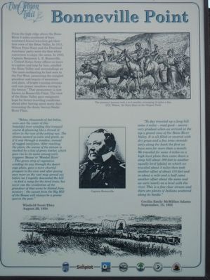
From the high ridge above the Boise River 5 miles southwest of here, westward-bound travelers got their first view of the Boise Valley. In 1811, Wilson Price Hunt and the Overland Astorians' party were the first white sojourners to enjoy the scene. In 1833, Captain Benjamin L. E. Bonneville, a United States Army officer on leave to explore and trap for furs, extolled the Boise Valley and surroundings as "the most enchanting he had sen in the Far West, presenting the mingled grandeur and beauty of the mountain and plain, of bright runnings streams and vast grassy meadows waving to the breeze." That promontory is now known as Bonneville Point. The view of the Boise Valley gave emigrants hope for better traveling conditions ahead after having spent many days traversing the dusty, barren Snake River Plain.
"Below, thousands of feet below, were seen the water of this beautiful river winding this tranquil course & gleaming like a thread of silver in the rays of the setting sun. The stream seemed as calm and gentle, as it was through a meadow, instead of rugged can(y)ons. After reaching the plain, the course of the stream is marked by a line of green timber, which gave rise to its name among early trappers 'Boisse" or 'Wooded River' - This green strip of vegetation winding its way through the desert sage plain, gave a more cheerful prospect to the view and after gazing once more on the vast map spread out before me I rapidly descended the hill - to find a camp for the tired train; but never can the recollection of the grandeur of the scene be blotted from memory - the sunset from the Big Hill of the Boisee will always be a greene spot in the past." Winfield Scot Ebey, August 20, 1854
"To day traveled up a long hill some 4 miles - road good - ascent very gradual when we arrived at the top a grand view of the Boise River Valley. It is all filled or covered with dry grass and a few trees immediately along the bank the first we have seen for more than a month. We traveled for some 4 miles on a high level plain then came down a steep hill about 200 feet to another equally level (plain) on which we traveled about 3 miles then took another offset of about 110 feet and in about a mile and a half came another offset about the same and we were nearly on a level with the river. This is a fine clear stream and there are plenty of Indians scattered along its banks." Cecilia Emily McMillan Adams, September 15, 1852
Erected by Ada County Parks and Recreation, Idaho Department of Transportation, Simplot.
Topics and series. This historical marker is listed in these topic lists: Exploration • Roads & Vehicles • Settlements & Settlers. In addition, it is included in the Oregon Trail series list.
Location. 43° 32.544′ N, 116° 6.588′ W. Marker is near Boise, Idaho, in Ada County. Marker is at the intersection of State Highway 21 and East Lake Forest Drive, on the right when traveling east on State Highway 21. Touch for map. Marker is in this post office area: Boise ID 83716, United States of America. Touch for directions.
Other nearby markers. At least 8 other markers are within walking distance of this marker. Idaho's Emigrant Trails (a few steps from this marker); Kelton Road (a few steps from this marker); Ezra Meeker (a few steps from this marker); Fort Boise (a few steps from this marker); "Our Road Was Very Steep…" (approx. 0.4 miles away); The Oregon Trail (approx. 0.8 miles away); Beaver Dick's Ferry (approx. 0.8 miles away); Whitman Overlook (approx. 0.9 miles away). Touch for a list and map of all markers in Boise.
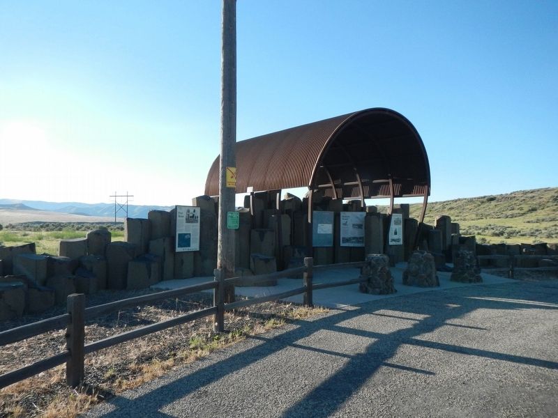
More about this marker. This marker is located at Oregon Trail display just off the highway.
Credits. This page was last revised on May 5, 2021. It was originally submitted on June 19, 2018, by Barry Swackhamer of Brentwood, California. This page has been viewed 490 times since then and 56 times this year. Photos: 1, 2. submitted on June 19, 2018, by Barry Swackhamer of Brentwood, California.

