Haymarket in Prince William County, Virginia — The American South (Mid-Atlantic)
Haymarket During the War
Civilian Hardships
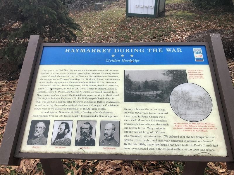
Throughout the Civil War, Haymarket and its residents endured the consequences of occupying an important geographical location. Marching armies passed through the town during the First and Second Battles of Manassas, the engagement at Thoroughfare Gap, the “Buckland Races,” and numerous other cavalry engagements. Confederate Gens. Robert E. Lee, Thomas J. "Stonewall" Jackson, James Longstreet, J.E.B. Stuart, Joseph E. Johnston, and P.G.T. Beauregard, as well as U.S. Gens. George D. Bayard, James B. Ricketts, Henry E. Davies, and George A. Custer, all passed through here. Many young local men joined the Confederate cause, serving in the 8th and 17th Virginia Infantry Regiments. St. Paul’s Episcopal Church (built in 1802) was used as a hospital after the First and Second Battles of Manassas, as well as during the measles epidemic that swept through the Confederate camps, west of the Manassas Battlefield, in the Autumn of 1861.
At midnight on November 5, 1862, a few days after Confederate bushwhackers fired on U.S. troops nearby, Federals under Gen. Adolph von Steinwehr burned the entire village. Only
this page online
Erected by Virginia Civil War Trails.
Topics and series. This historical marker is listed in this topic list: War, US Civil. In addition, it is included in the Virginia Civil War Trails series list. A significant historical month for this entry is November 1799.
Location. 38° 48.737′ N, 77° 38.231′ W. Marker is in Haymarket, Virginia, in Prince William County. It is on Washington Street (John Marshall Highway) (Virginia Route 55) west of Jefferson Street (Old Carolina Road), on the left when traveling west. Touch for map. Marker is in this post office area: Haymarket VA 20169, United States of America. Touch for directions.

Regionally, this
Photographed by Devry Becker Jones (CC0), January 2, 2021
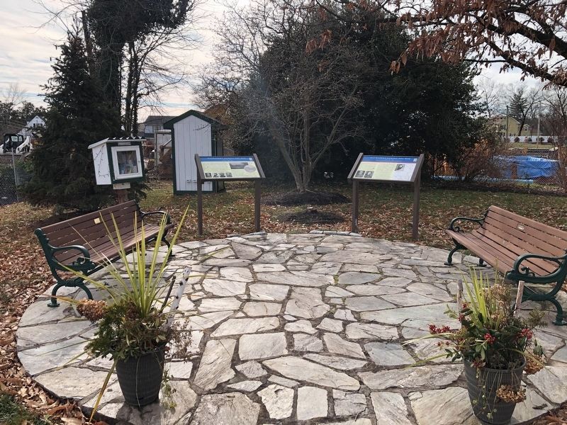
2. Two Markers Next to the Haymarket Museum
Other nearby markers. At least 8 other markers are within walking distance of this marker: A different marker also named Haymarket During the War (here, next to this marker); Colonial Roads (within shouting distance of this marker); Haymarket Post Office (within shouting distance of this marker); William Edward Ray, Sr. (about 400 feet away, measured in a direct line); In Memory of the Union Soldiers (approx. 0.2 miles away); St. Paul's, Episcopal (approx. 0.2 miles away); In This Area Are Buried (approx. 0.2 miles away); The Battle of Buckland Mills (approx. 0.9 miles away). Touch for a list and map of all markers in Haymarket.
Also see . . . Buckland Races. (Submitted on December 16, 2006.)
Credits. This page was last revised on January 2, 2021. It was originally submitted on December 16, 2006, by J. J. Prats of Powell, Ohio. This page has been viewed 3,337 times since then and 118 times this year. Last updated on June 21, 2018, by Bradley Owen of Morgantown, West Virginia. Photos: 1, 2. submitted on January 2, 2021, by Devry Becker Jones of Washington, District of Columbia. • Andrew Ruppenstein was the editor who published this page.
