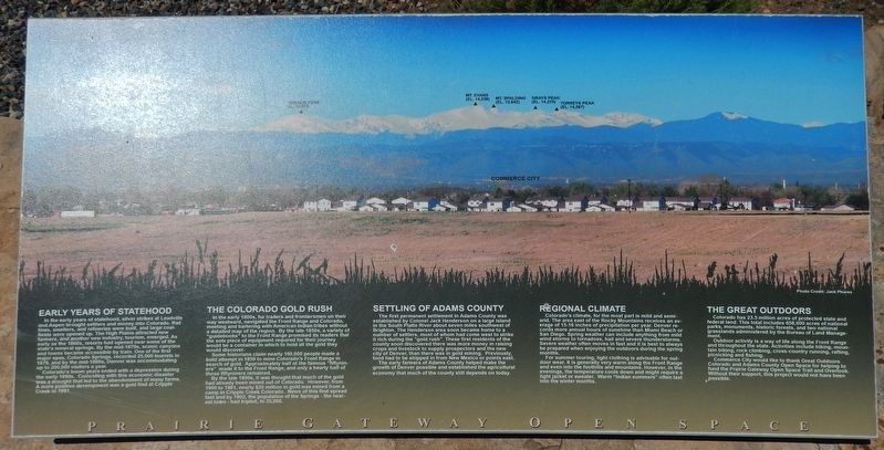
Commerce City in Adams County, Colorado — The American Mountains (Southwest)
Early Years of Statehood
Early Years of Statehood
In the early years of statehood, silver strikes at Leadville and Aspen brought settlers and money into Colorado. Rail lines, smelters, and refineries were built, and large coalfields were opened up. The High Plains attracted new farmers, and another new industry, tourism, emerged. As early as the 1860s, resorts had opened near some of the state's mineral springs. By the mid-1870s, scenic canyons and towns became accessible by train. One of the first major spas, Colorado Springs, recorded 25,000 tourists in 1878, and by the mid-1880s, Denver was accommodating up to 200,000 visitors a year.
Colorado's boom, years ended with a depression during the early 1890s. Coinciding with this economic disaster was a drought that led to the abandonment of many farms. A more positive development was a gold find at Cripple Creek in 1891.
The Colorado Gold Rush
In the early 1800s, fur traders and frontiersmen on their way westward, navigated the Front Range and Colorado, meeting and bartering with American Indian tribes without a detailed map of the region. By the late 1850s, a variety of "guidebooks" to the Front Range promised its readers that the sole piece of equipment required for their journey would be a container in which to hold all the gold they would discover.
Some historians claim nearly 100,000 people made a bold attempt in 1859 to mine Colorado's Front Range in search of gold. Approximately half of the famous "fiftyniners" made it to the Front Range, and only a hearty half of those fiftyniners remained.
By the late 1800s, it was thought that much of the gold had already been mined out of Colorado. However, from 1900 to 1901, nearly $20 million in gold was mined from a camp in Cripple Creek Colorado. News of this find spread fast and by 1902, the population of the Springs - the nearest town - had tripled, to 35,000.
Settling of Adams County
The first permanent settlement in Adams County was established by Colonel Jack Henderson on a large island in the South Platte River about seven miles southwest of Brighton. The Henderson area soon became home to a number of settlers, most of whom had come west to strike it rich during the "gold rush". These first residents of the county soon discovered there was more money in raising crops and livestock to supply prospectors and the new city of Denver, than there was in gold mining. Previously, food had to be shipped in from New Mexico or points east.
The early farmers of Adams County helped make the growth of Denver possible and established the agricultural economy that-much of the county still depends on today.
Regional Climate
Colorado's climate,
for the most part is mild and semi-arid. The area east of the Rocky Mountains receives an average of 15-16 inches of precipitation per year. Denver records more annual hours of sunshine than Miami Beach or San Diego. Spring weather can include anything from mild wind storms to tornadoes, hail and severe thunderstorms. Severe weather often moves in fast and it is best to always be prepared when enjoying the outdoors during the spring months.
For summer touring, light clothing is advisable for outdoor wear. It is generally very warm along the Front Range and even into the foothills and mountains. However, in the evenings, the temperature cools down and might require a light jacket or sweater. Warm "Indian summers" often last into the winter months.
The Great Outdoors
Colorado has 23.5 million acres of protected state and federal land. This total includes 658,000 acres of national parks, monuments, historic forests, and two national grasslands administered by the Bureau of Land Management.
Outdoor activity is a way of life along the Front Range and throughout the state. Activities include hiking, mountain biking, rock climbing, cross-country running, rafting, picnicking and fishing.
Commerce City would like to thank Great Outdoors Colorado and Adams County Open Space for helping to fund the Prairie Gateway Open Space Trail and Overlook. Without their support, this project would not have been possible.
Erected by Commerce City, Great Outdoors Colorado, and Adams County Open Space.
Topics. This historical marker is listed in these topic lists: Agriculture • Exploration • Industry & Commerce • Settlements & Settlers. A significant historical year for this entry is 1878.
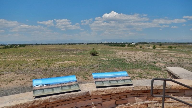
Location. 39° 48.731′ N, 104° 53.475′ W. Marker is in Commerce City, Colorado, in Adams County. Marker can be reached from Gateway Road, 0.7 miles north of Prairie Parkway (East 64th Avenue), on the left when traveling east. Marker is located in an open kiosk, overlooking Commerce City to the south, Denver to the west, and Thornton to the north. The kiosk is a central welcoming point for Commerce City's Prairie Gateway Open Space Park. Touch for map. Marker is in this post office area: Commerce City CO 80022, United States of America. Touch for directions.
Other nearby markers. At least 8 other markers are within 2 miles of this marker, measured as the crow flies. Where's the Water? (here, next to this marker); Habitat for Wildlife - A Rich History (a few steps from this marker); The Fourteeners (a few steps from this marker); Rocky Mountain Arsenal National Wildlife Refuge (approx. 1.6 miles away); South Plants (approx. 1.8 miles away); Headquarters Area (approx. 2 miles away); On This Site Stood the "White House" (approx. 2 miles away); Headquarters for a New Mission (approx. 2 miles away). Touch for a list and map of all markers in Commerce City.
More about this marker. Marker is a wide composite plaque, mounted horizontally on a waist-high stone wall. This is the second of a set of four adjacent markers outlining regional history.
Credits. This page was last revised on June 28, 2018. It was originally submitted on June 27, 2018, by Cosmos Mariner of Cape Canaveral, Florida. This page has been viewed 278 times since then and 15 times this year. Photos: 1, 2. submitted on June 27, 2018, by Cosmos Mariner of Cape Canaveral, Florida. • Syd Whittle was the editor who published this page.

