Downtown in San Antonio in Bexar County, Texas — The American South (West South Central)
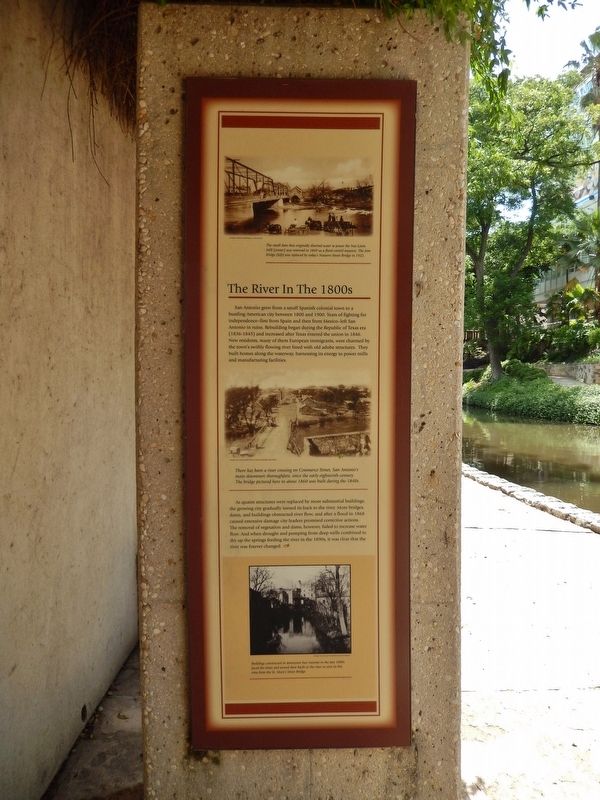
The River in the 1800's
San Antonio grew from a small Spanish colonial town to a bustling American city between 1800 and 1900. Years of fighting for independence - first from Spain and then from Mexico - left San Antonio in ruins. Rebuilding began during the Republic of Texas era (1836-1845) and increased after Texas entered the union in 1846. New residents, many of them European immigrants, were charmed by the town's swiftly flowing river lined with old adobe structures. They built homes along the waterway, harnessing its energy to power mills and manufacturing facilities.
As quaint structures were replaced by more substantial buildings, the growing city gradually turned its back to the river. More bridges, dams, and buildings obstructed river flow, and after a flood in 1868 caused extensive damage city leaders promised corrective actions. The removal of vegetation and dams, however, failed to increase water flow. And when drought and pumping from deep wells combined to dry up the springs feeding the river in the 1890s, it was clear that the river was forever changed.
Topics. This historical marker is listed in these topic lists: Settlements & Settlers • Waterways & Vessels.
Location. 29° 25.907′ N, 98° 29.266′ W. Marker is in San Antonio, Texas, in Bexar County. It is in Downtown. Marker can be reached from Lexington Avenue north of Avenue A, on the right when traveling north. Marker is located on the San Antonio River Walk, on the south side of the river, 1/10 mile east of the Lexington Avenue bridge. Marker is a short walk from the 107 Avenue A parking lot. Touch for map. Marker is at or near this postal address: 107 Avenue A, San Antonio TX 78205, United States of America. Touch for directions.
Other nearby markers. At least 8 other markers are within walking distance of this marker. River Communities (here, next to this marker); The River in the 1900s (here, next to this marker); The San Antonio River (here, next to this marker); Missions in the San Antonio River Valley (here, next to this marker); The Hugman Dam (a few steps from this marker); Mayor Maury Maverick Mural (a few steps from this marker); Toltec Apartments (about 500 feet away, measured in a direct line); Maverick-Carter House (about 700 feet away). Touch for a list and map of all markers in San Antonio.
More about this marker. This marker is one of five adjacent San Antonio River historical markers at this location.
Related markers. Click here for a list of markers that are related to this marker. San Antonio River History
Also see . . .
1. German Immigration to Texas. The largest ethnic group in Texas derived directly from Europe was persons of German birth or descent. As early as 1850, they constituted more than 5 percent of the total Texas population, a proportion that remained constant through the remainder of the nineteenth century. By the 1890s sizable German elements had appeared in Texas cities, particularly in San Antonio, Galveston, and Houston. As late as 1880 the population of San Antonio was one-third German. By then a greater percentage of Germans lived in towns and cities than was true of the Texas population at large. German immigration to Texas

Photographed By Courtesy: Maverick Publishing Co., San Antonio
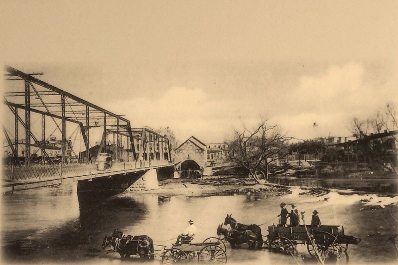
2. Marker detail: Nat Lewis Mill
The small dam that originally diverted water to power the Nat Lewis Mill (center) was removed in 1869 run flood control measure. The iron bridge (left) was replaced by today's Navarro Street Bridge in 1922.
2. The San Antonio River. When the Texas Revolution began, the river became the scene of heroic and catastrophic engagements, including the battle of Concepción, the Grass Fight, the siege of Bexar, the Goliad Massacre, and the battle of the Alamo. Although the San Antonio River has furnished drinking and irrigation water as well as power to turn the wheels of mills, foundries, and tanneries, in recent times it has been most significant for its beauty. In the city of San Antonio, where it is spanned by more than fifty bridges, this unhurried stream runs fifteen miles across six miles of city blocks. (Submitted on June 21, 2018, by Cosmos Mariner of Cape Canaveral, Florida.)

Courtesy: San Antonio Public Library, Texana/Geneology Department
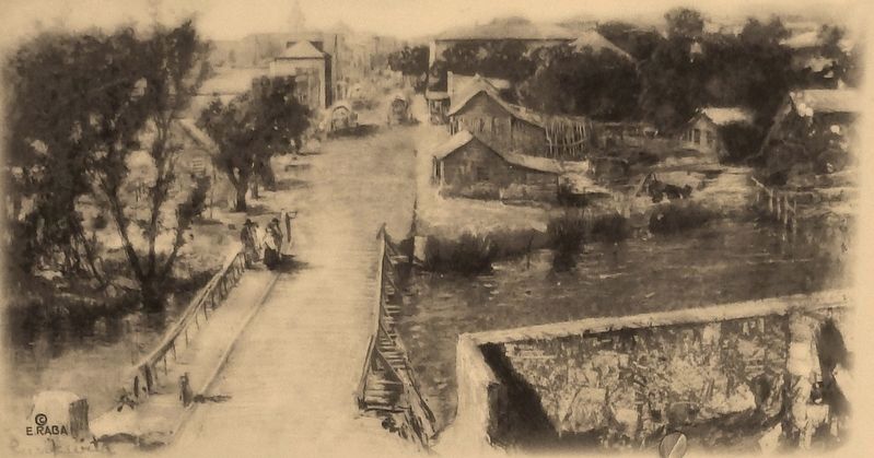
3. Marker detail: Commerce Street Bridge, c1860
There has been a river crossing on Commerce Street, San Antonio's main downtown thoroughfare, since the early eighteenth century. The bridge pictured here in about 1860 was built during the 1840s.

Photographed By Courtesy: San Antonio Conservation Society Foundation, May 21, 2018
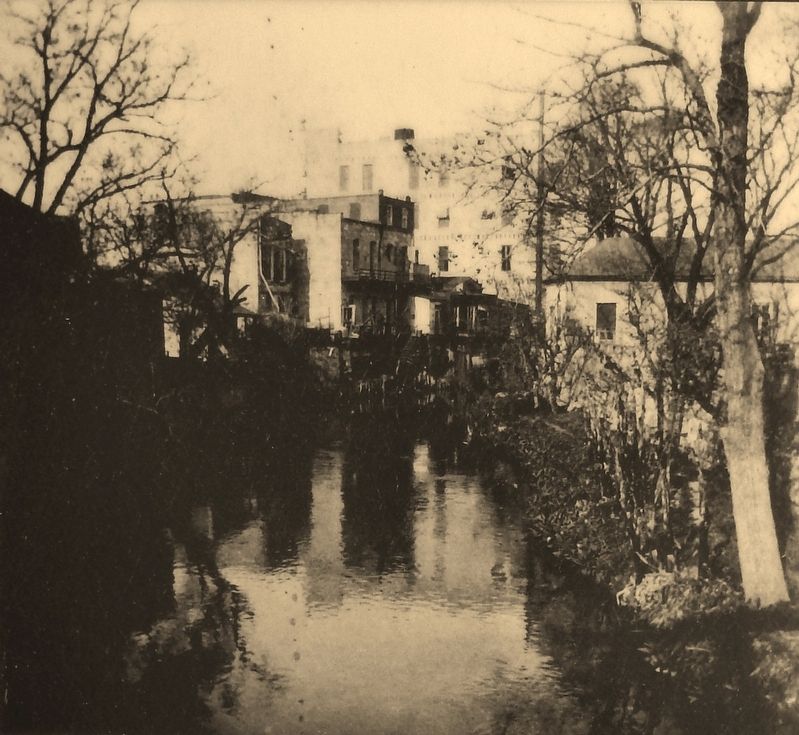
4. Marker detail: San Antonio River, late 1800's
Buildings constructed in downtown San Antonio in the late 1800s faced the street and turned their backs to the river as seen in this view from the St. Mary’s Street Bridge.
Credits. This page was last revised on February 2, 2023. It was originally submitted on June 21, 2018, by Cosmos Mariner of Cape Canaveral, Florida. This page has been viewed 327 times since then and 34 times this year. Last updated on July 3, 2018, by Cosmos Mariner of Cape Canaveral, Florida. Photos: 1, 2, 3, 4, 5. submitted on June 21, 2018, by Cosmos Mariner of Cape Canaveral, Florida. • Andrew Ruppenstein was the editor who published this page.

