Marker Logo
THE HISTORICAL
MARKER DATABASE
“Bite-Size Bits of Local, National, and Global History”
Near Kyle in Hays County, Texas — The American South (West South Central)
 

Kyle Cemetery
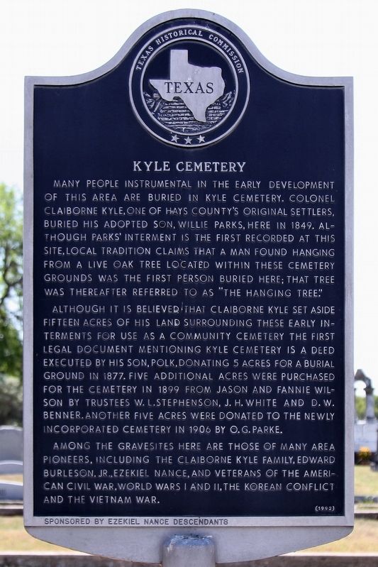
 
 
Kyle Cemetery Marker image. Click for full size.
Photographed by Larry D. Moore, July 3, 2018
1. Kyle Cemetery Marker
Inscription. Many people instrumental in the early development of this area are buried in Kyle Cemetery. Colonel Clairborne Kyle, one of Hays County's original settlers, buried his adopted son, willie Parks, here in 1849. Although Parks' interment is the first recorded at this site, local tradition claims that a man found hanging from a live oak tree located within these cemetery grounds was the first person buried here; that tree was thereafter referred to as "the hanging tree." Although it is believed that Claiborne Kyle set aside fifteen acres of his land surrounding these early interments for use as a community the first legal document mentioning Kyle Cemetery is a deed executed by his son, Polk, donating 5 acres for a burial ground in 1877, five additional acres were purchased for the cemetery in 1899 from Jason and Fannie Wilson by trustees W.L. Stephenson, J.H. White and D.W. Benner. Another five acres were donated to the newly incorporated cemetery in 1906 by O.G. Parke. Among the gravesites here are those of many area pioneers, including the Claiborne Kyle family, Edward Burleson, Jr., Ezekiel Nance, and veterans of the American Civil War, World Wars I and II, the Korean Conflict and the Vietnam War.
 
Erected 1992 by Texas Historical Commission. (Marker Number 10290.)
 
Topics. This historical marker is listed in this topic list: Cemeteries & Burial Sites. A significant historical year for this entry is 1849.
 
Location. 29° 57.793′ N, 97° 53.87′ W. Marker is near Kyle, Texas, in Hays County. It is on South Old Stagecoach Road (County Road 136) 0.2 miles south of C Kyle Log House Road, on the left when traveling south. Touch for map. Marker is at or near this postal address: 2607 S Old Stagecoach Road, Kyle TX 78640, United States of America. Touch for directions.

Regionally, this marker is in the Hill Country
Paid Advertisement
Click or scan to see
this page online
and in the Austin Metropolitan Area. It is also in the American South. Globally, it is in North America, a Gulf of Mexico state, the Western Hemisphere, the Western World, and the Anglosphere. Historically, it finds itself in what was once New Spain, the Republic of Texas, one of the Confederate States of America, and the Antebellum South.

Other nearby markers. At least 8 other markers are within 3 miles of this marker, measured as the crow flies: Kyle Pioneer Family Cemetery (about 300 feet away, measured in a direct line); The Veracruz Family of Kyle (approx. 0.8 miles away); Beef for the Confederacy (approx. 1.3 miles away); The Kyle Auction Oak (approx. 2 miles away); Cora Jackman Donalson House (approx. 2 miles away); Peel-Kretzemeier House (approx. 2.1 miles away); Katherine Anne Porter (approx. 2.1 miles away); Old D. A. Young Building (approx. 2.1 miles away). Touch for a list and map of all markers in Kyle.
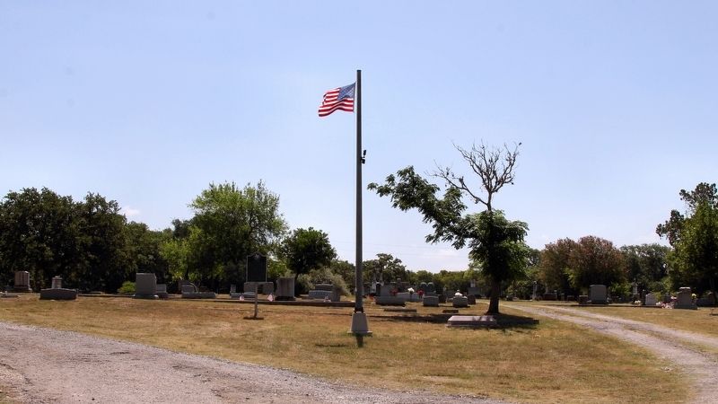
 
Kyle Cemetery Marker Area image. Click for full size.
Photographed by Larry D. Moore, July 3, 2018
2. Kyle Cemetery Marker Area
 
 
Credits. This page was last revised on July 4, 2018. It was originally submitted on July 4, 2018, by Larry D. Moore of Del Valle, Texas. This page has been viewed 623 times since then and 44 times this year. Photos:   1, 2. submitted on July 4, 2018, by Larry D. Moore of Del Valle, Texas. • Andrew Ruppenstein was the editor who published this page.

m=119684

CeraNet Cloud Computing sponsors the Historical Marker Database.
This website earns income from purchases you make after using our links to Amazon.com. We appreciate your support.
Paid Advertisement
Aug. 2, 2026