Near Santa Fe in Santa Fe County, New Mexico — The American Mountains (Southwest)
Cañoncito at Apache Canyon
Photographed by Bill Kirchner, April 16, 2012
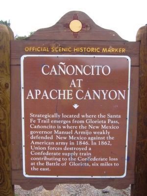
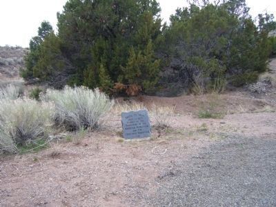
1. Cañoncito at Apache Canyon Marker
Strategically located where the Santa Fe Trail emerges from Glorieta Pass, Cañoncito is where the New Mexico Governor Manuel Armijo weakly defended New Mexico against the American Army in 1846. In 1862, Union forces destroyed a Confederate supply train contributing to the Confederate loss at the battle of Glorieta, six miles to the east.
Erected by New Mexico Historic Preservation Division. (Marker Number 115.)
Topics and series. This historical marker is listed in these topic lists: War, Mexican-American • War, US Civil. In addition, it is included in the Daughters of the American Revolution (DAR), and the Santa Fe Trail series lists. A significant historical year for this entry is 1846.
Location. 35° 32.908′ N, 105° 49.704′ W. Marker is near Santa Fe, New Mexico, in Santa Fe County. It is at the intersection of Old Las Vegas Highway (State Road 2108 Frontage Road) and Sleeping Dog Road, on the left when traveling west on Old Las Vegas Highway. Marker is located just off I-25 exit 294. Touch for map. Marker is in this post office area: Santa Fe NM 87505, United States of America. Touch for directions.

Regionally,
this page online
Other nearby markers. At least 8 other markers are within 5 miles of this marker, measured as the crow flies: Hispano New Mexicans in the US Civil War (here, next to this marker); Route 66 (approx. 3 miles away); Glorieta Pass Battlefield (approx. 4.3 miles away); a different marker also named Glorieta Pass Battlefield (approx. 4.3 miles away); The Battle of Glorieta Pass (approx. 4.8 miles away); Colorado Volunteers at the Battles of Glorieta Pass (approx. 4.8 miles away); New Mexico Volunteers at Battle of Glorieta Pass (approx. 4.8 miles away); Sibley's Brigade Memorial (approx. 4.8 miles away). Touch for a list and map of all markers in Santa Fe.
Another marker is no longer nearby. Glorieta Battlefield (was approx. 4.3 miles away but has been permanently removed).
Photographed by Bill Kirchner, April 16, 2012
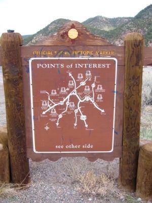
2. Rear of: Cañoncito at Apache Canyon Marker
Photographed by Bill Kirchner, April 16, 2012
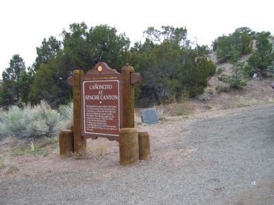
3. Cañoncito at Apache Canyon Marker
Photographed by Bill Kirchner
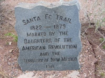
4. Santa Fe Trail Marker
This Trail Marker is located behind the marker.
Photographed by Bill Kirchner
5. Santa Fe Trail Marker

Photographed by Duane and Tracy Marsteller, September 24, 2025
6. Cañoncito at Apache Canyon Marker

Photographed by Duane and Tracy Marsteller, September 24, 2025
7. Cañoncito at Apache Canyon Marker
Credits. This page was last revised on March 11, 2026. It was originally submitted on November 9, 2009, by Charles Rummel of Magdalena, New Mexico. This page has been viewed 8,240 times since then and 351 times this year. Last updated on July 6, 2018, by Brian Anderson of New Albany, Ohio. Photos: 1, 2, 3, 4, 5. submitted on May 7, 2012, by Bill Kirchner of Tucson, Arizona. 6, 7. submitted on October 8, 2025, by Duane and Tracy Marsteller of Murfreesboro, Tennessee. • Syd Whittle was the editor who published this page.
