Clinton in Laurens County, South Carolina — The American South (South Atlantic)
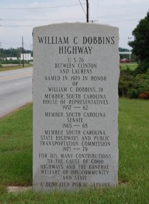
William C. Dobbins Highway
Between Clinton
and Laurens
Named in 1979 in Honor
of
William C. Dobbins, Jr.
Member, South Carolina
House of Representatives
1957-62
Member, South Carolina
Senate
1965-68
Member, South Carolina
State Highways and Public
Transportation Commission
1975-79
For His Many Contributions
to the Cause of Good
Highways and the General
Welfare of His Community
and State.
A Dedicated Public Servant
Erected 1979.
Topics. This historical marker is listed in this topic list: Roads & Vehicles. A significant historical year for this entry is 1979.
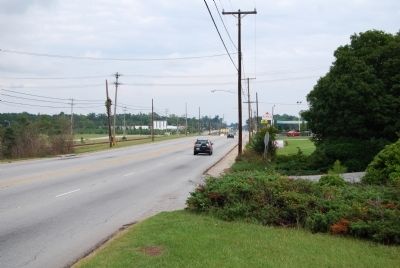
Location. 34° 28.167′ N, 81° 54.383′ W. Marker is in Clinton, South Carolina, in Laurens County. Marker is on W.C. Dobbins Highway, on the right when traveling west. Marker is near the intersection of Ab Jacks Road and W.C. Dobbins Highway, about 1/2 mile west of Clinton, South Carolina. Touch for map. Marker is in this post office area: Clinton SC 29325, United States of America. Touch for directions.
Other nearby markers. At least 10 other markers are within 2 miles of this marker, measured as the crow flies. Providence Associate Reformed Presbyterian Church (within shouting distance of this marker); Malcolm A. MacDonald (approx. 1.4 miles away); William Plumer Jacobs, D.D., LL.D. (approx. 1˝ miles away); Henry Clinton Young (approx. 1˝ miles away); Clinton Veterans Monument (approx. 1˝ miles away); Clinton Confederate Monument (approx. 1˝ miles away); Broad Street Methodist Church (approx. 1˝ miles away); A Piece of Musgrove's Mill (approx. 1˝ miles away); Eugene Blakely Sloan (1922-1969) - Eugene Blakely Sloan (approx. 1.6 miles away); The Reverend William Plumer Jacobs (approx. 1.6 miles away). Touch for a list and map of all markers in Clinton.
Credits. This page was last revised on December 14, 2019. It was originally submitted on October 2, 2008, by Brian Scott of Anderson, South Carolina. This page has been viewed 999 times since then and 27 times this year. Photos: 1, 2. submitted on October 2, 2008, by Brian Scott of Anderson, South Carolina.

