St. Denis Parish - St. Valbert Cemetery
Old St. Valbert Parish
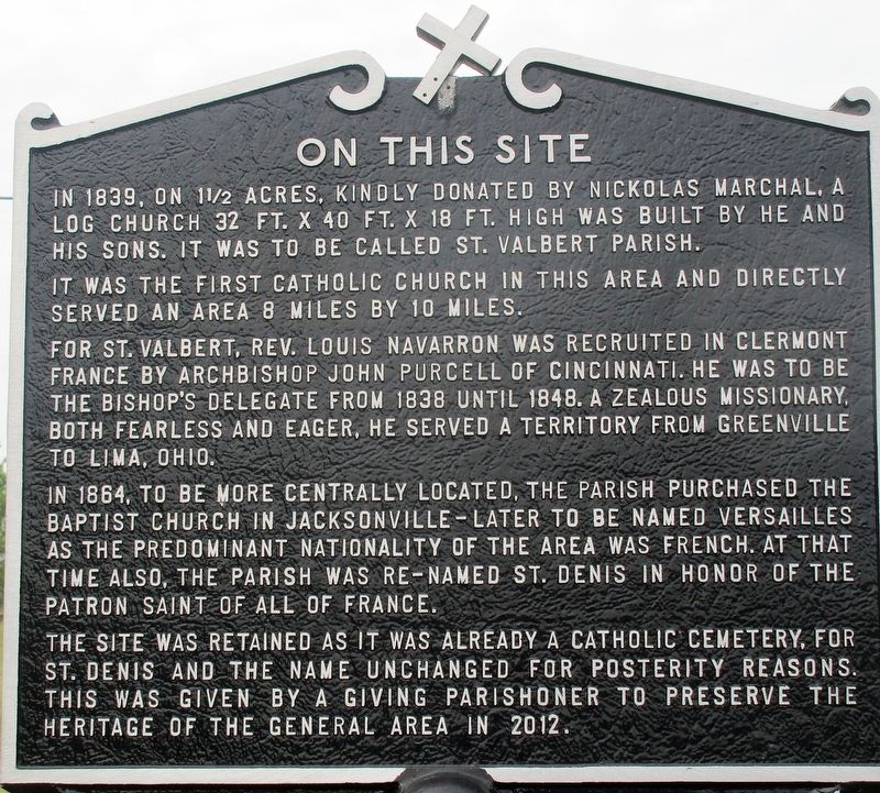
It was the first Catholic Church in this area and directly served an area 8 miles by 10 miles.
For St. Valbert, Rev. Louis Navarron was recruited in Clermont France by Archbishop John Purcell of Cincinnati. He was to be the bishop’s delegate from 1838 to 1848. A zealous missionary, both fearless and eager, he served a territory from Greenville to Lima, Ohio.
In 1864, to be more centrally located, the parish ourchased the Baptist Church in Jacksonville - later to be named Versailles as the predominant nationality of the area was French. At that time also, the parish was re-named St. Denis in honor of the patron saint of all of France.
The site was retained as it was already a Catholic Cemetery, for
St. Denis and the name unchanged for posterity reasons.
This was given by a giving parishioner to preserve the
heritage of the general area in 2012.
Erected 2012.
Topics. This historical marker is listed
this page online
Location. 40° 14.451′ N, 84° 27.861′ W. Marker is in Versailles, Ohio, in Darke County. It is at the intersection of Long Road (County Route 345) and Rehmert’s Run Road, on the right when traveling west on Long Road. Touch for map. Marker is at or near this postal address: 9265 Long Road, Versailles OH 45380, United States of America. Touch for directions.

Regionally, this marker is in the Till Plains. It is also in the American Midwest and in the Corn Belt. Globally, it is in North America, the Western Hemisphere, the Western World, and the Anglosphere. Historically, it finds itself in what was once the Haudenosaunee (Iroquois) Confederacy, the territory of the Mississippian Culture, and the Northwest Territory.
Other nearby markers. At least 8 other markers are within 2 miles of this marker, measured as the crow flies: St. Denis Parish (here, next to this marker); Original Plat of Jacksonville (approx. 1.6 miles away); The Fire of 1901 (approx. 1.6 miles away);
Credits. This page was last revised on July 18, 2024. It was originally submitted on July 18, 2018, by Rev. Ronald Irick of West Liberty, Ohio. This page has been viewed 1,127 times since then and 91 times this year. Photos: 1, 2, 3. submitted on July 18, 2018, by Rev. Ronald Irick of West Liberty, Ohio. 4. submitted on July 15, 2024, by Craig Doda of Napoleon, Ohio. • Andrew Ruppenstein was the editor who published this page.
