Riverside in Riverside County, California — The American West (Pacific Coastal)
Mount Rubidoux
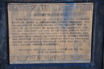
Photographed by Sharon N. Goodman, March 12, 2010
1. Mount Rubidoux Marker
Erected by Cultural Heritage Board, City of Riverside. (Marker Number 26.)
Topics and series. This historical marker is listed in these topic lists: Industry & Commerce • Landmarks • Notable Events • Notable Places. In addition, it is included in the Riverside Cultural Heritage Board Landmarks series list.
Location. 33° 59.155′ N, 117° 23.165′ W. Marker is in Riverside, California, in Riverside County. It is at the intersection of Mount Rubidoux Drive and 9th Street, on the right when traveling south on Mount Rubidoux Drive. Marker is located at the entrance to the park. Touch for map.
this page online

Regionally, this marker is in Greater Los Angeles, in the Inland Empire, and in the Peninsular Ranges. It is also in the American Southwest. Globally, it is in North America, on the Ring of Fire, on the Pacific Rim, in the Western Hemisphere, in the Western World, and in the Anglosphere. Historically, it finds itself in what was once New Spain and also Mexico’s Alta California.
Other nearby markers. At least 8 other markers are within walking distance of this marker: Henry E. Huntington (about 600 feet away, measured in a direct line); Buena Vista Bridge (approx. 0.2 miles away); Harry W. Hammond Residence (approx. 0.2 miles away); Devine House (approx. ¼ mile away); Jarvis House (approx. ¼ mile away); Lillian M. Spurgeon Residence (approx. ¼ mile away); Jaeger Family House (approx. ¼ mile away); Lt. Col. Shunzo Kido (approx. 0.3 miles away). Touch for a list and map of all markers in Riverside.
More about this marker. Most of the nearby landmarks are located inside a pedestrian park, with
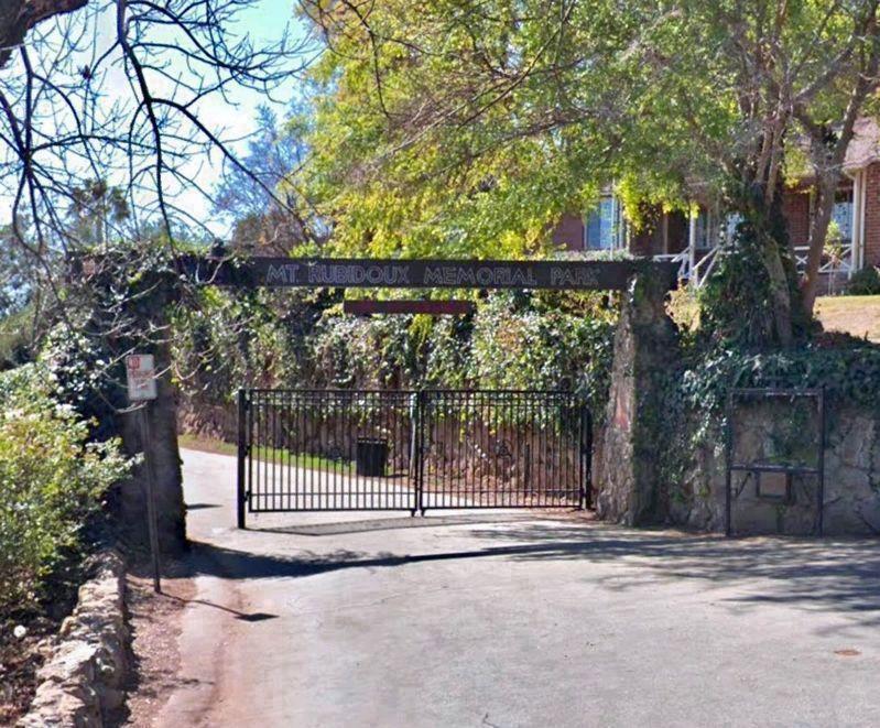
2015
2. Mount Rubidoux Marker
The marker is to the right of the gate.
Also see . . .
1. Mount Rubidoux. Wikipedia entry (Submitted on May 29, 2025, by Larry Gertner of New York, New York.)
2. Mount Rubidoux. City of Riverside website. (Submitted on May 29, 2025, by Larry Gertner of New York, New York.)
3. Landmarks of the City of Riverside (#26). Located west of downtown Riverside, Mt. Rubidoux is named for Louis Rubidoux, an early settler to the area. Frank Miller purchased the land in 1906 on which he built a road, planted vegetation and dedicated a cross to Father Junipero Serra. The nation’s first annual outdoor Easter Sunrise Service was initiated here in 1909 and inspired similar programs across the country. The Peace Tower was designed by Arthur Benton and built in 1925. (Submitted on June 20, 2026, by Volt Craft of Riverside, California.)

Photographed by Sharon N. Goodman
3. Mount Rubidoux
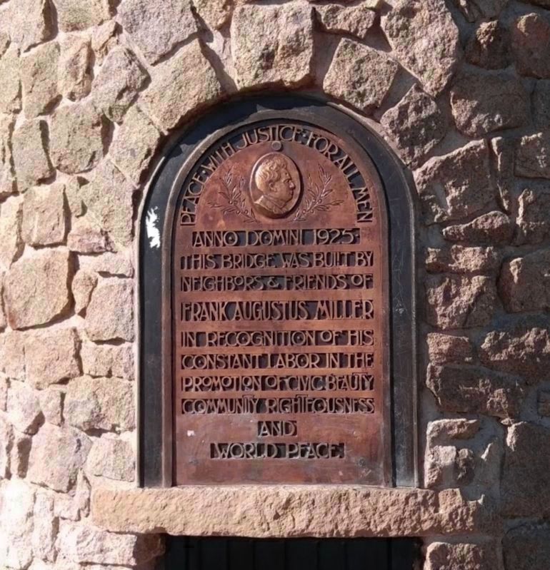
2017
4. Peace Tower Marker
Built 1925 in honor of Frank Augustus Miller in recognition of his constant promotion of world peace.
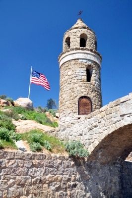
Photographed by Sharon N. Goodman
5. Peace Tower
Photographed by Sharon N. Goodman
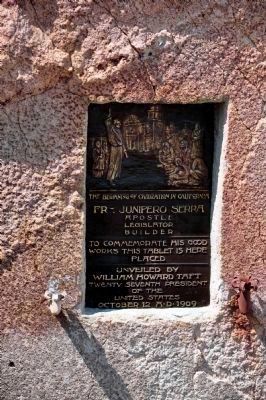
6. The Beginning of Civilization in California
Fr. Junipero Serra - Apostle - Legislator - Builder. To commemorate his good works this tablet is here placed. Unveiled by William Howard Taft, twenty seventh President of the United States, October 12 AD 1909.
circa 1920's
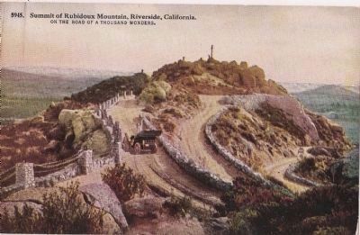
7. Old Post Card - Mount Rubidoux
“Summit of Rubidoux Mountain, Riverside, California. On the road of a thousand wonders. 5945.”
(From the early 1920's, in my grandfather’s collection)
Credits. This page was last revised on July 10, 2026. It was originally submitted on March 14, 2010, by Sharon N. Goodman of Round Rock, Texas. This page has been viewed 3,840 times since then and 96 times this year. Last updated on July 20, 2018, by Craig Baker of Sylmar, California. Photos: 1. submitted on March 14, 2010, by Sharon N. Goodman of Round Rock, Texas. 2. submitted on July 20, 2018, by Craig Baker of Sylmar, California. 3. submitted on March 14, 2010, by Sharon N. Goodman of Round Rock, Texas. 4. submitted on July 20, 2018, by Craig Baker of Sylmar, California. 5, 6. submitted on March 14, 2010, by Sharon N. Goodman of Round Rock, Texas. 7. submitted on February 19, 2011, by Sandra Hughes Tidwell of Killen, Alabama, USA. • Syd Whittle was the editor who published this page.
