Lake Oswego in Clackamas County, Oregon — The American West (Northwest)
The First People
Photographed by Andrew Ruppenstein, March 29, 2018
1. The First People Marker
Inscription.
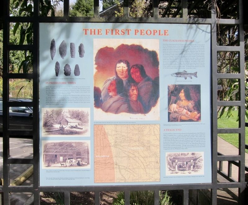
The First People. . In Prehistoric Times
Fifteen thousand years ago, the mouth of the Tualatin River was located at Like Oswego. The river's course changed when the cataclysmic Missoula floods poured down the Columbia Basin and inundated the Willamette Valley. The floods created the basin of Oswego Lake, and the Tualatin River formed a new channel that entered the Willamette above Willamette Falls.
The confluence of Oswego Creek and the Willamette River has been the site of human activity for thousands of years. Archaeological evidence shows that Native Americans inhabited this area 6,100 years ago. Projectile points and artifacts discovered in Lake Oswego's Old Town Neighborhood were made by an ancient people who lived on the west side of the Cascades. Obsidian for their spear points came from south central Oregon.
The Clackamas People
When Euro-Americans arrived in Oregon, the lower Willamette River was occupied by the Clackamas branch of the Chinookan people. The land west of Oswego Lake was occupied by the Tualatin band the Kalapuya Indians, a semi-nomadic people who relied on hunting and gathering. The Chinooks were a bay and river people who relied on fishing and trading at sites like Willamette Falls. The nearest Clackamas village was located just of Willamette Falls. In addition to salmon, the Clackamas caught suckers and eels with fixed baskets at the mouth of Sucker Creek (now Oswego Creek). Explorers marveled at their custom of head flattening, a mark of status that distinguished free Chinooks from slaves. They were great traders and Chinook Jargon (made up of Chinook, French, and English words) became the trade language of the entire Northwest. According to early settlers, the Indians called the lake "Waluga," after the wild swans that wintered here, but linguists have been unable to trace this word in native dialects. The name of Sucker Creek, however, may have an Indian origin. The Kalapuyans referred to the creek as “tch'akα mαmpit ueihιpet" which means "sucker-place creek."
A Tragic End
Contact with Euro-Americans was a disaster for the peaceful tribes of the Willamette Valley. It exposed them to small pox, measles, and malaria, which ravaged their population in a series of epidemics between 1792 and 1847. Nine-tenths of the Clackamas people perished in the winter of 1829-30 after contact with sick sailors on the Owyee, the first ship to sail up the Willamette. Few native people were left by the time white settlers arrived in the Willamette Valley. In 1856 the surviving 88 Clackamas Indians were removed and sent to the Grand Ronde Reservation, far from their ancestral homeland. Through intermarriage with other tribes they became extinct as a separate people.The U. S. government never honored the treaties it negotiated with the Willamette Valley tribes.
In Prehistoric Times
Fifteen thousand years ago, the mouth of the Tualatin River was located at Like Oswego. The river's course changed when the cataclysmic Missoula floods poured down the Columbia Basin and inundated the Willamette Valley. The floods created the basin of Oswego Lake, and the Tualatin River formed a new channel that entered the Willamette above Willamette Falls.
The confluence of Oswego Creek and the Willamette River has been the site of human activity for thousands of years. Archaeological evidence shows that Native Americans inhabited this area 6,100 years ago. Projectile points and artifacts discovered in Lake Oswego's Old Town Neighborhood were made by an ancient people who lived on the west side of the Cascades. Obsidian for their spear points came from south central Oregon.
The Clackamas People
When Euro-Americans arrived in Oregon, the lower Willamette River was occupied by the Clackamas branch of the Chinookan people. The land west of Oswego Lake was occupied by the Tualatin band the Kalapuya Indians, a semi-nomadic people who relied on hunting and gathering. The Chinooks were a bay and river people who relied on fishing and trading at sites like Willamette Falls. The nearest Clackamas village was located just of Willamette Falls. In addition to salmon, the Clackamas caught suckers and eels with fixed baskets at the mouth of Sucker Creek (now Oswego Creek). Explorers marveled at their custom of head flattening, a mark of status that distinguished free Chinooks from slaves. They were great traders and Chinook Jargon (made up of Chinook, French, and English words) became the trade language of the entire Northwest. According to early settlers, the Indians called the lake "Waluga," after the wild swans that wintered here, but linguists have been unable to trace this word in native dialects. The name of Sucker Creek, however, may have an Indian origin. The Kalapuyans referred to the creek as “tch'akα mαmpit ueihιpet" which means "sucker-place creek."
A Tragic End
Contact with Euro-Americans was a disaster for the peaceful tribes of the Willamette Valley. It exposed them to small pox, measles, and malaria, which ravaged their population in a series of epidemics between 1792 and 1847. Nine-tenths of the Clackamas people perished in the winter of 1829-30 after contact with sick sailors on the Owyee, the first ship to sail up the Willamette. Few native people were left by the time white settlers arrived in the Willamette Valley. In 1856 the surviving 88 Clackamas Indians were removed and sent to the Grand Ronde Reservation, far from their ancestral homeland. Through intermarriage with other tribes they became extinct as a separate people.The U. S. government never honored the treaties it negotiated with the Willamette Valley tribes.
Topics.
Click or scan to see this page online
This historical marker is listed in this topic list: Indigenous Peoples and Communities. A significant historical year for this entry is 1792.
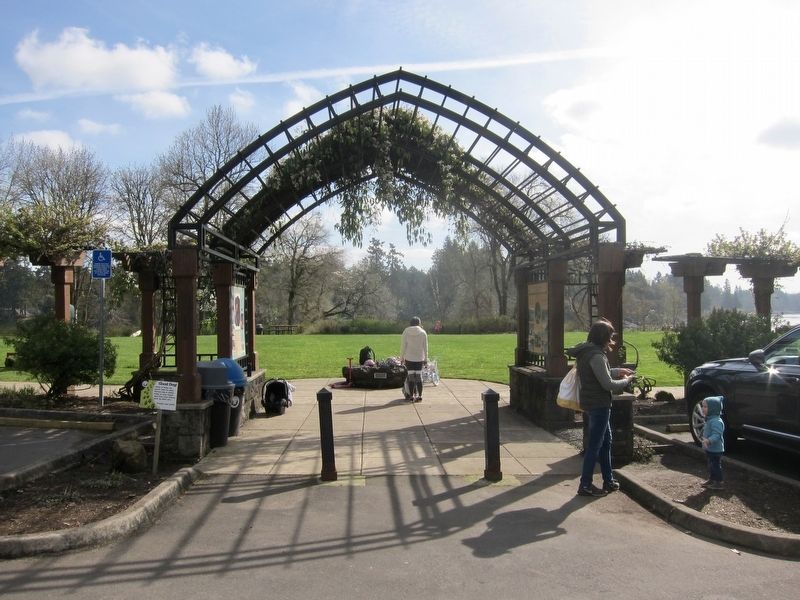
Location. 45° 24.632′ N, 122° 39.638′ W. Marker is in Lake Oswego, Oregon, in Clackamas County. It can be reached from the intersection of Old River Road and Green Street. Touch for map. Marker is in this post office area: Lake Oswego OR 97034, United States of America. Touch for directions.

Regionally, this marker is in the Willamette Valley and in Greater Portland Area. It is also on the American Pacific Coast, in the Pacific Northwest, and in the Lewis & Clark Corridor. Globally, it is in North America, in the Cascade Range, on the Ring of Fire, in the Pacific Rim, in the Western Hemisphere, in the Western World, and in the Anglosphere.
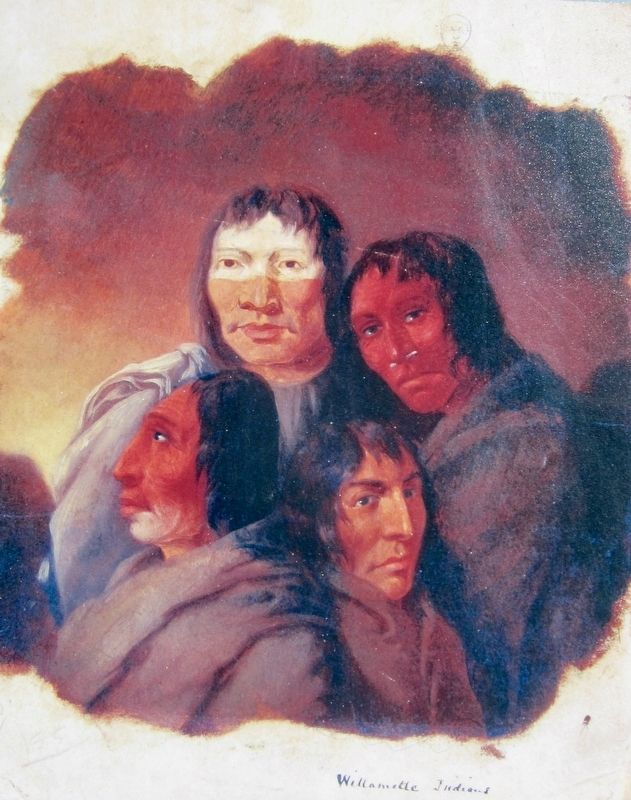
Paul Kane (image courtesy of the Stark Museum of Art, Orange, Texas), 1847
3. Marker inset: Four Clackamas Indians
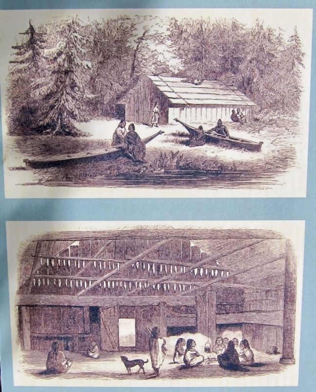
James G. Swan, from The Northwest Coast, of Three Years' Residence in Washington Territory, 1857
4. Marker inset: Exterior and interior of a Chinook lodge
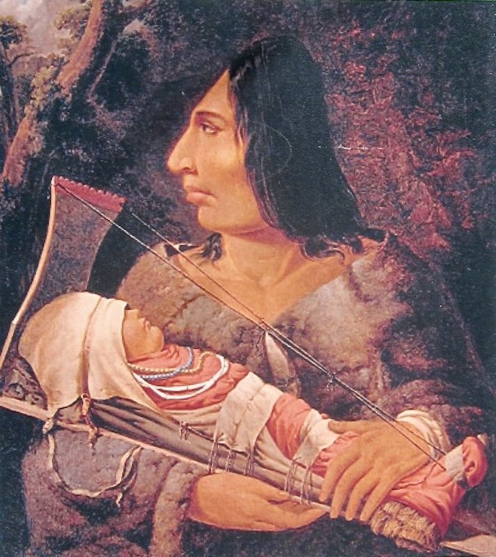
Paul Kane (image courtesy of the Montreal Museum of Fine Arts), 1848
5. Marker Inset: Chinook woman with child undergoing the process of head-flattening
Credits. This page was last revised on August 8, 2018. It was originally submitted on July 21, 2018, by Andrew Ruppenstein of Lamorinda, California. This page has been viewed 1,486 times since then and 93 times this year. Photos:1, 2, 3, 4, 5. submitted on July 21, 2018, by Andrew Ruppenstein of Lamorinda, California.