Downtown Miami in Miami-Dade County, Florida — The American South (South Atlantic)
The Concession Stand
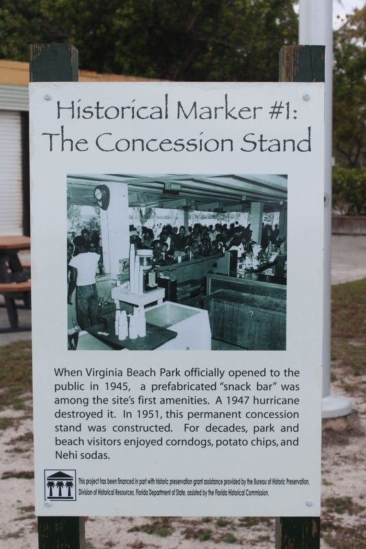
Photographed by Tim Fillmon, March 7, 2018
1. Historical Marker #1: The Concession Stand Marker
When Virginia Beach Park officially opened to the public in 1945, a prefabricated "snack bar" was among the site's first amenities. A 1947 hurricane destroyed it. In 1951, this permanent concession stand was constructed. For decades, park and beach visitors enjoyed corndogs, potato chips, and Nehi sodas.
This project has been financed in part with historic preservation assistance provided by Bureau of Historic Preservation, Division of Historical Resources, Florida Department of State, assisted by the Florida Historical Commission.
Erected by Virginia Key Beach Park. (Marker Number 1.)
Topics. This historical marker is listed in these topic lists: African Americans • Parks & Recreational Areas. A significant historical year for this entry is 1951.
Location. 25° 44.133′ N, 80° 9.373′ W. Marker is in Miami, Florida, in Miami-Dade County. It is in Downtown Miami. It can be reached from Virginia Key Drive 0.4 miles east of Rickenbacker Causeway. Marker is located near the state marker for the park. Touch for map. Marker is at or near this postal address: 4020 Virginia Beach Drive, Key Biscayne FL 33149, United States of America. Touch for directions.

Regionally, this marker is in South Florida and on the Gold Coast. It is also in the American South and on the Eastern Seaboard. Globally, it is in the North Atlantic Region, North America, a Gulf of Mexico state, the Western Hemisphere, the Western World, and the Anglosphere. Historically, it finds itself in what was once New Spain, the territory of the Mississippian Culture, one of the Confederate States of America, and the Antebellum South.
Other nearby markers. At least 8 other markers are within 3 miles of this marker, measured as the crow flies: Historical Marker #2 Dance Pavilion (within shouting distance of this marker); Virginia Key Beach Park
this page online
Another marker is no longer nearby. Brickell Park (was approx. 3.1 miles away but has been permanently removed).
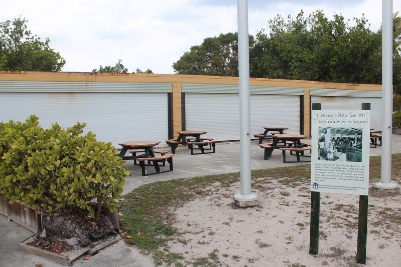
Photographed by Tim Fillmon, March 7, 2018
2. Historical Marker #1: The Concession Stand Marker with present stand behind it
Credits. This page was last revised on February 22, 2026. It was originally submitted on July 23, 2018, by Tim Fillmon of Webster, Florida. This page has been viewed 451 times since then and 110 times this year. Photos: 1, 2. submitted on July 23, 2018, by Tim Fillmon of Webster, Florida. • Andrew Ruppenstein was the editor who published this page.
