Near Anahuac in Chambers County, Texas — The American South (West South Central)
James Taylor White
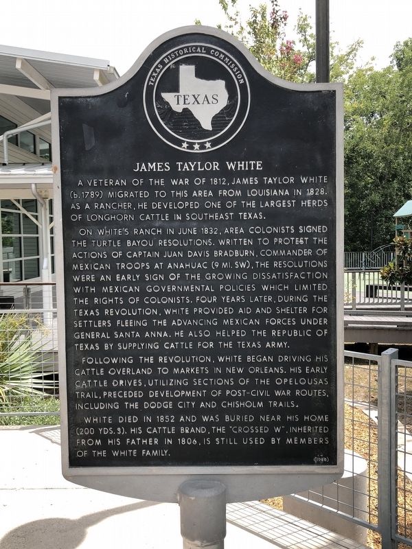
Photographed by Brian Anderson, August 5, 2018
1. James Taylor White Marker
A veteran of the War of 1812, James Taylor White (b.1789) migrated to this area from Louisiana in 1828. As a rancher, he developed one of the largest herds of Longhorn cattle in southeast Texas.
On White's ranch in June 1832, area colonists signed the Turtle Bayou Resolutions. Written to protest the actions of Captain Juan Davis Bradburn, commander of Mexican troops at Anahuac (9 mi. SW), the resolutions were an early sign of the growing dissatisfaction with Mexican governmental policies which limited the rights of colonists. Four years later, during the Texas Revolution, White provided aid and shelter for settlers fleeing the advancing Mexican forces under General Santa Anna. He also helped the Republic of Texas by supplying cattle for the Texas army.
Following the revolution, White began driving his cattle overland to markets in New Orleans. His early cattle drives, utilizing sections of the Opelousas Trail, preceded development of post-Civil War routes, including the Dodge City and Chisholm Trails.
White died in 1852 and was buried near his home (200 yds. S). His cattle brand, the "crossed W", inherited from his
this page online
Erected 1980 by Texas Historical Commission. (Marker Number 12650.)
Topics. This historical marker is listed in these topic lists: Immigration • Industry & Commerce • Settlements & Settlers • War, Texas Independence. A significant historical month for this entry is June 1832.
Location. 29° 50.246′ N, 94° 36.498′ W. Marker is near Anahuac, Texas, in Chambers County. It can be reached from Interstate 10 (Interstate 10 at milepost 815), on the right when traveling east. Marker is located in the Chambers County Safety Rest Area Eastbound (exit 814). Touch for map. Marker is at or near this postal address: 26022 Interstate Highway 10, Hankamer TX 77560, United States of America. Touch for directions.

Regionally, this marker is in the Houston Metropolitan Area. It is also in the American South and on the Gulf Coast. Globally, it is in North America, a Gulf of Mexico state, the Western Hemisphere, the Western World, and the Anglosphere. Historically, it finds itself in what was once New Spain, the Republic of Texas, and one of the Confederate States of
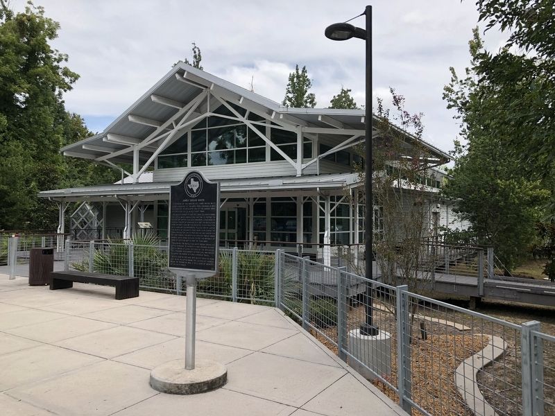
Photographed by Brian Anderson, August 5, 2018
2. James Taylor White Marker
Other nearby markers. At least 8 other markers are within 7 miles of this marker, measured as the crow flies: Chambers County Youth Project Show (approx. 2½ miles away); Turtle Bayou Resolutions (approx. 2.7 miles away); Anahuac Oil and Gas Field (approx. 3.6 miles away); Abshier Cemetery (approx. 5½ miles away); Black Education in Chambers County (approx. 5.9 miles away); Chambers County (approx. 6 miles away); Events at Anahuac Leading to the Texas Revolution (approx. 6.3 miles away); Lone Star Canal (approx. 6.4 miles away). Touch for a list and map of all markers in Anahuac.
Also see . . . White, James Taylor - The Handbook of Texas Online. Texas State Historical Association (TSHA) (Submitted on August 8, 2018, by Brian Anderson of New Albany, Ohio.)
Credits. This page was last revised on August 10, 2026. It was originally submitted on August 7, 2018, by Brian Anderson of New Albany, Ohio. This page has been viewed 3,134 times since then and 257 times this year. Last updated on August 7, 2026, by Joe Lotz of Flower Mound, Texas. Photos: 1, 2. submitted on August 8, 2018, by Brian Anderson of New Albany, Ohio. • Devry Becker Jones was the editor who published this page.
