Flagstaff in Coconino County, Arizona — The American Mountains (Southwest)
Arizonal Trail - A Tribute to Dale Shewalter
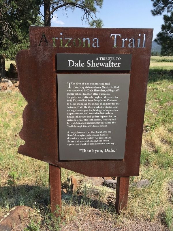
Photographed by Rob Mason, August 10, 2018
1. Arizonal Trail - A Tribute to Dale Shewalter
Topics. This historical marker is listed in this topic list: Parks & Recreational Areas. A significant historical year for this entry is 1985.
Location. 35° 13.099′ N, 111° 37.91′ W. Marker is in Flagstaff, Arizona, in Coconino County. It is on North Gemini Road. Touch for map. Marker is in this
this page online

Regionally, this marker is in Flagstaff & High Country and in Hopi. It is also in the American Southwest, in the Mountain West, on the Colorado Plateau, and at the Four Corners. Globally, it is in North America, the Western Hemisphere, the Western World, and the Anglosphere. Historically, it finds itself in what was once New Spain and also Mexico’s Alta California.
Other nearby markers. At least 8 other markers are within 2 miles of this marker, measured as the crow flies: Buffalo Park (about 300 feet away, measured in a direct line); Beale Wagon Road (about 300 feet away); Logging Wheels (approx. 1.3 miles away); Emerson School Bell (approx. 1.4 miles away); Julius Aubineau (approx. 1.4 miles away); "Bear" Howard's Chuck Box (approx. 1.4 miles away); Beale Road (approx. 1.4 miles away); Flagstaff Flag - Raising (approx. 1½ miles away). Touch for a list and map of all markers in Flagstaff.
Credits. This page was last revised on July 30, 2025. It was originally submitted on August 10, 2018, by Rob Mason of New River, Arizona. This page has been viewed 478 times since then and 45 times this year. Photo 1. submitted on August 10, 2018, by Rob Mason of New River, Arizona. • Andrew Ruppenstein was the editor who published this page.
